Tropical Storm Fred weakens to a tropical depression over Hispaniola. Florida still in cone
Tropical Storm Fred weakened to a tropical depression over central Hispaniola Wednesday night.
The National Hurricane Center predicted the storm will regain its strength by the time it nears Cuba and Florida later this week, with a potential landfall Monday morning in the Panhandle.
Most of Florida remained within the cone. But with hours of mountainous terrain ahead and several days to go before Fred neared the state, the storm’s potential effects on Florida remained unclear — outside of a high potential for a weekend of rain.
Some models show Fred closer to the peninsula and others show the storm keeping more to the Gulf of Mexico, depending on how it fares in Hispaniola. The hurricane center’s predicted track takes the middle ground between the extremes.
Fred was moving west-northwest at 15 mph with 35 mph maximum sustained winds, according to the hurricane center’s advisory at 2 a.m. Thursday. The storm was about 90 miles south southeast of Great Inagua Island.
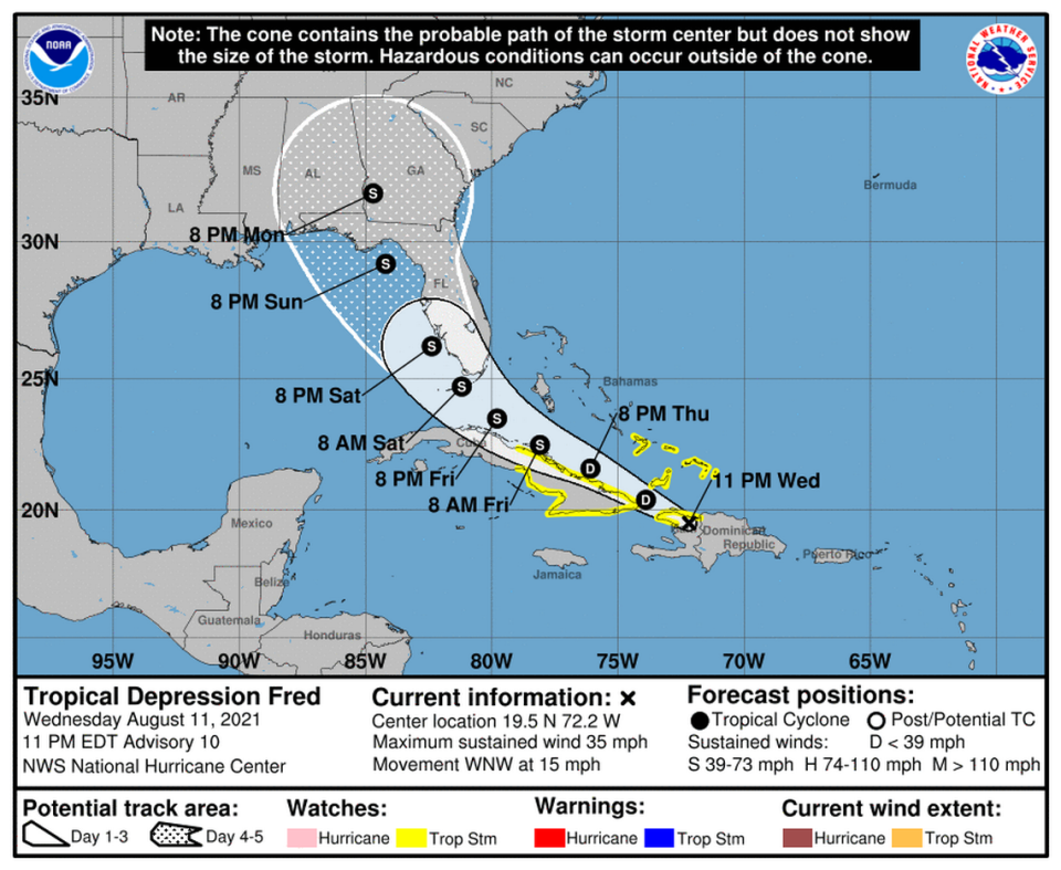
The center of Fred was over Hispaniola overnight, and expected to move near the Turks and Caicos Islands and the southeastern Bahamas on Thursday, and move near or north of the northern coast of central Cuba Thursday night and Friday.
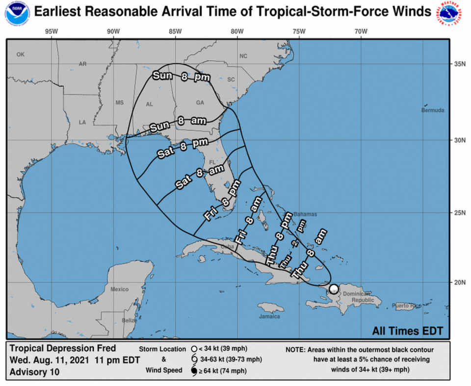
Forecasters say the Florida Keys could begin to feel some of Fred’s winds and rains on Friday, and portions of the Peninsula and Panhandle could feel effects this weekend. The hurricane center’s latest prediction shows the storm’s strongest sustained winds — 60 mph — while it’s approaching Florida’s west coast
The storm is expected to bring heavy rainfall, which could lead to flash, urban and small stream flooding, and possible mudslides across the U.S. Virgin Islands, Puerto Rico and the Dominican Republic.
The Dominican Republic could see 3 to 5 inches of rain, with up to 8 inches in some spots. Haiti, Turks and Caicos, the eastern Bahamas and Cuba are expected to see 1 to 3 inches with maximum totals of 5 inches in some areas. The western Bahamas and Florida could see a bit more rain, more like 3 to 5 inches with 8 inches in some spots.
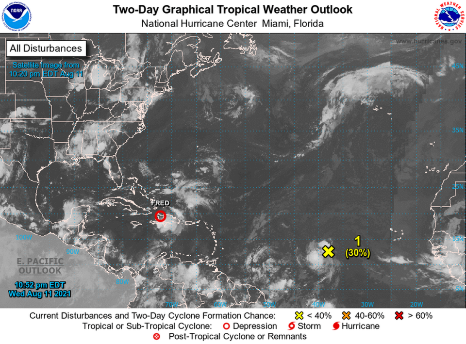
The hurricane center is also watching another disturbance — a tropical wave about 1600 miles east of the Lesser Antilles — for signs of strengthening. It had a 60% chance of forming in the next five days and 30% in the next two as of the 8 p.m. update.
The hurricane center said a tropical depression could form by early next week. The next storm name is Grace.
Fred Watches/Warnings
By 11 p.m., the Dominican Republic discontinued the all tropical storm warnings.
A Tropical Storm Watch is in effect for:
▪ Haiti from the northern border with the Dominican Republic to Gonaives.
▪ Turks and Caicos Islands.
▪ Southeastern Bahamas.
▪ Ciego de Avila, Camaguey, Las Tunas, Holguin, Granma, Santiago de Cuba, and Guantanamo.

