Tropical Storm Fred forms in Atlantic; Florida keeping a watchful eye on system's path later this week
SARASOTA, Fla. — Tropical Storm Fred developed just south of Puerto Rico late Tuesday, the National Hurricane Center confirmed, heading for the Dominican Republic and Haiti, with forecasters warning that its heavy rains could cause dangerous flooding and mudslides.
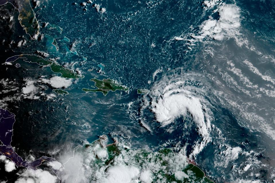
After a quiet month of no named storms in the region, Fred became the sixth of the Atlantic hurricane season as expected late Tuesday and tropical storm warnings were already in effect for the U.S. Virgin Islands and Puerto Rico.
“The most important thing today is preparation,” said Puerto Rico Gov. Pedro Pierluisi. “I am not going to minimize the potential impact of this event … we expect a lot of rain.”
Florida could be in the storm's path, but forecasters said it was too early to determine the exact track.
Data from the aircraft and surface observations indicate the disturbance gained some strength Tuesday night, with maximum sustained winds near 40 mph with higher gusts. Some additional strengthening is forecast overnight before Fred reaches eastern Dominican Republic on Wednesday morning.
Fred was the first named storm since Hurricane Elsa dissipated one month ago on July 9.
Gradual strengthening was forecast, and the disturbance was expected to become a tropical storm Tuesday night, the center said.
The disturbance is expected to pass near or over the U.S. Virgin Islands and Puerto Rico late Tuesday and early Wednesday, be near or over Hispaniola on Wednesday and be near the southeastern Bahamas and the Turks and Caicos Islands on Thursday. A tropical storm warning was in effect for Puerto Rico, the U.S. Virgin Islands and the Dominican Republic.
Heavy rain is likely over the Leeward Islands, the Virgin Islands and Puerto Rico, which could lead to flash, urban and small stream flooding and potential mudslides. The greatest threat for flooding will be across the eastern and southeastern portions of Puerto Rico.
Tropical storm conditions are possible elsewhere along the northern coasts of the Dominican Republic, northern Haiti, the Turks and Caicos, and the southeastern Bahamas beginning late Wednesday.
The system could intensify once it reaches the waters south of Florida or the eastern Gulf of Mexico by this weekend, forecasters said. But that path is subject to change depending on wind shear and whether the storm tracks over water or land.
"The system is being guided along to the west-northwest by the circulation around a large area of high pressure over the central Atlantic," AccuWeather hurricane expert Dan Kottlowski said.
Florida and the Keys could be in the system's path. This scenario could unfold if the high-pressure area weakens and allows the system to turn more to the north, Kottlowski said.
The 2021 Atlantic hurricane season is expected to be active, the National Oceanic and Atmospheric Administration said in an updated forecast last week: 15 to 21 named storms could develop; seven to 10 could be hurricanes.
An average season spawns seven hurricanes and peaks in August, September and October. If predictions hold true, this year will be a record sixth consecutive year of above-normal activity.
Hurricane season is upon us during a pandemic: Here's what you need to protect yourself.
Track the path of a tropical storm
Contributing: Doyle Rice and Jeanine Santucci; The Associated Press
This article originally appeared on Sarasota Herald-Tribune: Tropical Storm Fred forms in Atlantic with Florida in forecast path

