Hurricane Ian's latest path: Florida landfall forecast for Wednesday afternoon
- Oops!Something went wrong.Please try again later.
- Oops!Something went wrong.Please try again later.
Hurricane Ian strengthened to a Category 3 storm on Tuesday as it made landfall in Cuba.
Next, Ian heads to Florida. Landfall is expected late afternoon Wednesday between Tampa and Fort Myers, though track, timing and intensity could still change.
Florida Gov. Ron DeSantis has declared a state of emergency.
Latest Developments
Sep 27, 1:05 PM
FEMA: 'Do not underestimate' Ian
Federal Emergency Management Agency Administrator Deanne Criswell warned Tuesday, "Floridians are going to experience the impacts from the storm for a very long time."

"Our biggest concern as we wait for this storm to make landfall is storm surge," Criswell said. "In 2018, when Hurricane Michael impacted the Florida Panhandle, there were five recorded fatalities as a result of storm surge. So therefore, if people are told to evacuate by their local officials, please listen to them. The decision you choose to make may mean the difference between life and death."
SANDBAG ALERT: Pasco County is temporarily out of sandbags at all locations. Sand is still available. We are working to get more sandbags. Please bring your own shovel and bags. pic.twitter.com/aT5jqKFDuu
— Pasco Fire Rescue (@PascoFireRescue) September 27, 2022
She said a search and rescue coordination group has been activated, including members from FEMA’s urban search and rescue teams, the Coast Guard, the Department of Defense and the Department of the Interior.
The Red Cross has established 29 shelters and is prepared to open 60 more shelters if needed, she said.
Criswell stressed, “To those who may be watching at home, get ready and do not underestimate the potential that the storm can bring.”
Sep 27, 12:25 PM
Orlando’s airport closing Wednesday
The Orlando International Airport said operations will stop at 10:30 a.m. Wednesday.
The St. Pete-Clearwater International Airport is closing at 1 p.m. Tuesday while Tampa International Airport is suspending flights at 5 p.m. Tuesday.
Sep 27, 12:03 PM
Coastal Georgia, South Carolina under tropical storm watches
As Ian moves north over Florida, tropical storm force winds will reach coastal Georgia and South Carolina.
Tropical storm watches have been issued for Savannah and near Charleston.
Sep 27, 12:17 PM
Landfall in Florida forecast for Wednesday afternoon
Hurricane Ian’s track is moving south, with landfall forecast for late afternoon Wednesday between Tampa and Fort Myers as a Category 3 storm.
11 am TUESDAY #Ian update: As expected, @NHC_Atlantic moved track south of Tampa. Surge for Tampa 5-8 feet (and remember possible anti-surge), this track much worse for Venice, Punta Gorda, Fort Myers. Surge warnings 8-12 feet : Middle of Longboat Key to Bonita Beach. pic.twitter.com/BpYachs2dB
— Ginger Zee (@Ginger_Zee) September 27, 2022
The storm surge forecast for Tampa Bay has dropped from 10 feet to 8 feet. But now the predicted storm surge for Fort Myers has increased and could be as high as 12 feet.
Storm surge warning as of Tuesday 11 am ET update. Note the small reduction in Tampa and increase from longboat key to Charlotte Harbor to Bonita Beach. Also -Jacksonville — upgrade to 3-6 feet. #ian #hurricane pic.twitter.com/LpQT2EnANI
— Ginger Zee (@Ginger_Zee) September 27, 2022
Sep 27, 10:15 AM
About 2.5 million Floridians under evacuation orders
As Hurricane Ian heads toward Florida, officials’ main concern is the threat of storm surge and catastrophic flooding, Florida. Gov. Ron DeSantis said Tuesday.

DeSantis reiterated that there is still time to prepare or evacuate.
About 2.5 million Floridians are under mandatory or voluntary evacuation orders, he said.
SANDBAGS: @IHeartIRB homeowners are packing a sandbag site hoping to protect their homes as #HurricaneIan approaches #PinellasCounty #FL @abcactionnews pic.twitter.com/YXWtjSvQJF
— Sarah J. Hollenbeck (@SarahHollenbeck) September 26, 2022
-ABC News’ Alex Faul
Sep 27, 9:41 AM
Tornado watches issued in South Florida
Tornado watches have been issued in Miami, Fort Lauderdale, West Palm Beach, Naples and Key West as Hurricane Ian approaches.
The watches are in effect until 5 p.m. Tuesday.

-ABC News’ Max Golembo
Sep 27, 8:25 AM
Latest forecast shows landfall in Tampa Bay area
The forecast has shifted significantly east, now with landfall expected in the Tampa Bay area Wednesday night into early Thursday morning as a Category 3 hurricane.
This would mark Tampa Bay’s first direct hit from a major hurricane since 1921.
Latest track on #Ian shifts southeast (short term models have been doing this for more than 24 hours). What this means: current track still very bad for Tampa with a cat 3 landfall early Thursday morning. It also means Sarasota, Venice, Punta Gorda need to watch this carefully. pic.twitter.com/EejC8rL7ip
— Ginger Zee (@Ginger_Zee) September 27, 2022
Slow-moving Ian is expected to drop more than 15 inches of rain from Tampa to Orlando.
Major flooding is possible in Orlando, Tampa and St. Petersburg.
That RAIN will be a big problem for saturated central Florida. Orlando to Jacksonville — you could easily see inland flooding & tornadoes on those wrap-around bands! #ian @SamWnek @Wx_Max pic.twitter.com/ve0rQwXYre
— Ginger Zee (@Ginger_Zee) September 27, 2022
-ABC News’ Max Golembo
Sep 27, 9:21 AM
Hurricane Ian makes landfall after strengthening to major storm
Hurricane Ian made landfall over western Cuba early on Tuesday morning, the National Hurricane Center said.
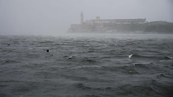

“Satellite and radar data indicate that the center of Ian has made landfall just southwest of the town of La Coloma in the Pinar Del Rio Province of Cuba at 4:30 a.m.,” the center said.
Ian’s winds at landfall were estimated at a maximum of 125 mph, making the storm a Category 3 hurricane.

-ABC News’ Max Golembo
Sep 26, 11:35 PM
Ian strengthens as winds grow to 105 mph
Hurricane Ian continued to intensify Monday night, with maximum sustained winds now at 105 mph.
The hurricane is about 105 miles east-southeast of the western tip of Cuba, which is expected to see significant wind and storm surge impacts soon.
The storm is expected to become a major hurricane overnight or Tuesday morning.
-ABC News' Melissa Griffin
Sep 26, 9:47 PM
Tampa International Airport to close as Ian approaches
Tampa International Airport will stop all operations starting 5 p.m. Tuesday to secure its airfield and terminals ahead of Hurricane Ian's expected landfall later this week.
TPA TO SUSPEND OPERATIONS: In preparation for Hurricane Ian, TPA will suspend all operations on Tuesday, September 27, at 5:00 p.m. The Airport will be closed to all visitors at that time. Read more: https://t.co/RbS1uKuXtf
— Tampa International Airport ✈️ (@FlyTPA) September 27, 2022
