Tropical Storm Idalia: What you need to know in Duval County as storm approaches

Northeast Florida will begin to see the impact of Idalia late Tuesday after the tropical storm strengthens into a powerful hurricane on track to make landfall on the Gulf side of Florida and then barrel across the state.
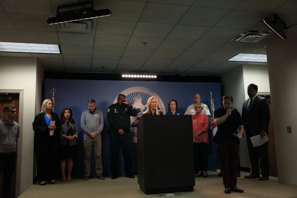
Storm conditions such as whipping wind and rain will intensify by Wednesday morning and the storm will finish moving through the area by early Thursday, according to Jacksonville Mayor Donna Deegan.
Here's what you need to know about how local officials are preparing for the storm:
What can Duval County expect?
Deegan declared a local state of emergency and said residents should prepare for possible "hurricane strength conditions."
"There is the potential for substantial flooding in vulnerable flooding along the St. Johns River and along the Atlantic coast," Deegan said.
School closures: Duval County schools closing Tuesday through Thursday for Idalia's projected impact on area
The latest on Idalia: Weather watches, warnings issued for Jacksonville area. See radar, current conditions
State response: 'Execute your plan now': How Florida, Gov. DeSantis are preparing state for Idalia
She warned about street flooding but said it won't be at the scale of Hurricane Irma's widespread building flooding in 2017. Idalia isn't shaping up to have the same combination of a hurricane making landfall in Florida, rain-saturated ground and the nor'easter that piled up water in the St. Johns River as Irma approached.
No evacuations have been ordered.
Deegan said the forecast anticipates strong, sustained tropical force winds and hurricane-force wind gusts, along with a storm surge of 3 to 4 feet. The storm will dump 3 to 6 inches of rain as it moves through Northeast Florida.
"We're working with the National Hurricane Center very closely on what to expect," Alex Boothe, a senior meteorologist with the National Weather Service office in Jacksonville, said at a noon Monday media briefing. "Right now, even though there's that little westward shift away from us, it's not changing our expectations of seeing strong tropical-force winds and gusts up to hurricane force, especially along the St. Johns River and at the beaches."
Jacksonville Sheriff T.K. Waters said his office will work with the Florida Highway Patrol to make decisions based on real-time conditions about whether to close any bridges during the storm. Such closures happen when wind gauges show 40 mph sustained winds at the bridges. The current forecast for the region is for winds of up to 58 mph
JEA CEO Jay Stowe said the utility expects some customers will lose power during the storm. He said JEA has been doing tree-trimming throughout the year to reduce the possibility of tree limbs knocking down power lines. Utility crews from Texas and Missouri will help JEA crews restore power. Customers can report electrical outages by calling (904) 665-6000 or online at JEA.com.
JEA on Monday began a suspension of utility cutoffs because of nonpayments by customers.
The Jacksonville Transportation Authority will indefinitely suspend St. Johns River Ferry service starting Tuesday morning by moving the ferry boat to a "secure location" until JTA can restart the ferry rides.
JTA will suspend its bus service, ReadiRide, Express Select, Skyway and paratransit service beginning Wednesday and plans to resume those transit options Thursday, depending on the severity of damage from the storm. JTA's customer service will be open during normal business hours from 5:30 a.m. to 8:30 p.m. to answer questions by calling (904) 630-3100.
The city's curbside collection of garbage, recycling and yard waste will be suspended on Wednesday. The city will do make-up collection on Saturday.
Jacksonville International Airport will remain open but passengers should monitor the status of their flights.
JaxPort will close its cargo gates to trucks coming onto port terminals starting at 3 p.m. Tuesday and all outbound trucks must leave the terminals by 5 p.m. that day.
JEA will be suspending shutoffs due to nonpayment starting Monday, August 28.
City of Jacksonville government offices will be closed Tuesday and Wednesday except for essential employees coming into work for storm-related duties.
How can residents keep informed about Idalia?
Residents can get information online at JaxReady.com and by using the JaxReady mobile app, along with local media reports. Social media accounts for X, formerly known as Twitter, include Deegan @MayorDeegan, the city of Jacksonville @CityofJax, and JaxReady @JaxReady.
What coastal impacts are Northeast Florida officials expecting?
Even though Hurricane Franklin avoided Florida, it's passage to the east still is creating dangerous marine and beach conditions because of swells it is sending toward shore. The arrival of Idalia will continue the threat of rip currents that can drown people.
Deegan said it is "absolutely no time to be in the water" over the coming days. "It'll be very dangerous."
The National Weather Service says coastal flooding is possible during high tide conditions Tuesday night through Wednesday.
Are sandbags available in Duval County?
The city of Jacksonville has not historically provided sandbags to resident, and that continues to be the city's policy.
"If you look at the scientific information around sandbags — if you really look at how they work or don't work — they just don't provide much help, frankly, and they can be a biohazard," Deegan said.
She said if people wish to put up sandbags on their own they can do so, but "at the end of the day, they may end up trapping more water in your house than they end up saving water from getting into your home."
Will Duval schools be closing due to the approaching storm?
The Duval County School District will close its schools from Tuesday through Thursday so it can begin preparing to use some of its schools as emergency shelters. The district will make a damage assessment on Thursday to determine whether to continue the school closures past Thursay.
What emergency shelters will be available for residents?
Six shelters will be open starting at noon Tuesday. They are:
The Legends Center (5130 Soutel Drive), open for general population.
Chimney Lakes Elementary School (9353 Staples Mill Drive), open for general population and pet-friendly.
Landmark Middle School (101 Kernan Blvd), open for general population and pet-friendly.
Atlantic Coast High School (9735 R.G. Skinner Parkway), special needs only.
Oceanway Elementary School (12555 Gillespie Ave.), open for general population.
LaVilla School of the Arts (501 N. Davis St.), open specifically for homeless individuals.
"
All Duval County schools will be closed Tuesday through Thursday so some work can get on converting some campuses to emergency shelter in advance of tropical storm Idelia become a powerful hurricane on t
This article originally appeared on Florida Times-Union: Here's the tropical storm forecast for Duval County

