Tropical storm Jasper approaches Australia as authorities warn of ‘life-threatening’ floods
Authorities have issued a warning over “life-threatening floods” as tropical Cyclone Jasper starts to approach northern Queensland in Australia.
Jasper is predicted to strengthen from a category 1 to a category 2 storm on the 5-tier scale, according to Queensland state deputy premier Steven Miles. He also warned residents of Cairns and other cities and towns to “take shelter now” as the cyclone is expected to make landfall between 5pm to 6pm local time.
It is expected to become the first cyclone of the current season to make landfall on the Australian coast.
“The message to Cairns locals and those in the warning area is to take shelter now, now is not the time to be moving around,” Mr Miles said.
Jasper is reportedly the first cyclone to cross part of the Daintree Rainforest in nearly 25 years.
The edge of the eye of the cyclone is spanning tens of kilometres, according to a Bureau of Meteorology specialist. And it is now making landfall on Wujal Wujal, an Indigenous community located approximately 150km north of Cairns.
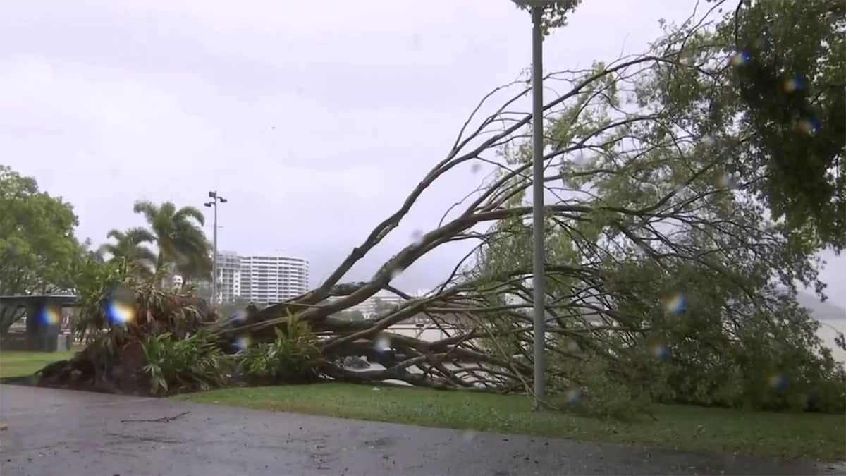
Damaging wind gusts of up to 120km per hour are hitting the coast further south, including Cairns.
The Sydney Morning Herald reported that the Cairns airport was closed on Tuesday night after the final flight left for Melbourne. Several airlines have either cancelled or rescheduled their services.
Photos showed boats typically docked at the Crystalbrook Superyacht Marina in Port Douglas in Queensland seeking refuge from the approaching storm.
Tens of thousands of residents in northern Queensland are preparing for the imminent impact, as warnings of “life-threatening flash flooding” loom large.
⚠️🌀Tropical cyclone #warning continues between #Cooktown & #Townsville, and a Watch area extending north to Cape Melville and inland. Gales forecast to begin later this afternoon. Landfall on Wednesday between #Cooktown & I#nnisfail. Details and updates: https://t.co/1o0bJcVXxp pic.twitter.com/3gAkuTDIAL
— Bureau of Meteorology, Queensland (@BOM_Qld) December 11, 2023
The Bureau of Meteorology predicted that the cyclone is expected to bring more than a month’s rainfall in just six hours.
“Tropical Cyclone Jasper is producing damaging wind gusts on the far north Queensland coast,” the Bureau of Meteorology said on Wednesday. “Destructive winds may develop during the afternoon.”
According to news.com.au, residents, including from Port Douglas and Cooktown, are well within the cyclone’s path while Cairns, Atherton, Innisfail and Ingham could all be severely affected by damaging winds and gales.
As Tropical Cyclone Jasper approaches Far North #Qld, now's the time to prepare. This video shows the different tropical cyclone categories & potential impacts. #TCJasper is currently a category 1, but may make landfall as a category 2 system.
Latest: https://t.co/OVGZZ8xBzr pic.twitter.com/objOCiub8c— Bureau of Meteorology, Australia (@BOM_au) December 12, 2023
Mayor Terry James of Cairns said the residents of the city seem to have become complacent.
He was quoted as saying by ABC Radio National: “It’s been a long time since we’ve had a direct hit in the Cairns area, so complacency is a massive problem and we see that all the time. There’s a lot of stories around to say Cairns is protected from the mountains but if you go back in history we have had some decent cyclones in the 1800s and early 1900s.”
He added: “We always prepare for the worst and we hope for the best.”

