Tropical Storm Sean forms. National Hurricane Center also tracking tropical wave
Tropical Storm Sean formed in the eastern Atlantic early this morning. It's one of two systems being tracked by the National Hurricane Center.
Another system in the Gulf of Mexico has disappeared off the Hurricane Center's tropical outlook map, although wet weather remains in the forecast along the Gulf Coast and across much of Florida in the coming days.
Widespread showers and thunderstorms are expected all along the Gulf Coast from Texas to the southern tip of Florida from the system of low pressure in the Gulf of Mexico, according to AccuWeather.
Areas most likely to be impacted include the Gulf Coast's central and eastern parts into Thursday.
Rainfall amounts of 1-2 inches are expected to be common from the central Louisiana coast to southern South Carolina and central Florida, with more isolated rain totals of 3 or 4 inches, according to AccuWeather.
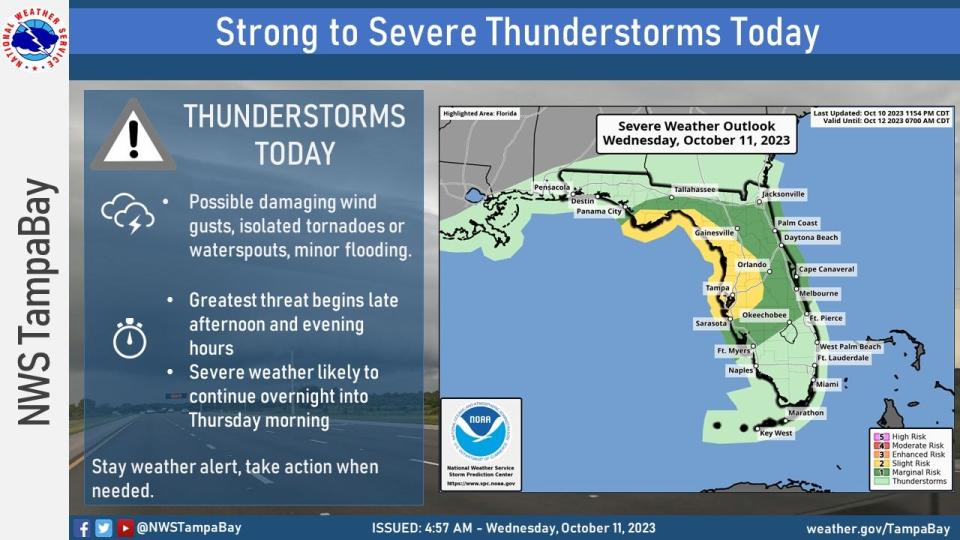
The National Weather Service Tampa Bay warned residents the greatest threats for severe weather could arrive by the late afternoon or evening today and continue into Thursday morning.
Strong to severe thunderstorms, damaging wind gusts, isolated tornadoes and minor flooding are possible.
Sean isn't expected to strengthen much as it heads west-northwest across the Atlantic. Wind shear is inhibiting development.
Farther east in the Atlantic, a tropical wave just off the coast of Africa has a low chance for development over the next seven days.
Here's the latest update from the NHC as of 2 p.m.:
Tropical Storm Sean: Where is it and where is it going?

Location: 780 miles west-southwest of Cabo Verde Islands
Maximum sustained winds: 40 mph
Movement: west-northwest at 13 mph
Pressure: 1006 mb
At 11 a.m., the center of Tropical Storm Sean was located near latitude 10.9 North, longitude 34.4 West. Sean is moving toward the west-northwest near 13 mph . Awest-northwestward to northwestward motion is forecast during the next few days.
Maximum sustained winds are near 40 mph, with higher gusts. Little change in strength is forecast during the next 72 hours.
Tropical-storm-force winds extend outward up to 90 miles from the center.
Hurricane season forecast: No-name storm brings nasty weather to Florida; cold fronts could chill hurricane season
Spaghetti models for Tropical Storm Sean
Special note about spaghetti models: Illustrations include an array of forecast tools and models, and not all are created equal. The hurricane center uses only the top four or five highest performing models to help make its forecasts.
What else is out there and how likely is it to strengthen?
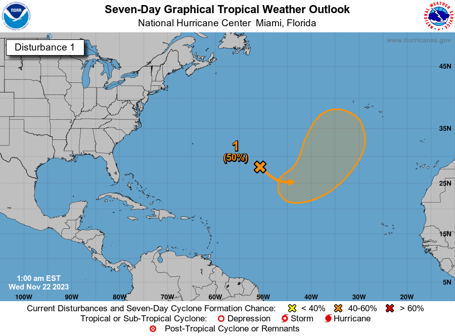
Tropical wave: A broad area of low pressure located several hundred miles to the south-southeast of the Cabo Verde Islands is producing a large area of showers and thunderstorms.
This activity has changed little in organization this afternoon, but environmental conditions appear conducive for some slow development over the next few days. This system should move generally westward across the eastern and central tropical Atlantic through early next week.
Formation chance through 48 hours: low, 20 percent.
Formation chance through 7 days: low, 30 percent.
Who is likely to be impacted?
No impacts to Florida or the rest of the U.S. are expected at this time from the tropical systems being tracked by the National Hurricane Center.
Forecasters urge all residents to continue monitoring the tropics and to always be prepared.
Weather watches and warnings issued in Florida
When is the Atlantic hurricane season?
The Atlantic hurricane season runs from June 1 through Nov. 30.
When is the peak of hurricane season?
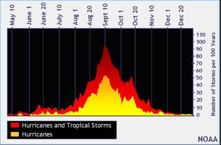
The peak of the season is Sept. 10, with the most activity happening between mid-August and mid-October, according to the Hurricane Center.
Tropical forecast over the next seven days
Excessive rainfall forecast
What's out there?
Systems currently being monitored by the National Hurricane Center.

Noaa
Embedded content: https://www.nhc.noaa.gov/xgtwo/two_atl_0d0.png?052051
What's next?
We will continue to update our tropical weather coverage daily. Download your local site's app to ensure you're always connected to the news. And look at our special subscription offers here.
This article originally appeared on Treasure Coast Newspapers: NHC tracking Tropical Storm Sean, tropical wave. Florida weather

