Tropical storm warning, tornado watch issued for South Florida ahead of Hurricane Ian
All of South Florida is now on alert for Hurricane Ian’s tropical-storm-force winds.
Forecasters announced at 5 p.m. Tuesday that all of South Florida, including portions of Florida’s southeast coast, was upgraded to a tropical storm warning as Hurricane Ian treks closer to the state.
This means Miami-Dade, Broward, Palm Beach and the Florida Keys are expected to feel tropical-storm-force winds between 39 to 73 mph within 36 hours.
A tropical storm warning is also in effect for Lake Okeechobee, Florida Bay, Flamingo to Althama Sound, Flamingo to Chokoloskee, Suwannee River to the Anclote River, Bimini and Grand Bahama Islands, and the Cuban provinces of La Habana, Mayabeque, and Matanzas.
“South Florida Residents: The threat from impacts beyond the cone has increased for all of South Florida. Greatest concerns remain for SW Florida at this time,” the National Weather Service in Miami said. “Stay informed and heed the advise of public safety officials.”
South Florida Residents: The threat from impacts beyond the cone has increased for all of south Florida. Greatest concerns remain for SW Florida at this time. Stay informed and heed the advise of public safety officials. #flwx #Ian. https://t.co/DqQi50IIid pic.twitter.com/YZU18gDjSk
— NWS Miami (@NWSMiami) September 27, 2022
And all of South Florida — including Monroe, Miami-Dade, Broward and Palm Beach — is under a tornado watch through 5 a.m. Wednesday.
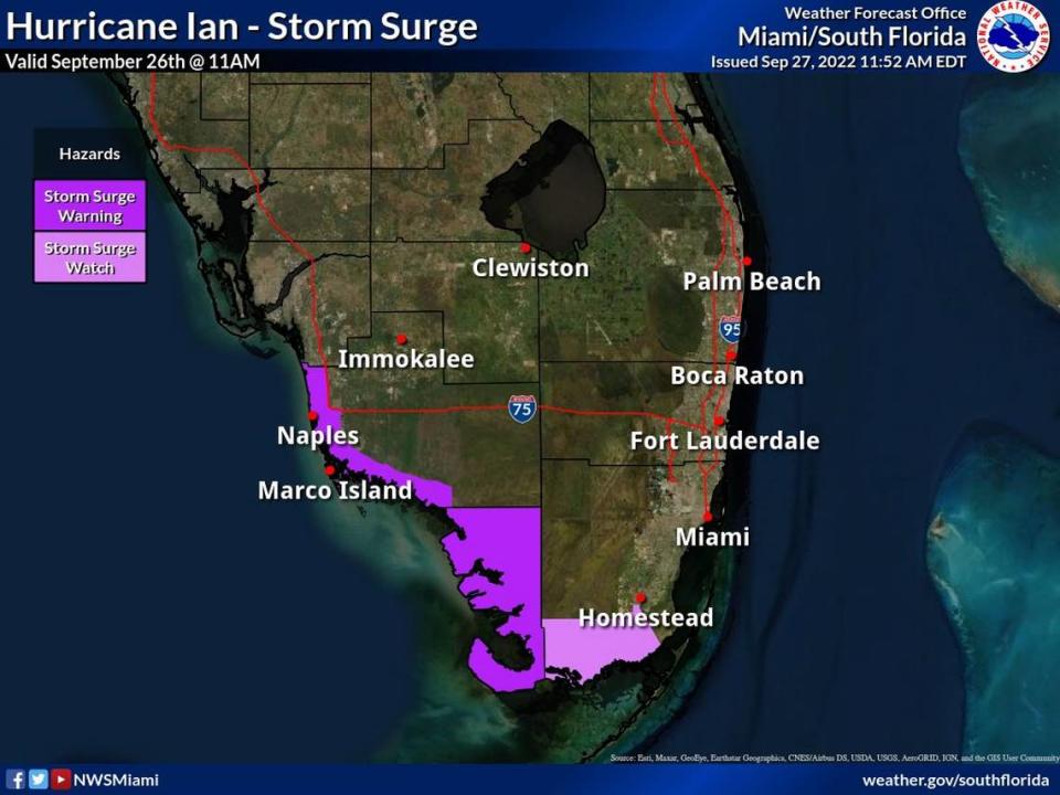
Also still in effect: A storm surge watch for the Florida Keys (from the Card Sound Bridge west to Key West), a hurricane warning for the Dry Tortugas and a flood watch for all of South Florida through at least Thursday morning.
READ MORE: When will South Florida, Keys see the worst of Ian and when will bad weather clear out?
The updated watches and warnings were issued as Hurricane Ian, a Cat 3 storm, left Cuba behind and is now in the Gulf of Mexico, where it’s forecast to strengthen into a Cat 4 hurricane soon. The forecast shows it passing to the west of the Florida Keys later Wednesday, bringing more of its flooding rain and tropical-storm-force winds to the region.
Ian’s projected path shifted south Tuesday, with the National Hurricane Center’s 5 p.m. update now pushing the storm to an earlier potential landfall north of the Port Charlotte area.
Miami Herald Staff Writer Omar Rodríguez Ortiz contributed to this report.

