Atlantic could churn out more than one tropical threat in coming weeks


It's just one week into the 2021 Atlantic hurricane season, and meteorologists are watching the tropics with a particularly close eye on the waters surrounding Central America. AccuWeather forecasters say the potential exists for development of a tropical depression or storm -- one that they have been scrutinizing for the past week -- and the chances will grow in mid- to late June. Additional disturbances could take shape in other parts of the basin as well.
An uptick in showers and thunderstorms over Central America, southern Mexico and some of the islands in the western Caribbean is forecast late this week and this weekend.
 |
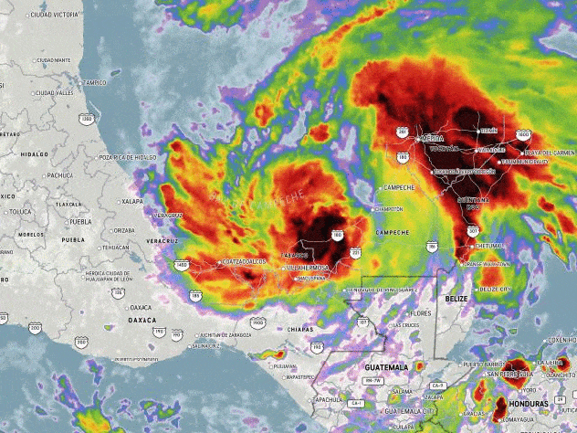
This image, captured on Monday, June 8, 2021, shows no organized features over the northwestern Caribbean, the Gulf of Mexico and Central America. Some low-grade circulations are evident over the southern Caribbean and off the Pacific coast of Central America. (CIRA at Colorado State/GOES-East) |
Strong wind shear will likely to remain an inhibiting factor for tropical development through the middle of this week over the western Caribbean and Gulf of Mexico; this has been the case thus far this season. However, that tropical suppression factor may be about to change.
Wind shear is the increase in speed or change in direction of breezes at different layers of the atmosphere above the sea surface or across the sea surface in the horizontal. When wind shear is strong, it tends to limit tropical storm development or cause an established tropical system to weaken. When wind shear is low or diminishes, the door can open for tropical systems to develop and strengthen more readily, especially when other favorable conditions come into play.
"Wind shear is expected to diminish over the western Caribbean Sea late this weekend to next week, which may allow the increased thunderstorm activity to gradually organize and form an area of low pressure," AccuWeather Senior Meteorologist Rob Miller said.
 |
"Provided wind shear remains low, this low pressure area may slowly develop into an organized tropical system in the northwestern Caribbean Sea or southwestern Gulf of Mexico this weekend to next week," Miller continued.
Cool water and dry air also tend to inhibit tropical development. Waters are sufficiently warm in the region to support tropical development and dry air in place from the start of this week is likely to be eroded from multiple angles by this weekend.
Regardless of whether an organized tropical system is named, downpours are expected to erupt and repeatedly soak parts of Costa Rica to Honduras, Guatemala, Belize and southeastern Mexico this weekend into next week. Incidents of flash flooding and mudslides are possible.
Steering breezes may cause any tropical features that form in the northwestern Caribbean to continue to drift northwestward.
There is potential for a tropical storm to develop in the northwestern Caribbean, according to AccuWeather Senior Meteorologist Joe Lundberg. He added that a "track into the Gulf of Mexico is a viable concern for the third week of June." If a storm were to develop, it would be the second named storm of the 2021 Atlantic hurricane season. The next named tropical storm will be given the name Bill.
Even before the season officially began on June 1, the Atlantic already had one storm under its belt. Ana developed northeast of Bermuda on May 22, first as a subtropical storm with both tropical and non-tropical characteristics. The system went on to strengthen into a fully tropical storm with maximum sustained winds of 45 mph on May 23.
CLICK HERE FOR THE FREE ACCUWEATHER APP
That threat remained out to sea, and while the current threat is still a developing situation, there is potential for more trouble to brew -- and potential impacts in the United States.
"The track of such a feature once into the Gulf is questionable this far out, but some areas such as southeastern Texas and Louisiana are very vulnerable following the 1-2 feet of rain that has fallen in the past few weeks," Lundberg added.
At the same time, a phenomenon known as the Central American Gyre is predicted to evolve. This feature may provide enough of a boost to initiate tropical activity.
An atmospheric gyre is a large circular zone of lower air pressure that slowly spins. The Central American version can encompass thousands of square miles and sometimes overlap waters in the western Caribbean, the eastern Pacific and sometimes even the southwestern part of the Gulf of Mexico.
 |
This broad low pressure zone typically makes it easier for clusters of drenching showers and thunderstorms to erupt. It is where these clusters linger over warm waters that tropical disturbances can gradually strengthen into tropical depressions or storms.
"The formation of this gyre would also raise the chance for tropical development in the northwest Caribbean, southern Bay of Campeche or off the west coast of Central America on or around June 15," AccuWeather Hurricane Expert Dan Kottlowski said.
With the evolving weather pattern, development along the Pacific coast of Central America and southern Mexico is perhaps a bit more likely, or at least may occur a bit sooner, than on the Atlantic side this weekend to early next week.
 |
"Whether or not there is tropical development over the coastal waters of the Eastern Pacific, flooding rainfall and strong winds can impact parts of El Salvador, southern Guatemala and southeast Mexico this weekend into early next week," Miller said.
It was just about a week earlier in the season last year that the formation of the Central American Gyre contributed to the formation of Tropical Storm Amanda along the coast of El Salvador over the Eastern Pacific on May 31, 2020.
Amanda moved ashore later on May 31, 2020, and then dissipated over southern Guatemala. However, part of the moisture and wind field left over from Amanda gave birth to Tropical Storm Cristobal along the coast of Mexico's Yucatan Peninsula in the southwestern Gulf of Mexico, which is considered to be in the Atlantic basin.
 |
Cristobal June 2020 Satellite Loop (NOAA / AccuWeather) |
Cristobal moved northward across the Gulf in the following days and made landfall as a tropical storm in southeastern Louisiana on June 7.
The 2020 Atlantic hurricane season went on to become the most active on record with 30 named systems that included 14 hurricanes. There were a record 12 landfalls in the U.S. For comparison, an average hurricane season yields around 14 named storms, with about seven that go on to strengthen into hurricanes, based on data over the 30-year period from 1991 to 2020.
 |
While AccuWeather meteorologists do not expected the 2021 Atlantic hurricane season to reach the same number of named systems as 2020, this season is expected to be very active and well above-average, with the potential for several direct impacts on the U.S.
There is another area that may be of concern for tropical activity at least for shipping, U.S. beach and Bermuda interests next week. This zone is well detached from the Central American gyre.
 |
A front is expected to stall just off the Atlantic coast next week. Fronts that linger in this zone have been known to help spawn tropical systems, especially during the early part of the season.
Waters off the Southeast coast will be watched for a lingering zone of disturbed weather that could slowly transform into a tropical system before heading out to sea.
In the worst-case scenario, there may be two more named systems in the Atlantic basin by the end of the third week in June, including a threat in the Gulf of Mexico. After Bill, Claudette is the next name on the 2021 list for the Atlantic.
Keep checking back on AccuWeather.com and stay tuned to the AccuWeather Network on DirecTV, Frontier, Spectrum, FuboTV, Philo, and Verizon Fios.
