Tropics may be quiet but cold front could bring threat of strong winds, tornadoes to Florida
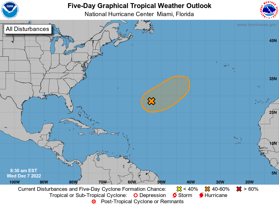
Conditions remain quiet in the Atlantic, with no tropical cyclones expected over the next five days, according to the latest advisory from the National Hurricane Center.
While the tropics may be quiet, a cold front over the Gulf of Mexico may bring cooler temperatures, along with a threat of strong winds and tornadoes, to Florida.
The front is expected to push through the state Tuesday night and Wednesday, bringing with it "significantly cooler air Thursday through the weekend," according to the National Weather Service, Tampa Bay.
Heads up #Panhandle. Showers and storms have already begun as a cold front approaches your area, but the risk for severe storms will increase this morning into the afternoon. Stay weather aware today as strong winds and stray tornadoes are possible. #FLwx pic.twitter.com/0lMxPcWIt3
— Florida Storms (@FloridaStorms) November 15, 2022
The front started moving through the Panhandle this morning.
"The risk for severe storms will increase this morning into the afternoon. "Strong winds and stray tornadoes are possible," according to the Florida Public Radio Emergency Network.
Cone of uncertainty: Many people misunderstand this famous hurricane forecast graphic. It can be a deadly mistake.
Coastal living comes with a price: After Hurricane Ian, Florida forced to rethink its cycle of rebuilding
Did sharks leave? Experts discuss hurricanes' impact on wildlife
What the science says: Is climate change fueling massive hurricanes in the Atlantic?
The front stretches from the northwestern Gulf from southeast Louisiana to Tampico, Mexico this morning. It's expected to reach from North Florida to the Bay of Campeche by Wednesday morning and shift into the southeastern Gulf by Thursday morning.
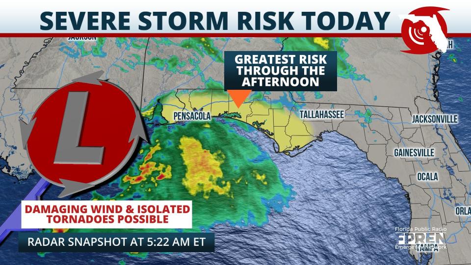
Strong thunderstorms are possible in the Panhandle today, especially from mid- to late-morning, according to the National Weather Service, Tallahassee. "Locally damaging wind gusts are the main threat but a tornado cannot be ruled out."
Before the cold front arrives, near record highs could be seen in some areas of the state, according to the National Weather Service, Melbourne.
Temperatures are forecast to hit the mid to upper 80s today along the East Coast and Central Florida.
Here's the latest update from the NHC as of 7 a.m. Nov. 15:
What's out there and where are they?
Who is likely to be impacted?
Forecasters urge all residents to continue monitoring the tropics and to always be prepared.
When is the Atlantic hurricane season?
The Atlantic hurricane season runs from June 1 through Nov. 30.
When is the peak of hurricane season?

Although the season has gotten off to a quiet start, the peak of the season is Sept. 10, with the most activity happening between mid-August and mid-October, according to the Hurricane Center.
Weather watches and warnings issued for your area
If you can't see any local weather warnings here, you'll need to open this story in a web browser.
Tropical forecast over next five days
See the National Hurricane Center's five-day graphical tropical weather outlook below.
Excessive rainfall forecast
What's out there?
Systems currently being monitored by the National Hurricane Center.
What's next?
We will continue to update our tropical weather coverage daily. Download your local site's app to ensure you're always connected to the news. And look at our special subscription offers here.
This article originally appeared on Palm Beach Post: Cold front forecast to bring strong winds, isolated tornadoes

