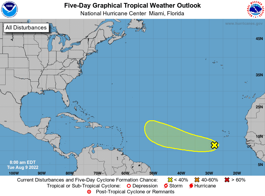
Tropics watch: Tropical wave weakens over Atlantic; chance of tropical depression down
Shower and thunderstorm activity associated with a tropical wave over the eastern Atlantic Ocean has become more limited Tuesday, forecasters at the National Hurricane Center said. While it's still possible a tropical depression could form this week, conditions are expected to become less favorable by this weekend.
More: Engineering holds answer to hurricane protection
New on the hurricane radar: Four WeatherSTEM stations installed in Delray — here's how they work
What's out there and where are they?
Tropical wave: An area of showers and thunderstorms over the eastern tropical Atlantic is associated with a tropical wave. This system is expected to move westward to west-northwestward at 15 to 20 mph during the next several days.
How likely are they to strengthen?
Gradual development of this system is possible and a tropical depression could form around the middle to latter portion of the week before environmental conditions become less favorable by this weekend.
Formation chance through 48 hours: Low, 20 percent
Formation chance through 5 days: Low, 30 percent

Who is likely to be impacted?
It's still too early at this time to determine whether Florida will feel the impact from this system. While the 2022 Atlantic hurricane season has been comparatively quiet so far, forecasters say residents in coastal areas should stay alert as the season's September peak approaches.
Tracking the tropics in real time:
These graphics, which update automatically, show you activity in the tropics in real time:
What's next?
We will continue to update our tropical weather coverage daily. Download your local site's app to ensure you're always connected to the news. And look at our special subscription offers here.
This article originally appeared on Palm Beach Post: Tropical depression may still form over Atlantic this week, but less likely

