Mapped: When will Storm Eunice hit the UK and where will be affected?
Storm Dudley battered the north of England, Scotland and Northern Ireland late on Wednesday and into Thursday, drenching the regions with heavy rain as high winds brought down power lines, trees and railway cables.
Train services in Scotland had to be halted and the Northern Powergrid said on Wednesday night that up to 14,000 homes had suffered power cuts.
Capel Curig in Wales experienced gusts of up to 81mph, with Emley Moore in Yorkshire seeing 74mph winds and Drumalbin in Scotland hit by 71mph gales.
What’s more, Dudley is about to be followed by Storm Eunice, which the Met Office has cautioned could be one of the worst to strike Britain in 30 years as it issued amber and yellow weather warnings across the UK.
A rare red warning has also been issued for the south west of England and Wales taking in Bristol, Cardiff and Swansea to caution against the extreme conditions and the danger posed by flying debris, while travellers hoping to journey by train from London to York or Leeds on Friday have been advised against attempting the trip.
Here’s an hour-by-hour look at Storm Dudley’s predicted progress across the UK into Friday before Eunice arrives to take its place.
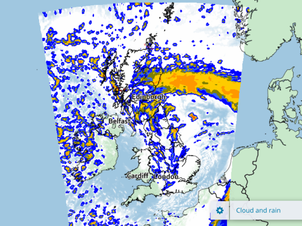
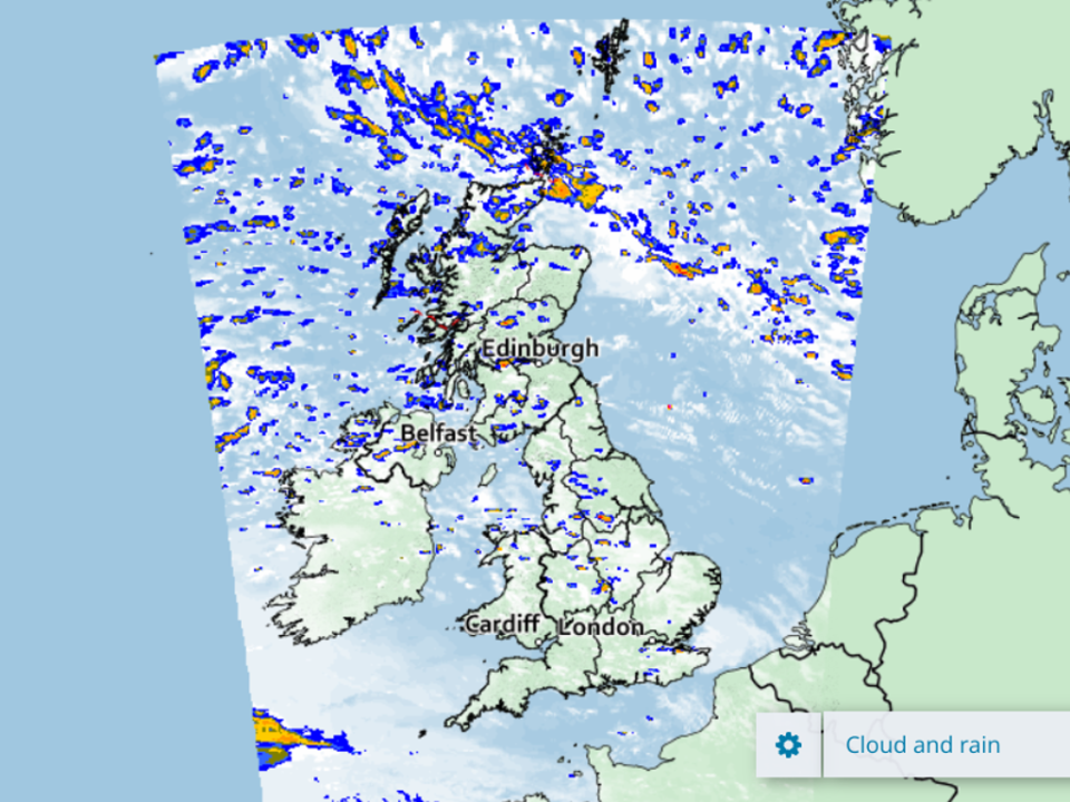
12pm
After avoiding the worst of the weather for much of Wednesday, central Wales looks likely to get a dousing come Thursday lunchtime, according to the current forecast.
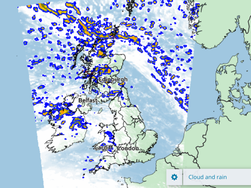
1pm
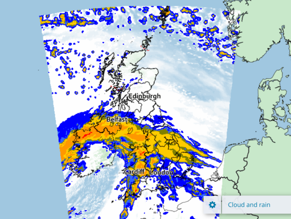
The picture remains incredibly fragmented as we enter the afternoon, with extremely scattered showers across Scotland, Northern Ireland and the West Midlands.
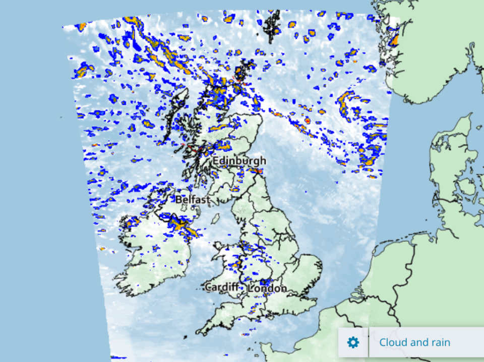
2pm
That pattern continues as the afternoon progresses, with some rain beginning to drift east towards London.
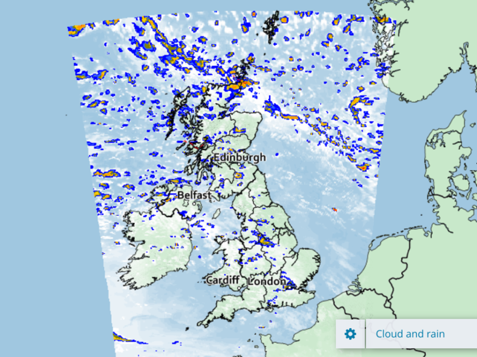
3pm
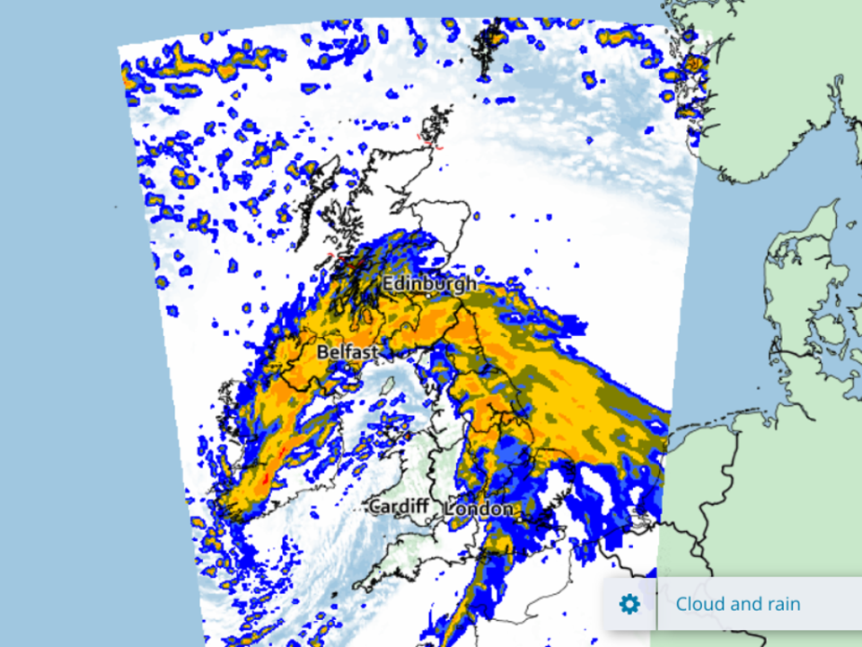
A degree of calm is predicted by this point – but don’t get too comfortable.
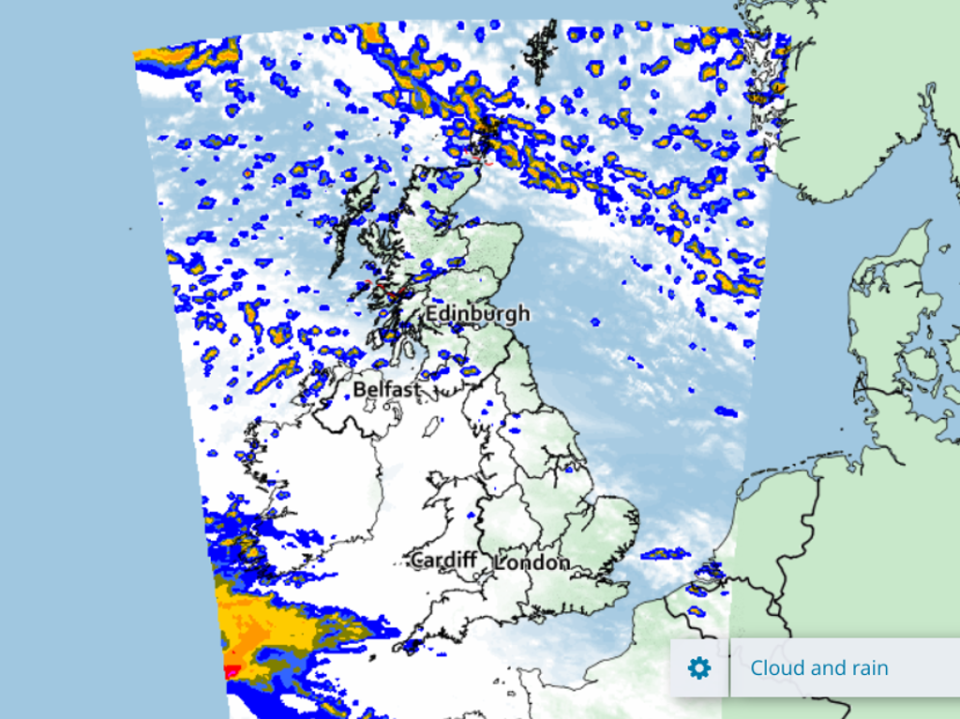
6pm
By sunset, the sinister spectre of Eunice makes her entrance from the west, with southern Ireland and Cornwall bearing the brunt of it from the Atlantic.
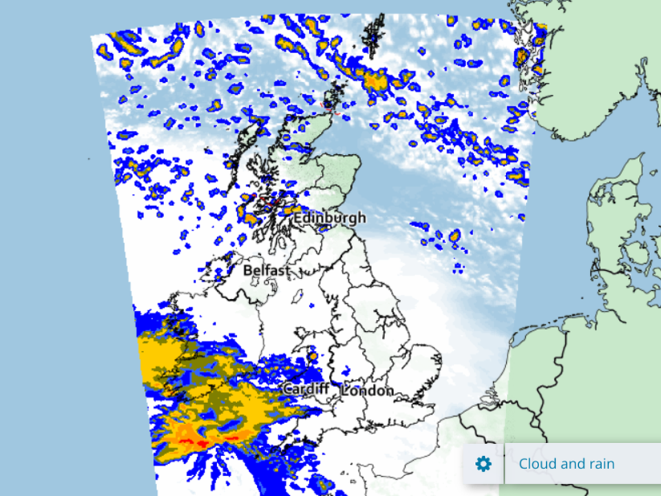
9pm
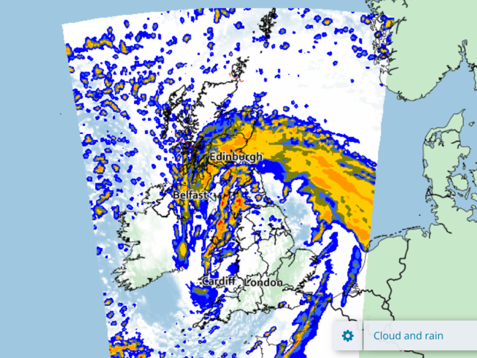
Ireland and Wales can expect a fairly brutal soaking this evening.
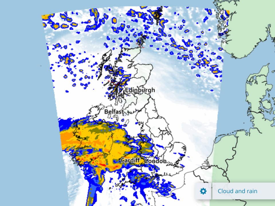
12am
Around midnight, Eunice will be drifting east towards central England ahead of what promises to be an alarmingly wet and windy Friday for one and all.
3am
Northern Ireland, Wales and northern England look set to get the worst of it in the early hours of Friday morning.
6am
The sickle shape of the storm means it will take in Belfast, Edinburgh and the cities of north eastern England at one stroke.
9am
Eunice will gradually drift to the north east as Friday morning progresses, leaving high winds, more rain and no doubt widespread chaos in its wake.
12pm
By Friday lunchtime, central and eastern Scotland will have the worst of it northern and central England face sporadic showers.