UK weather – live: Yellow weather warning issued as Met Office forecast return of snow
The Met Office has issued a fresh weather warning over the weekend as the UK braces for another spell of snow next week.
The yellow weather warning for rain is expected to affect areas in western Scotland from Sunday at 6pm until 9pm on Monday - bringing travel disruption, power cuts and flooding.
It comes as experts warned that snow will fall in Scotland and even potentially down south as cold air dubbed the “Troll from Trondheim” makes its way over the country from Norway.
Jim Dale, Senior Meteorological Consultant at British Weather Services told The Independent: “We haven’t got to end of winter yet and next week will be colder. There will be snow in Scotland and the north and potentially in the south.”
In its long-range forecast, the Met Office has also said there will be some hill snow over the weekend and that “there is a chance colder conditions could start to feature” in the second week of February.
Key points
Snow forecast as ‘Troll from Trondheim’ to hit UK
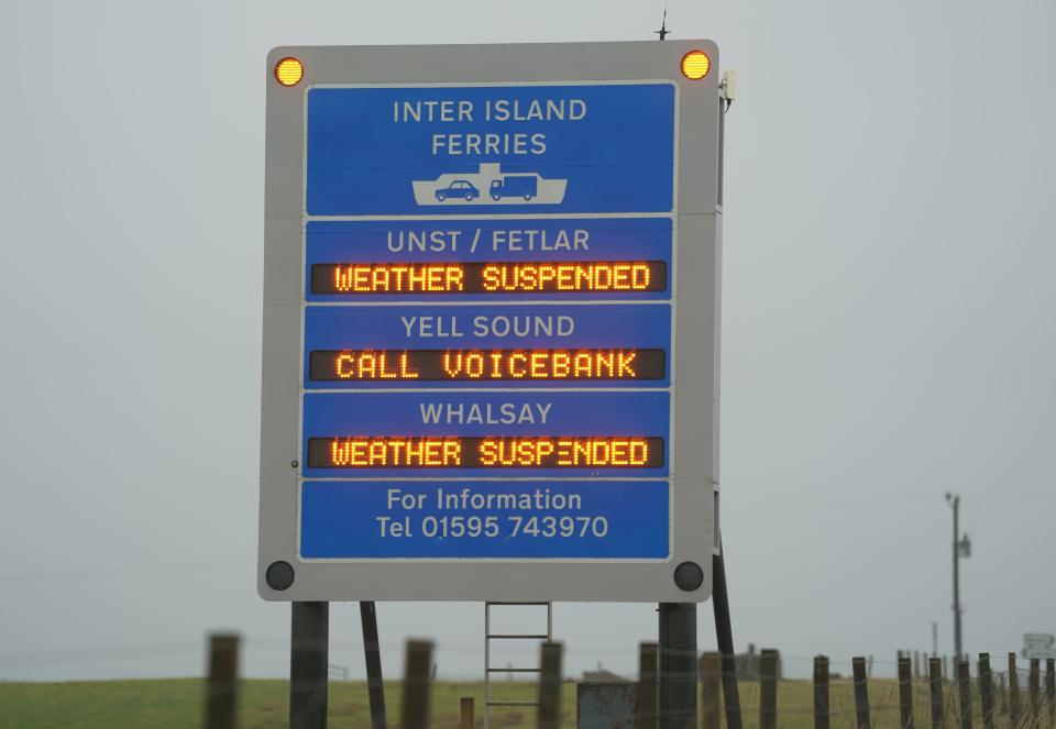
Trains and ferries cancelled in Scotland over safety concerns
Earthquake hits parts of UK as locals left fearing ‘car hit house’
Watch: 'Jaw-dropping' satellite images show storm swirling toward US west coast
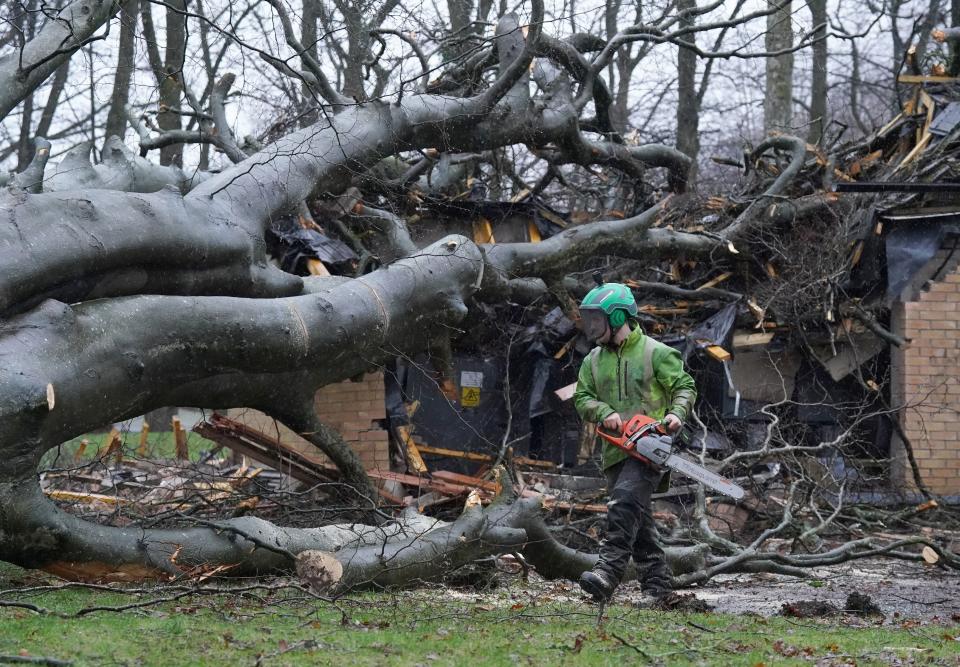
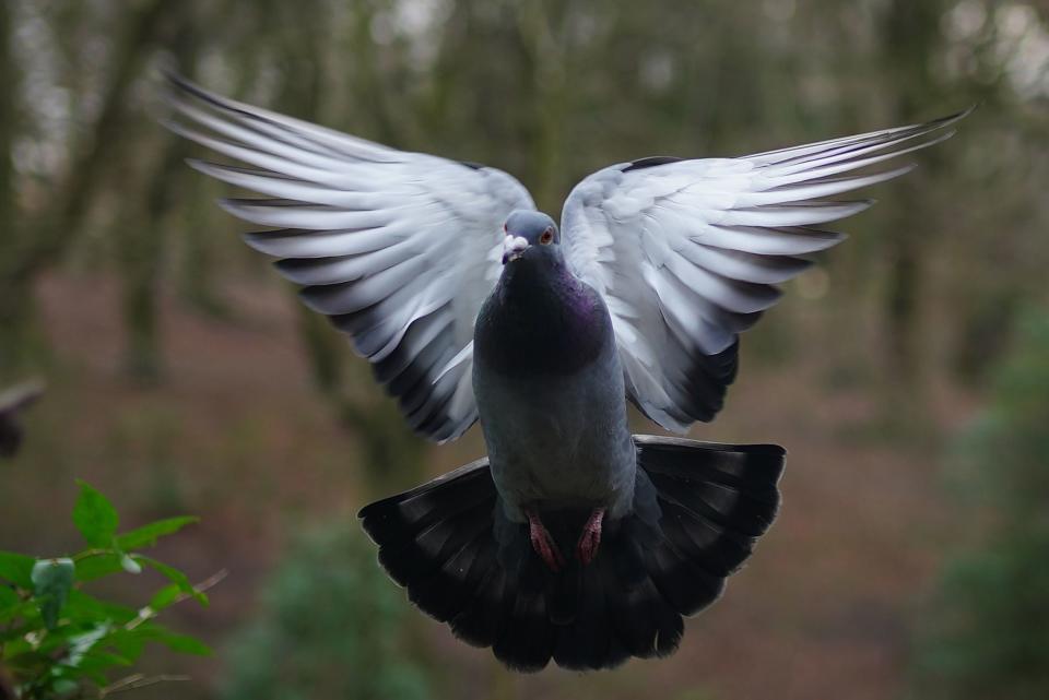
Latest weather pictures
Wednesday 31 January 2024 23:59 , Athena Stavrou

ICYMI: Earthquake hits parts of UK as locals left fearing ‘car hit house’
Thursday 1 February 2024 01:30 , Athena Stavrou
An earthquake has struck parts of the UK, leaving locals fearing a car had crashed into their house.
The British Geological Survey (BGS) said the 3.3 magnitude quake hit the Isle of Mull in the Inner Hebrides at 7.30pm on Monday.
It said movement was felt on Mull itself, on surrounding islands and on the mainland, mainly from within around 50km of the epicentre, which was in the north west of the island.

Earthquake hits parts of UK as locals left fearing ‘car hit house’
ICYMI: Trains and ferries cancelled in Scotland over safety concerns
Thursday 1 February 2024 03:00 , Athena Stavrou
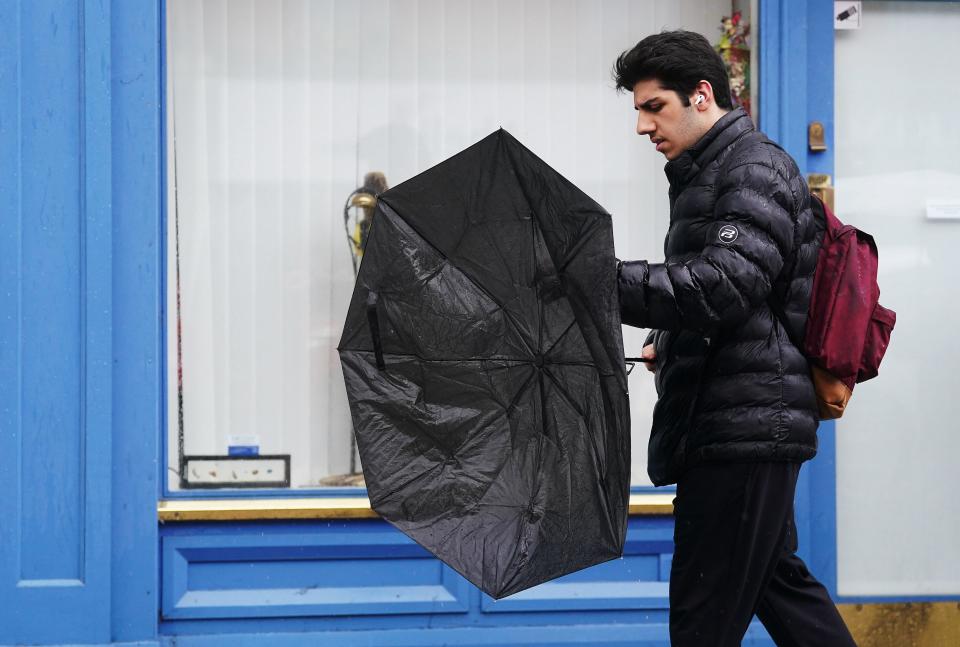
More than 40 train services were cancelled in Scotland on Wednesday morning out of concern for passenger safety as the effects of Storm Ingunn began to be felt.
Services between cities such as Dundee and Glasgow and Aberdeen to Edinburgh were cancelled while services linking Inverness to a number of northern towns were also withdrawn due to the weather.
Speed restrictions were put in place across much of the network and safety inspections are set to continue on sections of the track throughout the day.
Meanwhile, ferry operator Calmac has cancelled all departures on five of its routes.
Watch: 'Jaw-dropping' satellite images show storm swirling toward US west coast
Thursday 1 February 2024 04:00 , Athena Stavrou
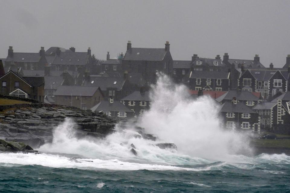
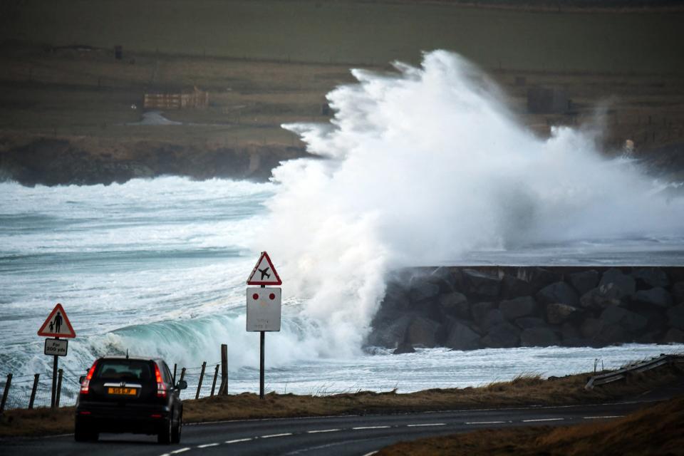
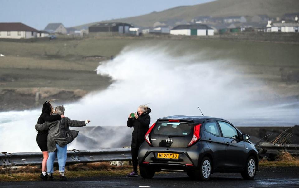
Huge waves in the Shetland Islands - latest weather pictures
Thursday 1 February 2024 05:00 , Athena Stavrou
Weather forecast for rest of the week
Thursday 1 February 2024 06:00 , Athena Stavrou
Thursday:
After a chilly start, a mostly dry day with gentle winds and some sunshine. However, some showers in the north, giving way to some wet and windy weather here later.
Outlook for Friday to Sunday:
Often windy with rain at times, especially in the north and west. Briefly turning colder in the north this weekend, with some hill snow, otherwise mild. Brightest in the east.
Earthquake hits parts of UK as locals left fearing ‘car hit house’
Thursday 1 February 2024 09:19 , Alexander Butler
An earthquake has struck parts of the UK, leaving locals fearing a car had crashed into their house.
The British Geological Survey (BGS) said the 3.3 magnitude quake hit the Isle of Mull in the Inner Hebrides at 7.30pm on Monday.
It said movement was felt on Mull itself, on surrounding islands and on the mainland, mainly from within around 50km of the epicentre, which was in the north west of the island.
Earthquake hits parts of UK as locals left fearing ‘car hit house’
Today’s weather forecast
Thursday 1 February 2024 11:36 , Athena Stavrou
Today:
After a chilly start, it will be a mostly dry day with gentle winds and some sunshine. However, windier with some showers in the north, giving way to some wet and windy weather here later. Feeling a little cooler.
Tonight:
Cloud and hill fog edging east overnight with patchy light rain or drizzle across western hills, especially in the north. A mild and rather windy night for all.
Snow expected next week
Thursday 1 February 2024 13:07 , Athena Stavrou
Following a relatively mild end to January, experts have warned that snow will return to the UK next week as temperatures plummet to -8C in some areas.
Jim Dale, Senior Meteorological Consultant at British Weather Services told The Independent: “We haven’t got to the end of winter yet and next week will be colder. There will be snow in Scotland and the north and potentially in the south.”
According to WXCharts, an interactive weather map provider using Met Office data, the UK will be coldest on 10 February, with certain areas of Scotland and Wales seeing minimum temperatures dropping to -8C.
The maps predict widespread snow cover with 2cm of snow falling per hour at its peak.
In its long-range forecast, the Met Office has also said there will be some hill snow over the weekend and that “there is a chance colder conditions could start to feature” in the second week of February.

More storms to come this year?
Thursday 1 February 2024 14:09 , Athena Stavrou
After Storm Jocelyn last week, the UK will continue to see spells of wet and windy weather, especially in northern and western areas, according to the Met Office.
The forecasters added that long range models suggest that late January and early February weather could see some drier interludes further south, while wet and windy weather remains possible in the north and west.
In terms of what this means for named storms, it’s too early to pick out when the next one might be, but there remains a chance of further impactful weather as we move through meteorological winter and into spring.
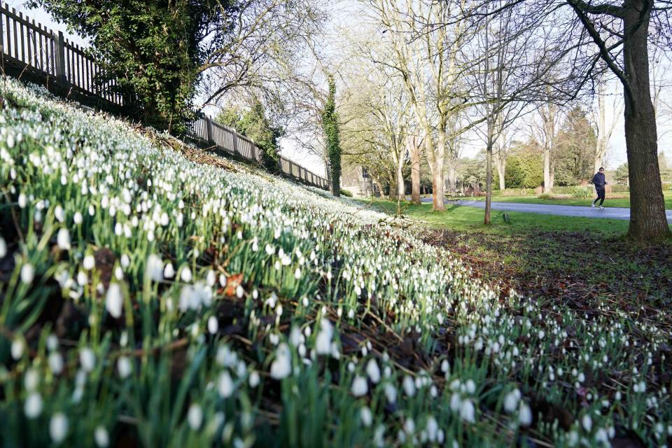
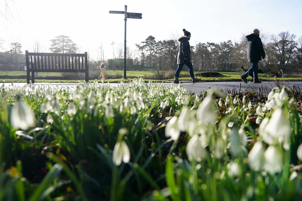
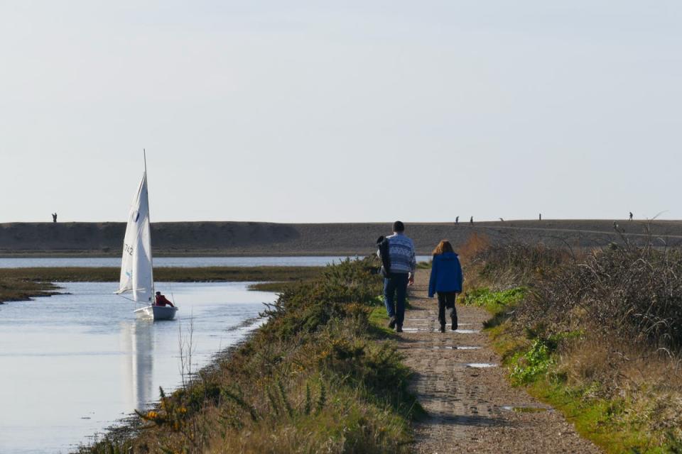
Latest weather pictures - glimpses of spring on sunny Thursday morning
Thursday 1 February 2024 15:24 , Athena Stavrou

Met Office’s summary of January weather
Thursday 1 February 2024 16:28 , Athena Stavrou
The Met Office has dubbed the first month of the year a “month of contrast”.
January brought the UK three named storms, a significant spell of cold, wintry weather and finally a new UK daily maximum temperature record for January.
The forecasters said that temperatures and rainfall amounts varied throughout the month, with mild and wet weather interrupted by a cold and dry spell from the second week of January, albeit with some significant snow for northern areas of the UK.
Overall, this means that the average mean temperature for the UK for January 2024 is near average according to provisional Met Office figures. UK mean temperatures ended the month at 3.8°C, around 0.1°C lower than the long-term average for the month.
Met Office Senior Scientist Mike Kendon said: “Overall, the UK temperature and rainfall for January were fairly near average but these belie the fact that the weather has never been too far away from the headlines. Storms Henk, Jocelyn and Isha all brought significant impacts, as did the cold and snowy conditions around the middle of the month.”
Watch: tonight’s weather forecast
Thursday 1 February 2024 17:30 , Athena Stavrou
☔ Persistent rain in Scotland gradually clearings eastwards tonight
☁️ Elsewhere, turning cloudier from the west with patchy drizzle over the hills
💨 Becoming windier in the north and milder 📈 pic.twitter.com/64spjjSluS— Met Office (@metoffice) February 1, 2024
Tonight’s weather forecast
Thursday 1 February 2024 19:30 , Athena Stavrou
As Britain prepares to be hit with more snow next week, here’s what to expect tonight, according to the Met Office:
“Cloud increasing from the west overnight, bringing hill fog and outbreaks of rain to northern and western areas, locally heavy at first in the far north. Briefly chilly under clear spells in the southeast. Turning windy, especially in the north.”
Watch: This weekends weather forecast
Thursday 1 February 2024 20:30 , Athena Stavrou
Want to know what the weather has in store for this weekend? 👀
Here's Alex with all the info 👇 pic.twitter.com/RLqLHBUb9y— Met Office (@metoffice) February 1, 2024
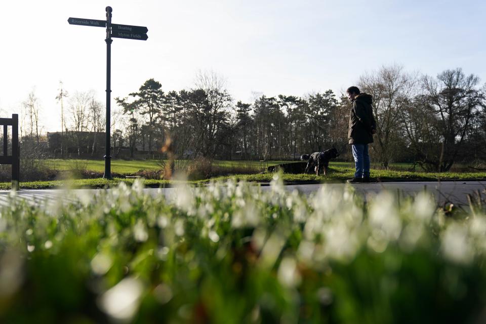
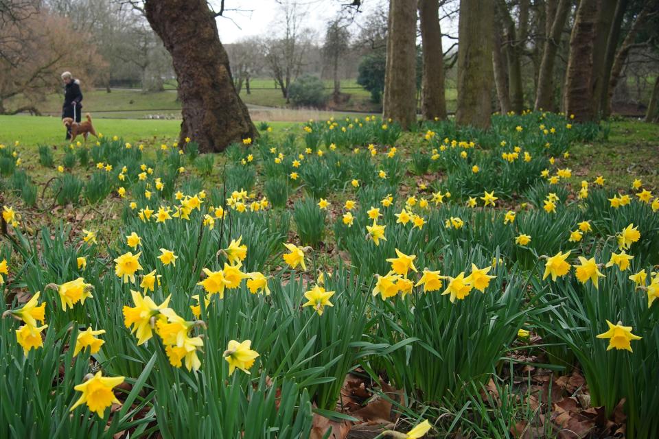
Latest weather pictures - spring flowers
Thursday 1 February 2024 21:30 , Athena Stavrou
Snow expected next week
Thursday 1 February 2024 22:30 , Athena Stavrou
Following a relatively mild end to January, experts have warned that snow will return to the UK next week as temperatures plummet to -8C in some areas.
Jim Dale, Senior Meteorological Consultant at British Weather Services told The Independent: “We haven’t got to the end of winter yet and next week will be colder. There will be snow in Scotland and the north and potentially in the south.”
According to WXCharts, an interactive weather map provider using Met Office data, the UK will be coldest on 10 February, with certain areas of Scotland and Wales seeing minimum temperatures dropping to -8C.
The maps predict widespread snow cover with 2cm of snow falling per hour at its peak.
In its long-range forecast, the Met Office has also said there will be some hill snow over the weekend and that “there is a chance colder conditions could start to feature” in the second week of February.
Earthquake hits parts of UK as locals left fearing ‘car hit house’
Thursday 1 February 2024 23:30 , Athena Stavrou
An earthquake has struck parts of the UK, leaving locals fearing a car had crashed into their house.
The British Geological Survey (BGS) said the 3.3 magnitude quake hit the Isle of Mull in the Inner Hebrides at 7.30pm on Monday.
It said movement was felt on Mull itself, on surrounding islands and on the mainland, mainly from within around 50km of the epicentre, which was in the north west of the island.
Earthquake hits parts of UK as locals left fearing ‘car hit house’
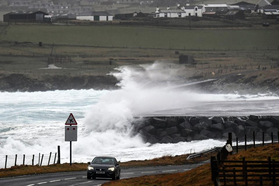
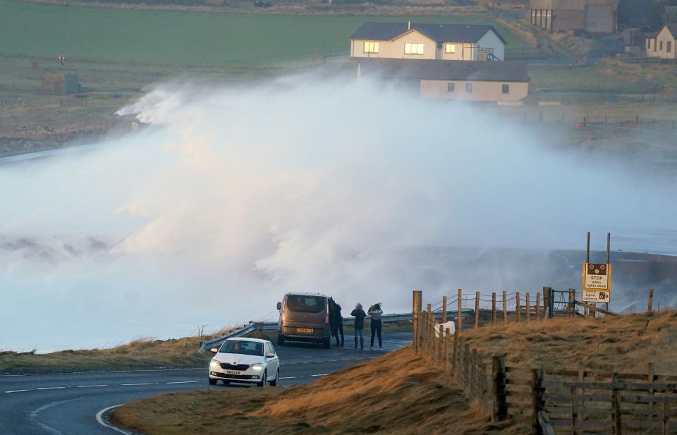
In pictures: Huge waves in the Shetland Islands
Friday 2 February 2024 00:30 , Athena Stavrou
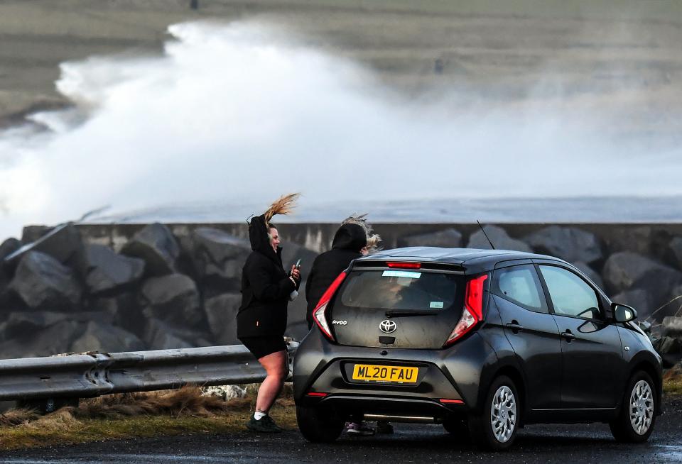
Friday 2 February 2024 02:13 , Alex Ross
Weather experts have warned that the UK is likely facing its stormiest winter on record as the country has already faced ten named storms with over half of the season still to go.
The storm season begins each year in September and there are usually around six or seven storms in that year.
Since storm naming was introduced in 2015 the furthest through the list the group has got is to number 11, Storm Katie, which impacted the UK in March 2016.
Jim Dale, senior meteorological consultant at British Weather Services, warned the effects of these storms will only get worse alongside climate change.
Experts explain extreme weather as UK prepares for stormiest winter on record
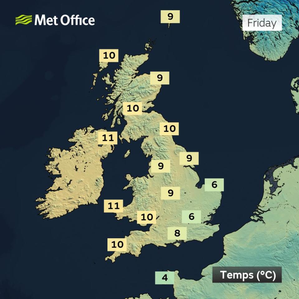
UK weather forecast for Friday
Friday 2 February 2024 03:10 , Stuti Mishra
The day is set to start on a mild but cloudy note with temperatures climbing higher than the previous days, the Met Office forecast shows. Residents in the west and northwest can expect intermittent rain throughout the day, while brighter intervals are expected in the east and the sheltered areas on the lee side of hills.
Despite the cloudy conditions, temperatures are forecast to remain “very mild”, adding a touch of warmth.
But some gales are expected in parts of Scotland over the higher grounds, the forecaster says.
Scotland could see 50-60 mph gales
Friday 2 February 2024 04:10 , Stuti Mishra
As the weather takes on a milder tone across the country, relief from persistent rain is on the horizon for the Scottish Highlands.
However, higher grounds are bracing for strong gales ranging between 50-60 mph today, according to Met Office forecast.
“We could see gales for parts of Scotland, as well as some strong gusts of 50-60 mph across the Pennines,” the forecaster wrote on X, formerly known as Twitter.
It'll be turning cloudier but also windier as we head into Friday, as the closely packed isobars show 🌬️
We could see gales for parts of Scotland, as well as some strong gusts of 50-60 mph across the Pennines 💨 pic.twitter.com/vCoTPUqCee— Met Office (@metoffice) February 1, 2024
UK prepares for stormiest winter on record
Friday 2 February 2024 05:10 , Stuti Mishra
Weather experts have warned that the UK is likely facing its stormiest winter on record as the country has already faced ten named storms with over half of the season still to go.
The storm season begins each year in September and there are usually around six or seven storms in that year.
Since storm naming was introduced in 2015 the furthest through the list the group has got is to number 11, Storm Katie, which impacted the UK in March 2016.
This year’s storm naming season is now just one name away from matching 2015/16’s number of named storms, with over seven months still to go until the list is reset again.
Read more:
Experts explain extreme weather as UK prepares for stormiest winter on record
'Month of contrasts'
Friday 2 February 2024 06:10 , Stuti Mishra
January 2024 turned out to be near average in terms of temperature and rainfall for the UK, but it was a month of contrasts.
While there were long cold snaps, storms and heavy rain, the UK also recorded its highest January temperature.
The country had its sixth sunniest January on record, offering a welcome contrast to the previous month.
Storms, temperature extremes, and varied precipitation marked January's weather, showing how abrupt the UK weather can be.
“Of course, contrasting winter weather in the UK isn’t a new phenomenon," Met Office senior scientist Mike Kendon said. "What this January clearly demonstrates is just how abrupt these changes in weather type can be.”
January was a month of contrasts for the UK's weather.
We had rain, freezing temperatures, sunshine and some record-breaking daily highs.
Read the blog below, or check out this short thread 🧵— Met Office (@metoffice) February 1, 2024
Weekend weather forecast:
Friday 2 February 2024 07:10 , Stuti Mishra
The weekend is going to be a mixed bag with scattered showers and breaks of sunshine, the Met Office forecast shows.
Southern regions can expect a blend of patchy rain followed by brighter intervals, while the northern areas will encounter blustery showers. The northwest might face prolonged and heavy rainfall,
Here's the full forecast:
Want to know what the weather has in store for this weekend? 👀
Here's Alex with all the info 👇 pic.twitter.com/RLqLHBUb9y— Met Office (@metoffice) February 1, 2024
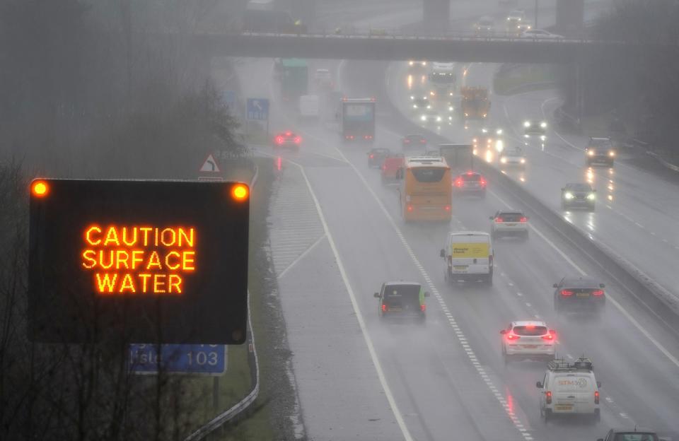
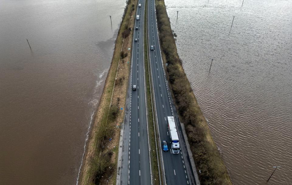
Dangerous levels of bacteria found in flood water from UK rivers
Friday 2 February 2024 08:23 , Maryam Zakir-Hussain
High levels of dangerous bacteria have been found in flood water from UK rivers that could pose a risk to human health.
Water samples taken from a Surrey housing estate close to the River Mole, a street near the River Ouse in York and a Shrewsbury park near the River Severn, found E.coli, faecal matter and ammonia.
It comes after the UK was lashed by Storm Isha and Jocelyn, causing severe flooding in various parts of the country.
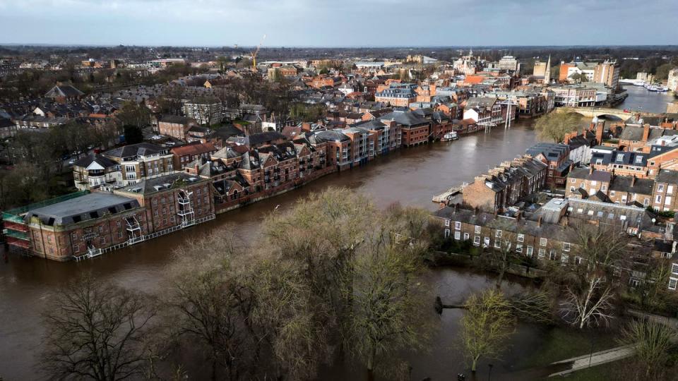
Dangerous levels of bacteria found in flood water from UK rivers
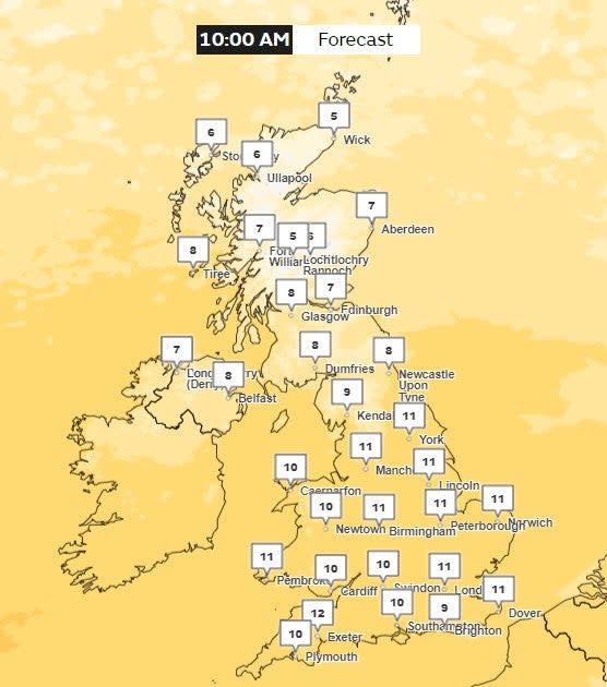
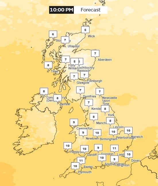
Met Office weather forecast for Saturday
Friday 2 February 2024 09:56 , Maryam Zakir-Hussain
Temperatures on Saturday look to be mild for most of the UK as the mercury hovers between 8C to 11C for most of England.
Further north, temperatures drop as low as 5C in parts of Scotland, with the higher temperatures reaching 7C.
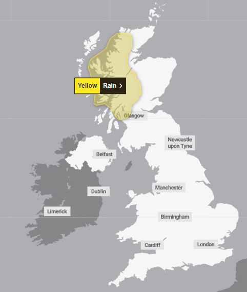
Yellow weather warning issued across parts of Scotland
Friday 2 February 2024 11:00 , Maryam Zakir-Hussain
A yellow weather warning for rain has been issued across parts of Scotland from Sunday to Monday.
The warning is in place from 6pm on Sunday to 9pm on Monday.
Regions affected are Central, Tayside & Fife, Highlands & Eilean Siar, and Strathclyde.
⚠️ Yellow weather warning issued ⚠️
Rain across parts of Scotland
Sunday 1800 – Monday 2100
Latest info 👉 https://t.co/QwDLMfRBfs
Stay #WeatherAware ⚠️ pic.twitter.com/bkv4WAqY7j— Met Office (@metoffice) February 2, 2024
Yellow weather warning for rain
Friday 2 February 2024 15:38 , Athena Stavrou
The Met Office has issued a yellow weather warning for rain on Sunday.
The warning is expected to affect areas in western Scotland from Sunday at 6pm until 9pm on Monday.
Deputy Chief Meteorologist at the Met Office, David Hayter said: “There’s likely to be some persistent rain for northern Scotland – perhaps wintry at times for Shetland - on Sunday. The rain will slowly push north through Sunday, before pivoting and then returning south later on Monday.”
The alert warns there is a chance of power cuts, transport delays, communities being cut off and that homes could flood.
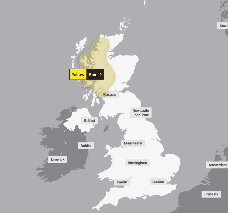
What to expect as a yellow weather warning comes into place over the weekend
Friday 2 February 2024 17:03 , Athena Stavrou
The Met Office has issued a yellow weather warning for rain over western Scotland on Sunday.
It is set to come into place on Sunday at 6pm and remain until 9pm on Monday.
Here’s what to expect:
There is a small chance that homes and businesses could be flooded, causing damage to some buildings
Where flooding occurs, there is a slight chance of delays or cancellations to train and bus services
Spray and flooding could lead to difficult driving conditions and some road closures
There is a small chance that some communities will become cut off by flooded roads
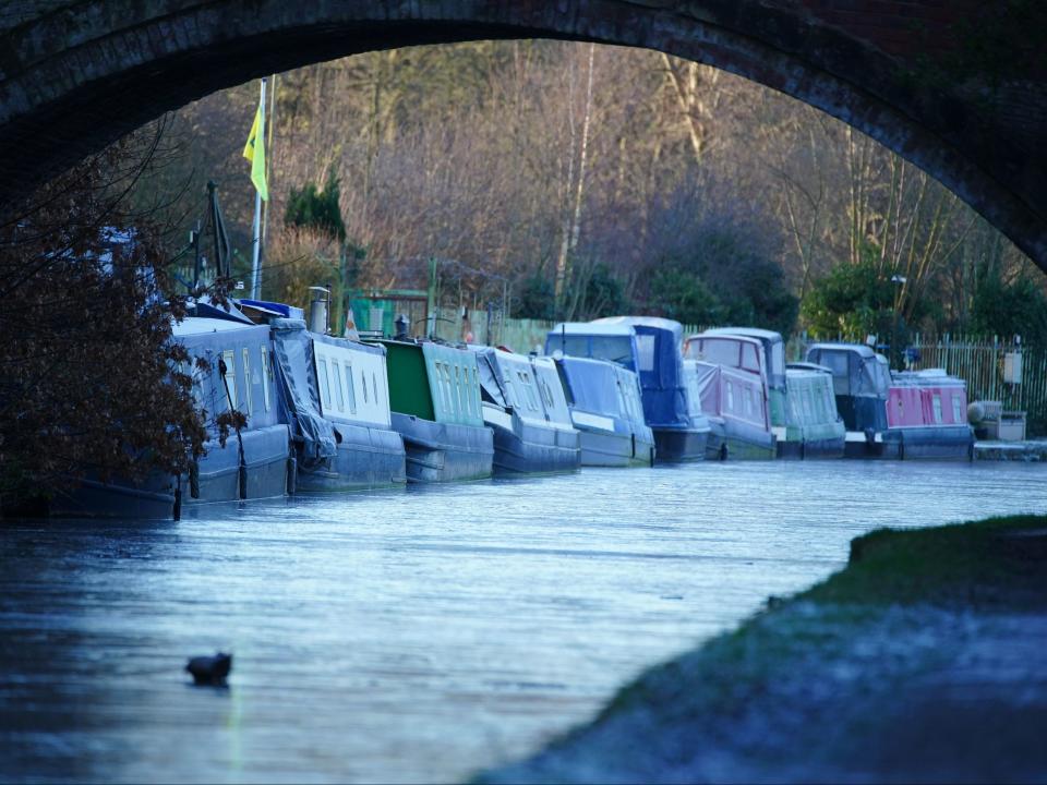
Latest weather pictures
Friday 2 February 2024 18:30 , Athena Stavrou

Friday 2 February 2024 20:00 , Athena Stavrou
The Met Office has said that the north of the UK will see a chance of wintry showers later next week.
It comes as temperatures are expected to plunge across the country as the beginning of February comes with a particularly cold spell.
Stephen Dixon, a spokesperson for Met Office, told The Independent: “For the latter part of next week, there’s a cold flow of air over the UK. In the north, we will see colder conditions with the chance of wintry showers.”
UK prepares for stormiest winter on record
Friday 2 February 2024 21:30 , Athena Stavrou
Weather experts have warned that the UK is likely facing its stormiest winter on record as the country has already faced ten named storms with over half of the season still to go.
The storm season begins each year in September and there are usually around six or seven storms in that year.
Since storm naming was introduced in 2015 the furthest through the list the group has got is to number 11, Storm Katie, which impacted the UK in March 2016.
This year’s storm naming season is now just one name away from matching 2015/16’s number of named storms, with over seven months still to go until the list is reset again.
Read the full article below:
Experts explain extreme weather as UK prepares for stormiest winter on record
170mm of rain to fall over the weekend
Friday 2 February 2024 23:00 , Athena Stavrou
Parts of the UK have been told to expect up to 170mm of rain over the weekened, as the Met Office issues a yellow weather warning for Sunday.
Deputy Chief Meteorologist at the Met Office, David Hayter said: “There’s likely to be some persistent rain for northern Scotland – perhaps wintry at times for Shetland - on Sunday. The rain will slowly push north through Sunday, before pivoting and then returning south later on Monday.
He added: Some southern parts of the warning area may see a drier interlude for a time on Monday and there is some uncertainly as to how far north the rain gets.
“40-75 mm of rain may fall quite widely in the warning areas, but there is potential for 120-170 mm in the wettest areas, this perhaps most likely in parts of Argyll, Lochaber and Wester Ross.”
Weather forecast for tonight
Saturday 3 February 2024 00:30 , Athena Stavrou
As the UK heads into a gloomy weekend, here’s the weather forecast for Friday night according to the Met Office:
This Evening and Tonight:
Mild and generally cloudy in the south with patchy rain and drizzle in the west. Clearer and feeling fresher in the north with showers across western Scotland. Staying windy in the north, with gales in places.
Watch: This weekend’s forecast
Saturday 3 February 2024 02:00 , Athena Stavrou
The UK is expecting a gloomy and cold first weekend of February as temperatures plummet.
Here’s the Met Office’s weather forecast for the weekend:
Making plans for this weekend? 🛍️🏃♂️🍽️🚵
Here's the latest forecast to help 👇 pic.twitter.com/UvbCeOfc3F— Met Office (@metoffice) February 2, 2024
‘Month of contrasts’
Saturday 3 February 2024 03:30 , Athena Stavrou
January 2024 turned out to be near average in terms of temperature and rainfall for the UK, but it was a month of contrasts.
While there were long cold snaps, storms and heavy rain, the UK also recorded its highest January temperature.
The country had its sixth sunniest January on record, offering a welcome contrast to the previous month.
Storms, temperature extremes, and varied precipitation marked January’s weather, showing how abrupt the UK weather can be.
“Of course, contrasting winter weather in the UK isn’t a new phenomenon,” Met Office senior scientist Mike Kendon said. “What this January clearly demonstrates is just how abrupt these changes in weather type can be.”
Snow expected next week
Saturday 3 February 2024 05:00 , Athena Stavrou
Following a relatively mild end to January, experts have warned that snow will return to the UK next week as temperatures plummet to -8C in some areas.
Jim Dale, Senior Meteorological Consultant at British Weather Services told The Independent: “We haven’t got to the end of winter yet and next week will be colder. There will be snow in Scotland and the north and potentially in the south.”
According to WXCharts, an interactive weather map provider using Met Office data, the UK will be coldest on 10 February, with certain areas of Scotland and Wales seeing minimum temperatures dropping to -8C.
The maps predict widespread snow cover with 2cm of snow falling per hour at its peak.
In its long-range forecast, the Met Office has also said there will be some hill snow over the weekend and that “there is a chance colder conditions could start to feature” in the second week of February.
This weekend’s forecast
Saturday 3 February 2024 06:00 , Athena Stavrou
Good morning and welcome to our live weather updates. For those just joining us, here’s a look at the weekend forecast below:
Saturday:
Staying mostly cloudy and mild in the south with patchy rain mostly in the west. Brighter with sunny spells elsewhere with showers across western Scotland. Windy in the north.
Outlook for Sunday to Tuesday:
Generally mild and rather cloudy into the start of the new week. Rain at times, especially in the north and west, and often windy. Turning colder from the north Tuesday.
UK prepares for stormiest winter on record
Saturday 3 February 2024 07:00 , Athena Stavrou
Weather experts have warned that the UK is likely facing its stormiest winter on record as the country has already faced ten named storms with over half of the season still to go.
The storm season begins each year in September and there are usually around six or seven storms in that year.
Since storm naming was introduced in 2015 the furthest through the list the group has got is to number 11, Storm Katie, which impacted the UK in March 2016.
This year’s storm naming season is now just one name away from matching 2015/16’s number of named storms, with over seven months still to go until the list is reset again.
Read the full article below:
Experts explain extreme weather as UK prepares for stormiest winter on record
Watch: Waves crash over runway at Shetland’s Sumburgh airport as storm batters UK with 85mph winds
Saturday 3 February 2024 09:16 , Alexander Butler
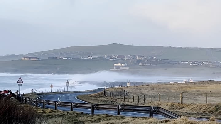
Waves crash over runway at Shetland airport as storm batters UK with 85mph winds
Experts explain extreme weather as UK prepares for stormiest winter on record
Saturday 3 February 2024 10:00 , Alexander Butler
Weather experts have warned that the UK is likely facing its stormiest winter on record as the country has already faced ten named storms with over half of the season still to go.
The storm season begins each year in September and there are usually around six or seven storms in that year.
Since storm naming was introduced in 2015 the furthest through the list the group has got is to number 11, Storm Katie, which impacted the UK in March 2016.
Experts explain extreme weather as UK prepares for stormiest winter on record
UK records warmest ever January temperature, Met Office reveals
Saturday 3 February 2024 11:00 , Alexander Butler
The record for the highest maximum temperature on a January day has just been broken after a provisional record was measured in northern Scotland.
The Met Office said they had recorded a 19.6C temperature on Sunday in Kinlochewe, a village in the northwest Highlands about an hour’s drive from Inverness.
In a post on X, the Met Office said: “There has provisionally been a new UK January daily max temperature record set today at Kinlochewe where the temperature reached 19.6C.
UK records warmest ever January temperature, hitting 19.6C
Everything you need to know about walking your dog in the cold weather
Saturday 3 February 2024 12:00 , Alexander Butler
Our furry friends can get cold too.
But despite the continuous fall in temperature during these winter months, dogs still need to go outside for their daily walks.
If you are a dog owner, here’s what you need to know about getting your pet outdoors in the colder weather.

Everything you need to know about walking your dog in the cold weather
Pictured: Satellite image of cloudy skies
Saturday 3 February 2024 15:12 , Alexander Butler
The latest satellite 🛰️ image shows the rather cloudy skies that are affecting many areas, bringing patchy rain in the south and blustery showers further north 🌧️🌦️
In the brighter breaks though temperatures have climbed to 15.9 °C at Pershore 🌥️ pic.twitter.com/L8TEf1F5Sy— Met Office (@metoffice) February 3, 2024
Everything you need to know about walking your dog in the cold weather
Saturday 3 February 2024 17:00 , Alexander Butler
Our furry friends can get cold too.
But despite the continuous fall in temperature during these winter months, dogs still need to go outside for their daily walks.
If you are a dog owner, here’s what you need to know about getting your pet outdoors in the colder weather.
Everything you need to know about walking your dog in the cold weather
Experts explain extreme weather as UK prepares for stormiest winter on record
Saturday 3 February 2024 18:00 , Alexander Butler
Weather experts have warned that the UK is likely facing its stormiest winter on record as the country has already faced ten named storms with over half of the season still to go.
The storm season begins each year in September and there are usually around six or seven storms in that year.
Since storm naming was introduced in 2015 the furthest through the list the group has got is to number 11, Storm Katie, which impacted the UK in March 2016.
Experts explain extreme weather as UK prepares for stormiest winter on record
Watch: Waves crash over runway at Shetland’s Sumburgh airport as storm batters UK with 85mph winds
Saturday 3 February 2024 19:00 , Alexander Butler
Waves crash over runway at Shetland airport as storm batters UK with 85mph winds
When is it going to rain?
Saturday 3 February 2024 20:00 , Lydia Patrick
A yellow warning for heavy rain has been issued across western Scotland from Sunday evening into Monday.
Up to 170mm of rainfall call fall over western Scotland.
Round 2 of the weekend is fast approaching
Here's a look at the weather you can expect on Sunday ☔☁️🌬️🌡️ pic.twitter.com/04jMenTxl4— Met Office (@metoffice) February 3, 2024
Where will see the heaviest downpours?
Saturday 3 February 2024 21:00 , Lydia Patrick
“There’s likely to be some persistent rain for northern Scotland – perhaps wintry at times for Shetland - on Sunday. The rain will slowly push north through Sunday, before pivoting and then returning south later on Monday.
Some southern parts of the warning area may see a drier interlude for a time on Monday and there is some uncertainly as to how far north the rain gets. 40-75 mm of rain may fall quite widely in the warning areas, but there is potential for 120-170 mm in the wettest areas, this perhaps most likely in parts of Argyll, Lochaber and Wester Ross.”
Deputy Chief Meteorologist at the Met Office, David Hayter
Experts explain extreme weather as UK prepares for stormiest winter on record
Saturday 3 February 2024 22:00 , Lydia Patrick
Weather experts have warned that the UK is likely facing its stormiest winter on record as the country has already faced ten named storms with over half of the season still to go.
The storm season begins each year in September and there are usually around six or seven storms in that year.
Since storm naming was introduced in 2015 the furthest through the list the group has got is to number 11, Storm Katie, which impacted the UK in March 2016.
This year’s storm naming season is now just one name away from matching 2015/16’s number of named storms, with over seven months still to go until the list is reset again.
Experts explain extreme weather as UK prepares for stormiest winter on record
This evening’s forecast
Saturday 3 February 2024 23:00 , Lydia Patrick
The south of England and Wales will be sunny with patchy light rain, predict the Met Office.
Elsehwerewill be clearer with showers in the north and northwest.
Northern Ireland and western Scotland will experience heavier downpours and wind.
☁️ A cloudy end to Saturday for many of us, though a few clearer spells will hold on across northern England and eastern Scotland
🌫️ Particularly murky along coasts and hills in the southwest, with patchy drizzle
🌂 Showers also continuing across northern and western Scotland pic.twitter.com/mpDk5aZkfr— Met Office (@metoffice) February 3, 2024
Tomorrow’s weather forecast
00:00 , Lydia Patrick
Heavy rain is set to hit western Scotland with lighter rain across Northern Ireland, northern England and the Welsh hills.
The southeast will be drier and cloudier and the northeast of Scotland will experience brighter conditions- with showers.
The whole country is set to be windy and mild.
Round 2 of the weekend is fast approaching
Here's a look at the weather you can expect on Sunday ☔☁️🌬️🌡️ pic.twitter.com/04jMenTxl4— Met Office (@metoffice) February 3, 2024
Mapped - Sunday’s rain warning
01:00 , Lydia Patrick
There is a chance communities could become cut off in western Scotland tomorrow as heavy rain is set to fall.
The Met Office has issued a warning tomorrow from 6pm tomorrow until 9pm Monday.

Experts explain extreme weather as UK prepares for stormiest winter on record
02:00 , Lydia Patrick
Weather experts have warned that the UK is likely facing its stormiest winter on record as the country has already faced ten named storms with over half of the season still to go.
The storm season begins each year in September and there are usually around six or seven storms in that year.
Since storm naming was introduced in 2015 the furthest through the list the group has got is to number 11, Storm Katie, which impacted the UK in March 2016.
This year’s storm naming season is now just one name away from matching 2015/16’s number of named storms, with over seven months still to go until the list is reset again.
Experts explain extreme weather as UK prepares for stormiest winter on record
Watch - Waves crash over runway at Shetland’s Sumburgh airport as storm batters UK with 85mph winds
03:00 , Lydia Patrick
Waves crash over runway at Shetland airport as storm batters UK with 85mph winds
Will the UK see more extreme weather conditions?
04:00 , Lydia Patrick
From Storm Agnes in September to Storm Jocelyn last week, the extreme weather has been wreaking havoc on the UK - flooding homes and businesses and even killing several.
The weather expert warned that the main issue comes as the storms will likely intensify as climate change worsens and bring stronger winds and more rain or snow.
“The expectation going forward is that we’ll see more intense storms and droughts,” he said. “Records are being beaten left right and centre and this will continue.”
He added: “This will impact people as there will be more floods and drought. This will affect everyone including farmers who won’t have a job going forward because fields will be sodden or in drought. That’s the serious reality of it.”
Why is the UK seeing more extreme weather conditions?
05:00 , Lydia Patrick
Mr Dale said the changes come as a direct result of energy being put into the atmosphere because of warmer global temperatures.
He likened the changes in storms to a pot of milk being heating on the stove over a long period of time at a low temperature.
He said: “If you put a pan of milk on the stove and put it on a very low heat it would slowly get warmer over time. What we’ve been doing is turning up the notch and now the milk has started to boil and is frothing over.”
He added: “The difference is, you can mop up spilled milk but you can’t mop up flooded areas.”

Experts explain extreme weather as UK prepares for stormiest winter on record
06:00 , Lydia Patrick
Weather experts have warned that the UK is likely facing its stormiest winter on record as the country has already faced ten named storms with over half of the season still to go.
The storm season begins each year in September and there are usually around six or seven storms in that year.
Since storm naming was introduced in 2015 the furthest through the list the group has got is to number 11, Storm Katie, which impacted the UK in March 2016.
This year’s storm naming season is now just one name away from matching 2015/16’s number of named storms, with over seven months still to go until the list is reset again.
Experts explain extreme weather as UK prepares for stormiest winter on record
Mapped - Today’s rain warning
07:00 , Lydia Patrick
There is a chance communities could become cut off in western Scotland tomorrow as heavy rain is set to fall.
The Met Office has issued a warning from 6pm tomorrow until 9pm Monday.