The UK's best walks and hikes
- Oops!Something went wrong.Please try again later.
Sign up to The Week's Travel newsletter for destination guides and the latest trends
Wainwright's Coast to Coast Walk, northern England
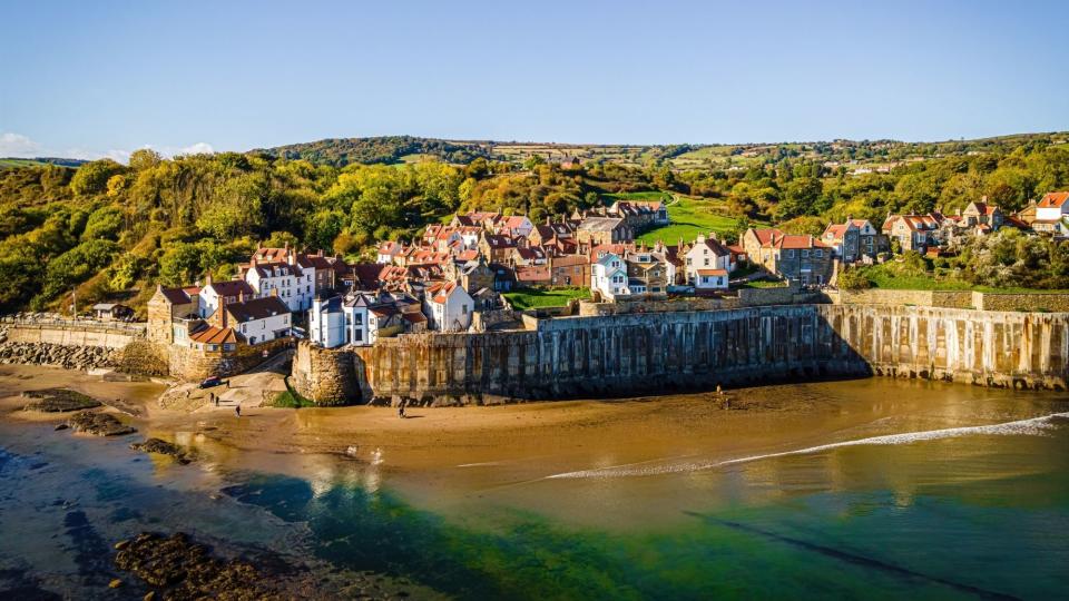
Celebrating its 50th anniversary in 2023 and given National Trail status, the 197-mile Coast to Coast path was devised in 1973 by author Alfred Wainwright. Starting from St Bees Head in Cumbria to Robin Hood's Bay in North Yorkshire, Wainwright's walk has "stood the test of time", said the BBC, and "takes in the splendour" of the Lake District, the Yorkshire Dales and the North York Moors. The "magical" walking route has "lost none of its bracing, thoroughly British appeal", said Daniel Stables in The Telegraph. "I didn't see another soul."
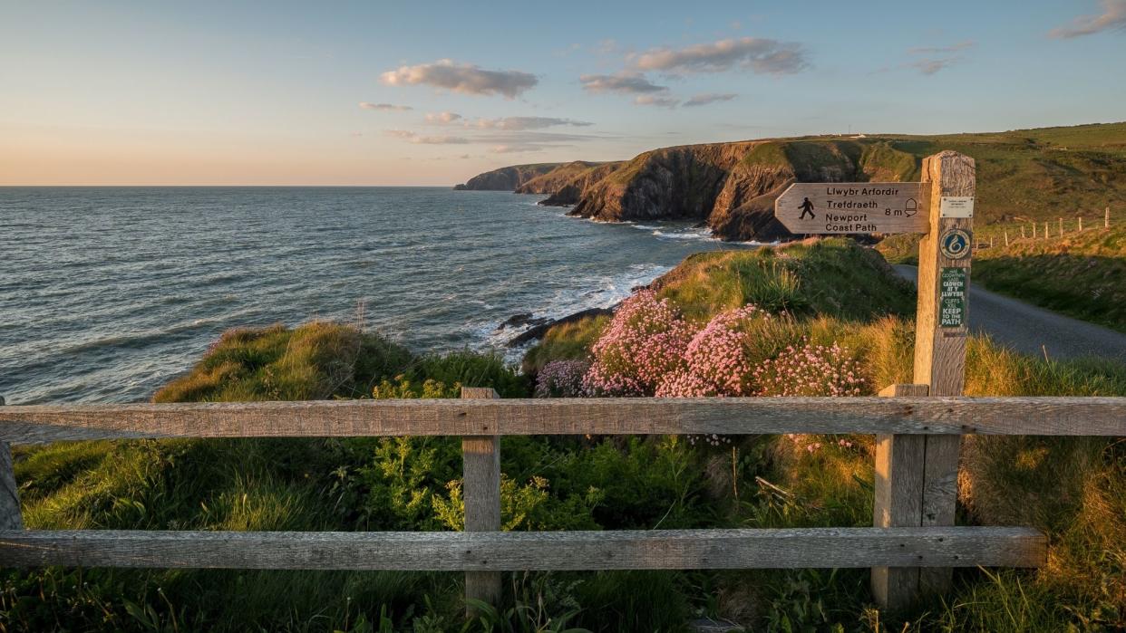
Pembrokeshire Coast Path, Wales

Regarded as "one of the world's great walking trails", said Celtic Trails, this is a coastal walk in the "truest sense", with "minimal" sections inland. Stretching from St Dogmaels in the north to Amroth in the south, the Pembrokeshire Coast Path "twists and turns" its way for 186 miles along the most "breathtaking" coastline in Britain, said National Trails. It covers almost "every kind of maritime landscape" from "rugged cliff tops and sheltered coves to wide-open beaches and winding estuaries".
Cloughmore Stone walk, Kilbroney Forest Park, Northern Ireland
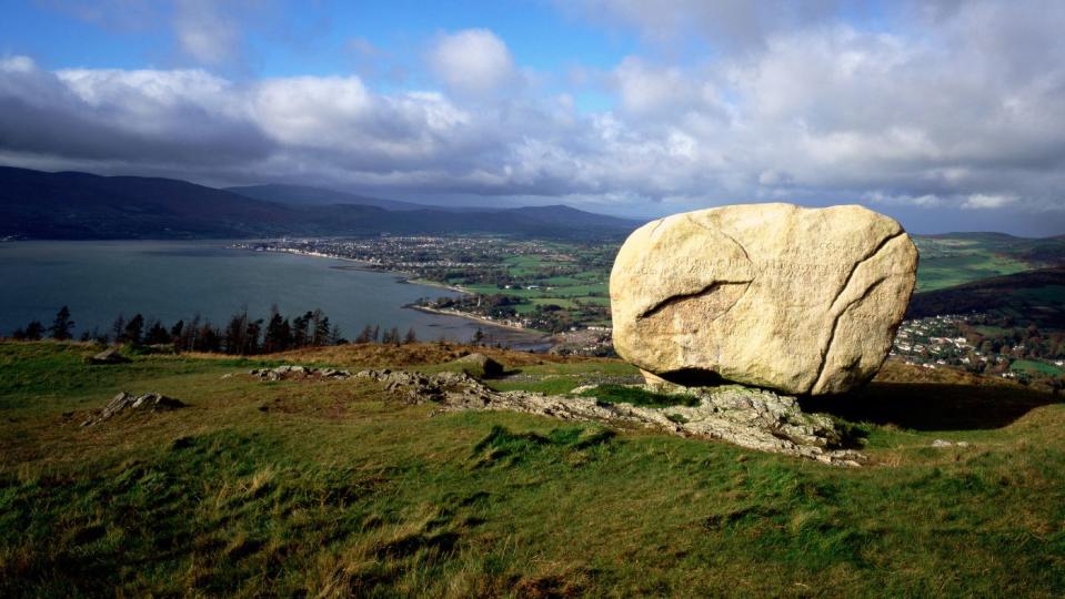
The Kilbroney Forest Park in Rostrevor, County Down, was the “inspiration for Narnia”, said Ireland Before You Die. Offering “stunning views” over Carlingford Lough, it conjures up “magical scenes” of a Nordic fjord in Northern Ireland. “Take a walk to the Cloughmore Stone and circle back through the majestic forest to make the most of your visit.”
Trekking across the Shetlands
The Shetland Islands are stunning in their stark beauty, and as “untamed” as anywhere in the country. A path across them, the Shetland Way, is being planned, said Simon Parker in The Times, but in the meantime, “intrepid” walkers “are free to carve out” their own long-distance routes – and the launch of Loganair flights direct from Heathrow has recently made the whole trip rather easier for some.
The 100-mile hike across the island chain, from its southern to northern tip, is not easy. The landscape is “bleak and austere, with barely a tree to speak of”, and high winds and heavy rain are par for the course. But the friendliness of the locals is a comfort, and when you reach your final destination – the 170-metre cliffs of Unst’s Hermaness Nature Reserve – you will be “the northernmost human in Britain”, a feeling that may leave you with quite a high.
Chipping Campden to Bath, Cotswold Way, England
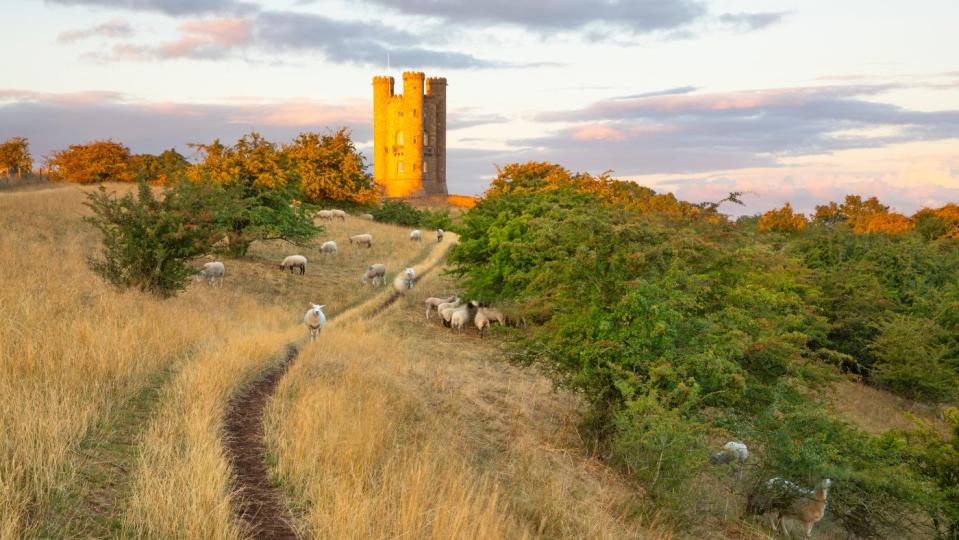
Extending from the “quintessentially English” market town of Chipping Campden to the Roman city of Bath, the 102-mile Cotswold Way had its 50th anniversary in 2020, said National Trails. Following the western edge of the Cotswold Hills, the route journeys through “rolling pastures”, “beech woodland” and “honey-coloured villages” built from Cotswold stone.
To get the most from your time in the Cotswolds it’s recommended taking “eight or nine walking days to complete the trail”, said Macs Adventure. But if you are short of time then you may choose to “split the walk up” and do either the North or South section, “meaning you can return later to do the other half”.
Milngavie to Fort William, West Highland Way, Scotland
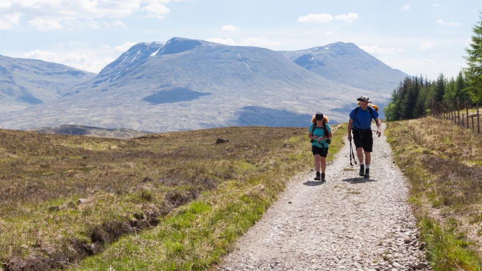
Scotland’s first long-distance walking route opened in 1980, and it is “still its most popular”, said Scotland’s Great Trails. Starting in Milngavie, just eight miles outside of Glasgow, the route passes Loch Lomond and heads north through “increasingly rugged scenery”. Enjoy the “vast wilderness” of Rannoch Moor and pass Glen Coe before reaching Fort William at the foot of the UK’s highest mountain, Ben Nevis.
The linear route is 96 miles long and “generally completed over six to eight days”, said Wilderness Scotland. But if you only have a couple of days the “general consensus” is to do the section from Inveroran to the Kinghouse, and/or the Kingshouse to Kinlochleven. These two stages are the “real classic” sections of the West Highland Way, with the “most memorable scenery”.
Storey Arms to Pen y Fan, Bannau Brycheiniog, Wales
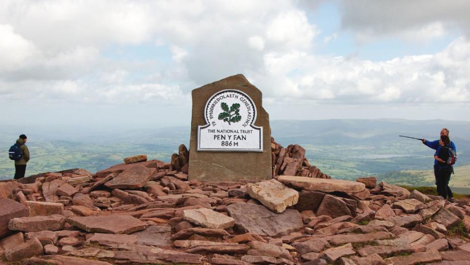
The Brecon Beacons National Park has officially been renamed to Bannau Brycheiniog, its Welsh name meaning “the peaks of Brychan’s kingdom”, said Sky News. But while the name has changed, the scenery and walks remain as epic as ever. One such route – from the Storey Arms to the summit of Pen y Fan (886m) – is a “classic” and “very popular” short walk, said the Saturday Walkers Club. The walk up and down Pen y Fan can be completed in “three to four hours for someone of reasonable fitness”, said Dave Roberts on Mud and Routes.
Scafell Pike, Lake District, England
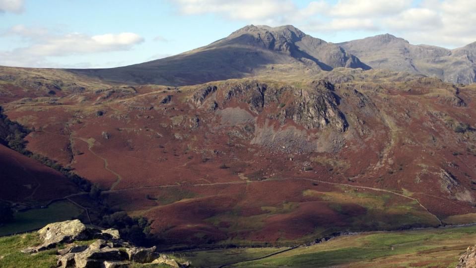
At 978m above sea level in the Lake District, Scafell Pike is the highest mountain in England. The great thing about climbing Scafell Pike was that it was “so much prettier” than we’d been expecting, said Walk My World. Most of the route is “really beautiful” and despite it “not being easy” it is an “achievable” walk, taking around four to five hours to complete. The easiest route to Scafell Pike is the direct line via Brown Tongue from Wasdale, according to the Lake District National Park website. While popular with people who “just want to bag the summit”, this route “only really scratches the surface of what’s on offer”. A better choice is to “indulge in a longer approach that explores all the nuances of this great mountain range”.
Portbradden to the Giant’s Causeway, County Antrim, Northern Ireland
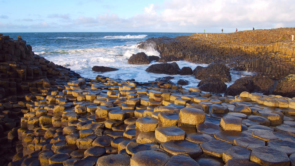
Northern Ireland is a “walker’s paradise” and the “undeniably impressive” Giant’s Causeway in County Antrim is the “most popular tourist attraction”, said Daniel Graham on Countryfile. If you “step off the beaten track”, you’ll be able to “marvel at this coast’s geology, myths and breathtaking views in virtual solitude”. The Causeway Coast path stretches for 33 miles, but a nice option is a six-mile moderate route from the hamlet of Portbradden to the Causeway itself.
The Quiraing, Isle of Skye, Scotland
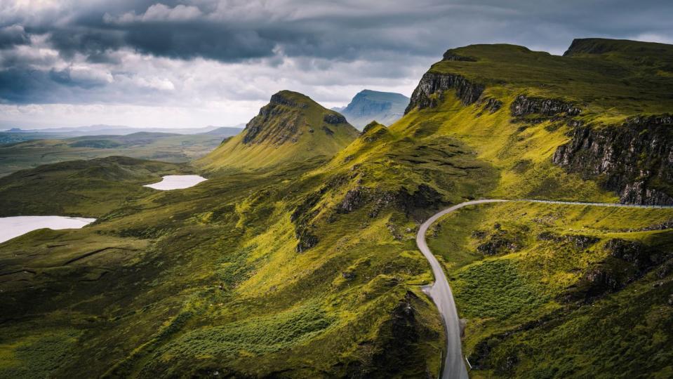
The scenery in Scotland is “breathtaking” and the walking routes offer “incredible views” that “showcase the soul-stirring beauty” of Scottish nature, said Emma Gillies on the Nordic Visitor blog. On the Isle of Skye, the Quiraing is a place of “jagged rock formations propped up on the Trotternish Ridge, an area shaped by ancient landslides”. Walking through the “stunning, ethereal landscape” is “even better” than driving around it, and on a four-mile circular route you can “climb up the slopes” and pass “craggy rock towers and pinnacles”. As you ascend, look out for the Table, the Needle and the Prison.
Hadrian’s Wall path, Cumbria and Northumberland, England
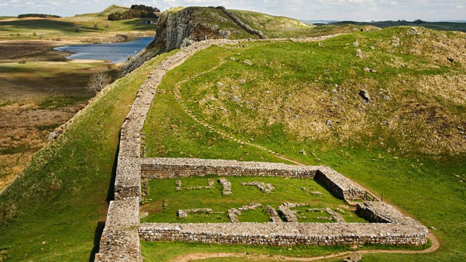
Stretching across Cumbria and Northumberland, from coast to coast, Hadrian’s Wall formed the northwest frontier of the Roman empire for almost 300 years. Last year was its 1,900th anniversary: the Emperor Hadrian came to Britain to build it in AD122, said Sean Newsom in The Times. Although parts of the wall have been lost down the centuries, its remains are still visible across significant stretches, and in recent years, archaeological finds have shed light on the lives of those who manned it. A single day is not enough to do it justice, so go for a long weekend, basing yourself near its central stretch.
Ridgeway Trail, Wiltshire to Buckinghamshire, England
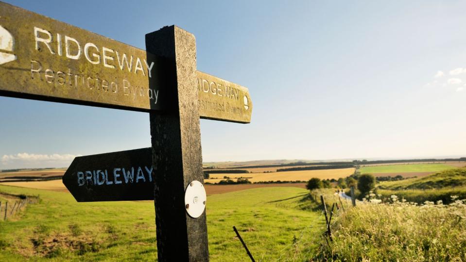
This year marks the 50th anniversary of the Ridgeway National Trail, a “cracker” of a long-distance footpath that runs through the heart of southern England for 86 miles, said Mary-Ann Ochota in The Guardian. One of 16 National Trails in England and Wales, it follows ancient pathways (including the Ridgeway itself, popularly supposed to be Britain’s oldest road) on its way between Avebury in Wiltshire and Ivinghoe Beacon in Buckinghamshire. With much of it on high ground, it passes close to some fabulous ancient sites, including Wayland’s Smithy (a stone-age tomb), the “mystical” Uffington White Horse and, at Avebury, the world’s largest megalithic stone circle.
Snowdon, Snowdonia National Park, Gwynedd, Wales
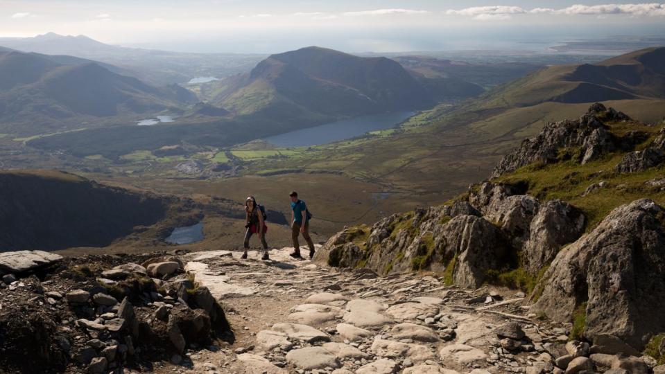
There are six official routes up the highest peak in Wales and it is “one of the most popular summits in the British Isles”, said WalesOnline. According to the National Trust, the Llanberis Path is the easiest with the Watkin Path the most challenging. But the best way to “avoid a traffic jam of climbers” is to take the Snowdon Ranger, said The Guardian. With “excellent views en route”, the Snowdon Ranger will also leave you with “a sense of achievement at the top”. A perfect way to end a hike.
Craster to Dunstanburgh Castle, Northumberland, England
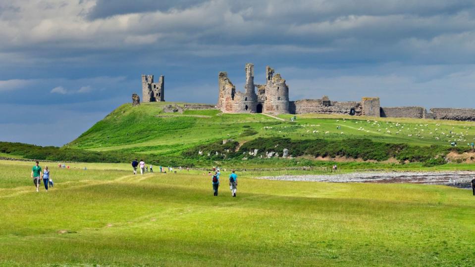
For those wanting a shorter walk and some history, the 1.5-mile route from Craster to Dunstanburgh Castle is perfect. While the “scenic path” may only take around 30 minutes one way, at its end lies the “moody, weather-beaten castle”, said Lonely Planet. The “dramatic” walk along the coast is only one of the walking routes to the castle (the other is from Embleton) and it’s not possible to get to Dunstanburgh by car.
South West Coast Path, England
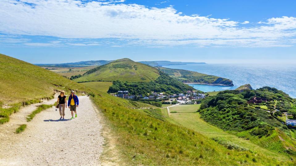
The South West Coast Path is one of the longest trails in the UK, stretching along the shores of Devon, Cornwall and Dorset. With the route 630 miles in length there are 400 short walks to choose from and so many “picturesque” places to choose as your base, said The Observer. One walk starts in “quintessential” seaside resort of Ilfracombe and passes through two “jaw-dropping surfers’ beaches”. For those coming from afar or looking to do a multi-day hike there are plenty of options from a “homely” Victorian terrace property that offers “unbeatable views” of Ilfracombe’s natural harbour, to a “traditional Cornish farmhouse”.
The Lost Valley, Glen Coe, Argyll and Bute, Scotland
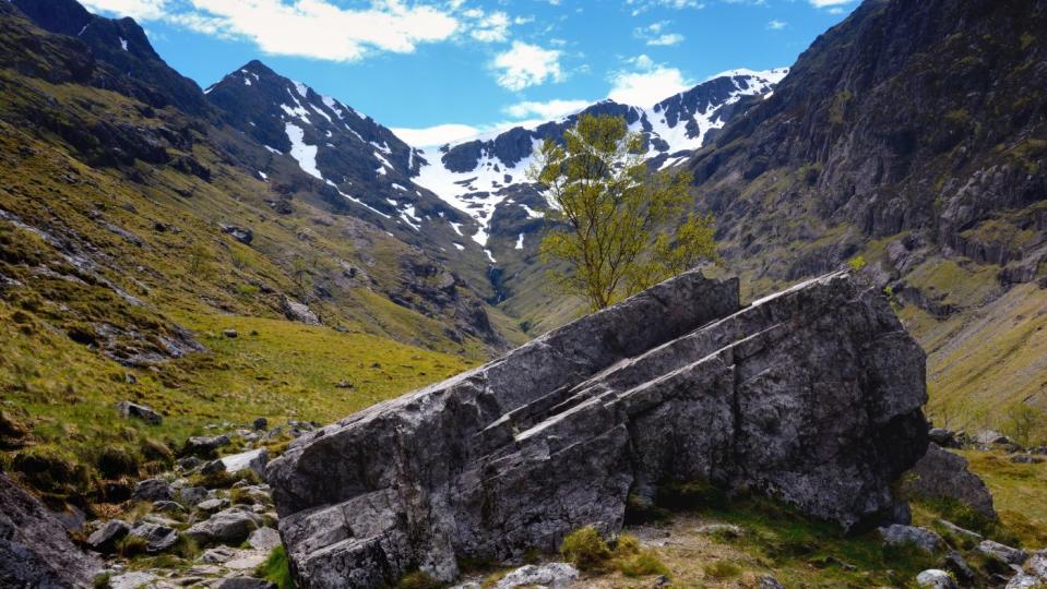
In the “lofty folds” of the Lost Valley in Glen Coe, Scotland, legend has it that the MacDonald clan used it to “stow their rustled cattle”, said Countryfile. It now is a “hidden gem” of a walking route. While the “often mist-shrouded” glen runs for ten miles beneath the “magnificently rugged mountains” the Glen Coe walk is 4.5 miles, said Fergal MacErlean and Dan Aspel in Countryfile. This particular walk at one point runs between two of the “dramatic northern ridges” known as the Three Sisters and is a “mountaineer’s paradise”. But be careful in the winter months as the weather conditions render it a “major challenge”.
Buttermere, Lake District, Cumbria, England
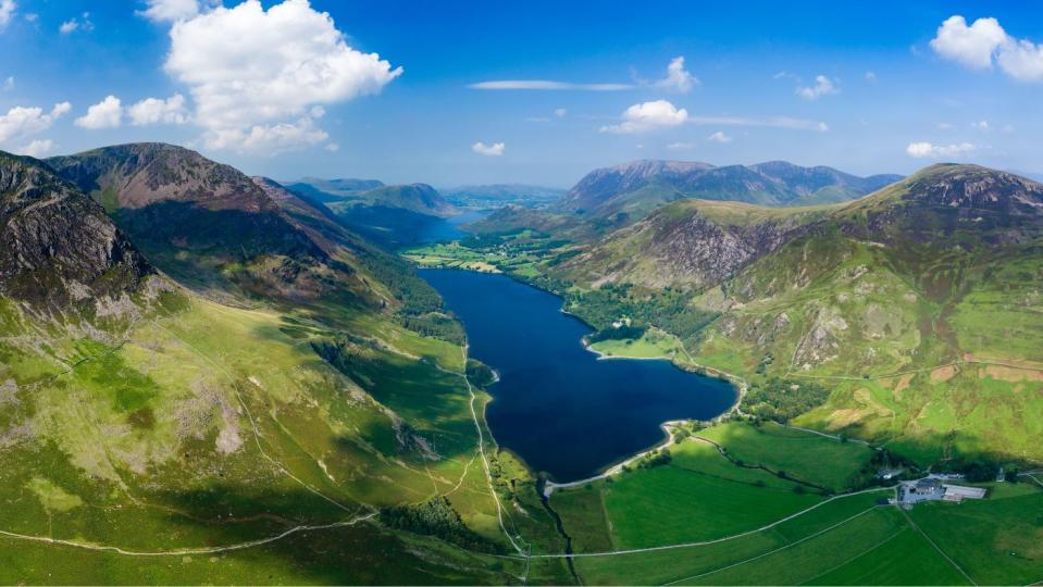
Windermere may be one of the most popular tourist destinations in the Lake District, but for somewhere more peaceful Buttermere is the place to go. The “serenity” of Buttermere makes it “so special”, said the Manchester Evening News and the “manageable” walking route around the lake offers “breathtaking views”. The 4.5-mile walk around the lake can be done in a few hours, but also overlooking Buttermere is a series of fells, which are accessible via several routes. From them you can “admire the lake from above”.
Kinder Scout loop via Jacob’s Ladder, Pennine Way, Derbyshire Peak District, England
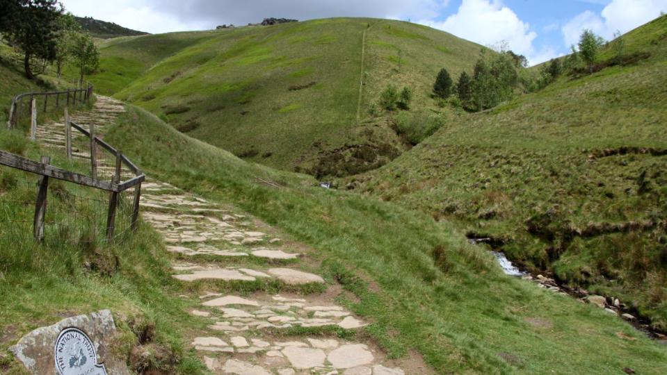
To get hiking “kudos” it’s a good idea to tackle Britain’s “premier long-distance path”, said Lonely Planet. While the full 267-mile Pennine Way route – from Edale in Derbyshire to Kirk Yetholm in the Scottish Borders – will take three weeks and is “technically challenging”, the 8.5-mile Kinder Scout loop via Jacob’s Ladder “offers a taster”. It’s not just hills and “fabulous panoramas” though, as the loop also features an “impressive” waterfall. The Kinder Downfall sits at 98ft (30m) and is not to be missed. And to treat those “blistered feet” there are plenty of “beguiling country pubs” offering the “medicinal qualities of a pint of real ale”.
Lakeside Way, Kielder Water and Forest Park, Northumberland, England
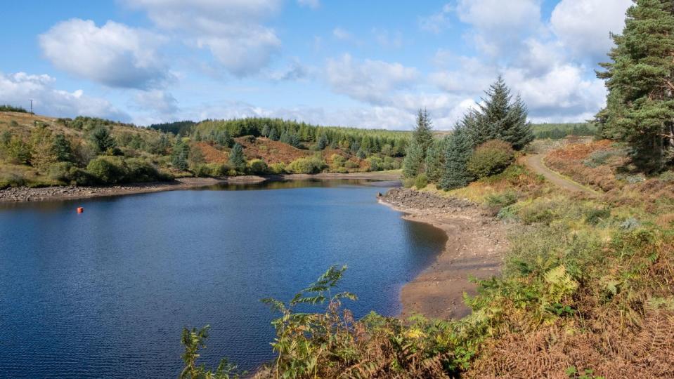
Kielder Water is the largest man-made lake in the UK (10.8km). It is set within 400 sq km of woodland, and there are lots of walks, including the Lakeside Way that follows the 42km shoreline. A multi-user trail suitable for walkers, cyclists and horse riders, the Lakeside Way provides access to “some of the lesser known but most scenic parts of the lake shore”, said the Long Distance Walkers Association. It’s a “fantastic opportunity” for beginners and families to experience the Kielder Water and Forest Park environment at “close quarters”.
Bala Lake walk, Gwynedd, Wales
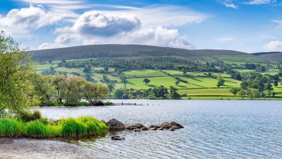
At more than 5.6km long, Bala Lake (Llyn Tegid) is the largest in Wales. A freshwater glacial lake, it’s perfect for wild swimming, and there’s a 36km path around it for hikers. The area on the south side of the lake is “wonderful for walkers”, said GPS Cycle and Walking Routes. Footpaths climb into the hills and forests for “fabulous views of the lake below”.
The Loe circular walk, Cornwall, England
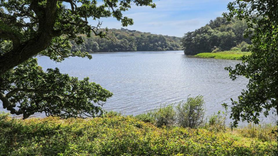
Originally an inlet of Mount’s Bay, Loe Pool is Cornwall’s largest natural lake, separated from the sea by a shingle beach. There’s a popular 10km circular walking route around the lake, accessed from the Penrose Estate. The lake “runs deep with history and legend”, said Pat Kinsella on Countryfile, but it’s the “diversity of the trails” that trace the banks of The Loe and the “richness of its wildlife” that make it such a “special place”.
Malham Tarn circular walk, Yorkshire Dales, England
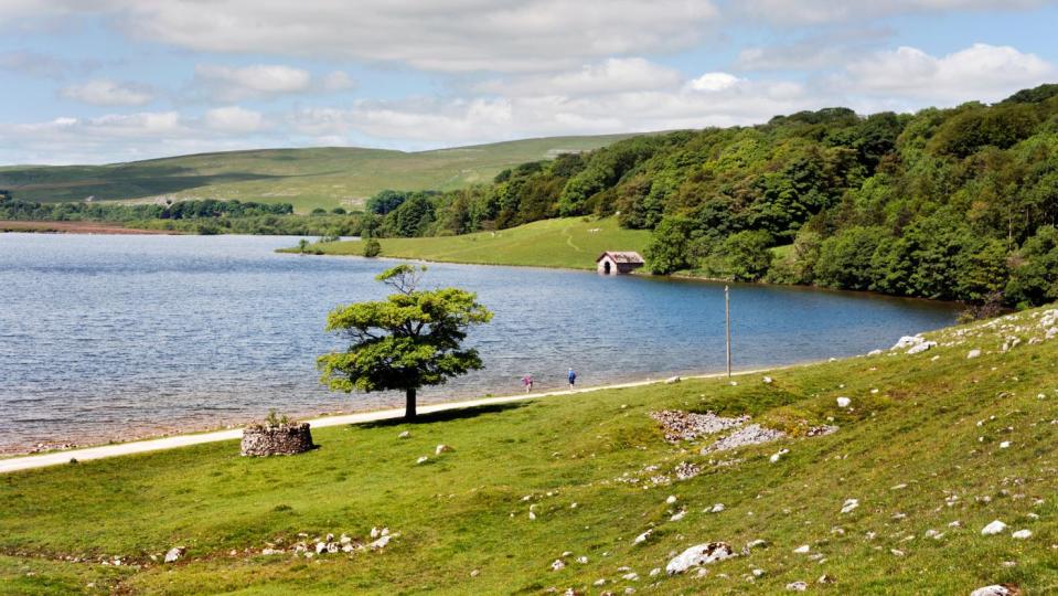
Yorkshire’s Malham Tarn sits at an altitude of 377 metres and is one of only eight upland alkaline lakes in Europe. The National Trust has a circular trail that goes around it. This is a “stunning adventure” that showcases many “gorgeous features” of the Yorkshire Dales National Park, said 10 Adventures. “Immerse yourself in nature” and check out the “cascading waterfalls, limestone ravines and natural coves” that make up this area. “This is a challenging path, so it is not for the faint of heart.”

