'Undergoing a transformation': How increased high tide flooding could reshape the NC coast
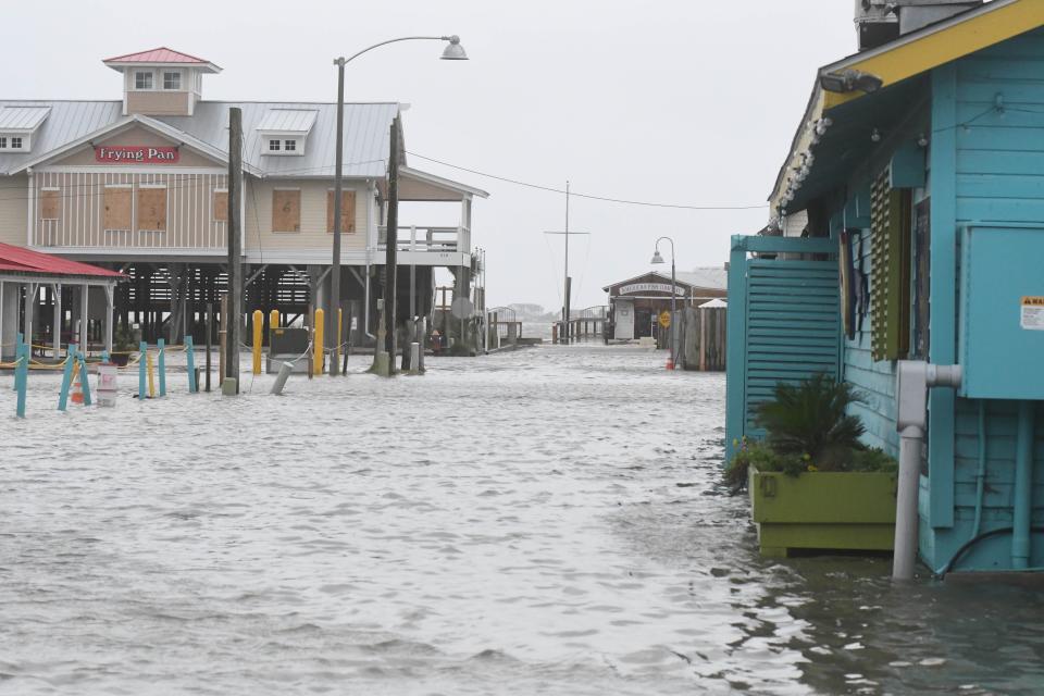
Southport is no stranger to dealing with tidal flooding.
Bordered by the Cape Fear River on the east and the Intracoastal Waterway on the south, the Brunswick County community at the river's mouth has been in a constant tug-of-war with Mother Nature since its founding in 1792. Although residents have grown to live with the nuisance flooding, high water events have been growing more common.
Infrastructure and post-storm emergency repair projects in recent years have helped stabilize some waterfront areas, and city officials are hoping recently allocated state funds can offer some relief for the flood-prone Yacht Basin area. But Mayor Joe Hatem knows that climate change means it's going to be a constant battle to hold back the rising waters.
"We are undergoing a transformation and we want to be ready for that, and we intend to do everything we can with the technology available to us to do that," he said.
Previously: 2 Brunswick communities stopped developments being built in their backyard. Here's how.
Read this: Meet the new principals and administrators in New Hanover County schools this year
But Southport could soon be facing a raft of new challenges.
The National Oceanic and Atmospheric Administration (NOAA) this month reported that nearly 2/3 of the federal tide stations along the U.S. East and Gulf coasts saw increased flooding last year, and the rising tides are a sign of what's to come.
That's because high-tide flooding (HTF), defined as anywhere from 1.75 to 2 feet above the daily average high tide, is becoming increasingly common due to years of sea-level rise. The government's latest estimate calls for the seas to rise 1 foot over the next 30 years — as much as the rise measured over the past 100 years.
According to NOAA, East Coast and Gulf Coast states will experience at least a 150% increase in HTF compared to the year 2000, limited only by periodic weather and climate events. And that trend is only going to continue as the warming of the planet, tied to temperatures changes that are already baked in due to the massive release of greenhouse gases since the Industrial Revolution, gathers speed. By 2050, NOAA predicts high-tide flooding on a national scale is expected to be between about 45 to 70 days a year on average.
Some estimates for parts of coastal North Carolina could see even more high-tide days. In 2021, the tide gauge near the Cape Fear Memorial Bridge in Wilmington recorded two high-tide flood days. That could jump to 40 to 65 flood days in 2050, according to NOAA. The situation is even more concerning farther up the N.C. coast on the Outer Banks. There, projections show Oregon Inlet experiencing 110 to 166 high-tide days in 2050. That's up from just five recorded last year. In Duck, 30 miles north of Oregon Inlet, NOAA projections forecast up to 120 high-tide days by 2050. The town experienced 11 in 2021.
“Water levels are nearing the brim in many communities,” William Sweet, a NOAA oceanographer told USA Today earlier this month. “We’re having sunny day flooding, (with) no storm at all and you’re starting to overwhelm the defenses."
'Can't floodproof everything'
As concerning as the NOAA forecasts are, Dr. Larry Cahoon thinks the real situation could be even worse.
The oceanographer at the University of North Carolina Wilmington said his review of data from Wilmington's tidal gauge, backed up by a look at water levels recorded at gauges in Beaufort, N.C., and Myrtle Beach, shows regional water levels are rising more than had been predicted. Cahoon said that's because the Gulf Stream, which swings close to the Carolina coastline as it moves north, has itself warmed up. That makes the water less dense and allows it to ride higher, pushing even more water toward the coast.
"We've seen a dramatic increase in sea-level rise," Cahoon said. "Where it goes from here, I couldn't begin to tell you."
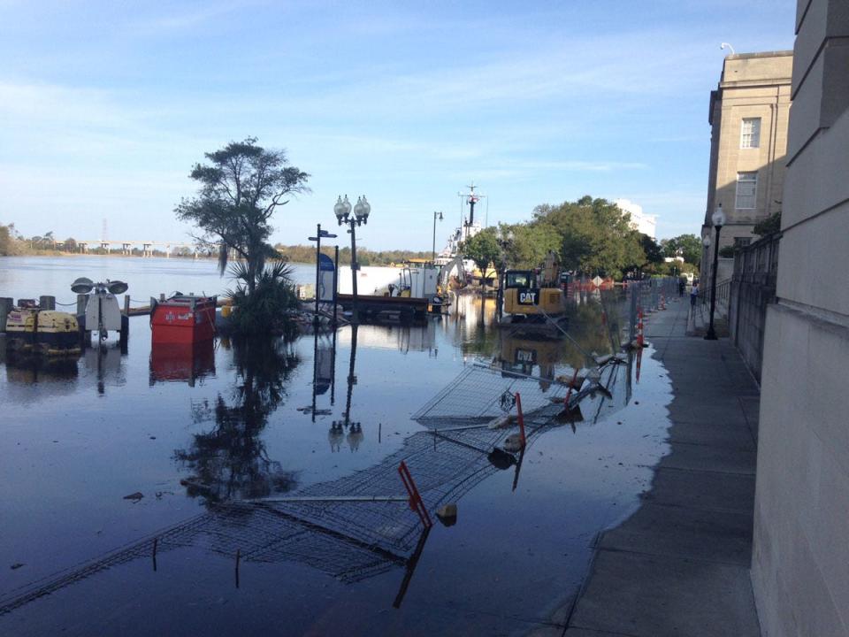
The rising water levels are also allowing sea water to push further inland, a situation amplified by high tide events. Cahoon said that means more stress on freshwater and brackish habitats, many of which are already struggling from the increased salinity, as seen by the proliferation of "ghost forests" of dormant or dying trees all along the N.C. coast and increased erosion in many areas.
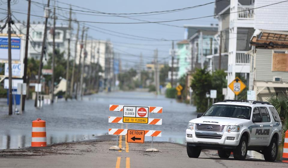
It also increases inland flooding, especially when tied to a tropical storm event. Cahoon noted that one of the highest water levels ever recorded at the Wilmington tide gauge was during 2020's Hurricane Isaias, a weak Category 1 storm that happened to follow a path along the coast that allowed its righthand quadrant — which is a hurricane's strongest section — to blow right up the Cape Fear River.
Crime news: New Hanover County man pleads guilty to impregnating child, will spend decades in prison
New Hanover County: How occupancy tax is supporting tourism in New Hanover County
"When hurricanes happen, they're going to do far more damage than what we saw just 20 years ago," Cahoon said.
The higher tides, and not just from HTF or storm events, are also impacting coastal infrastructure. Cahoon said seawater can be very destructive, corroding and collapsing utility lines and pipes, undermining stormwater systems as it pushes up into drains, damaging buildings and vehicles, and short-circuiting electrical systems.
"It's a very tough situation a lot of our communities are facing because we can't floodproof everything," he said. "There's no engineering way out of it."
'No quick or easy solutions'
The Cape Fear Public Utilities Authority, which provides water and sewer services to most residents of New Hanover County, is already planning to live with higher water levels.
Gary McSmith, the utility's chief engineer, said resiliency and an eye to the future is taken into account every time a pump station, pipe or manhole is rehabbed or replaced.
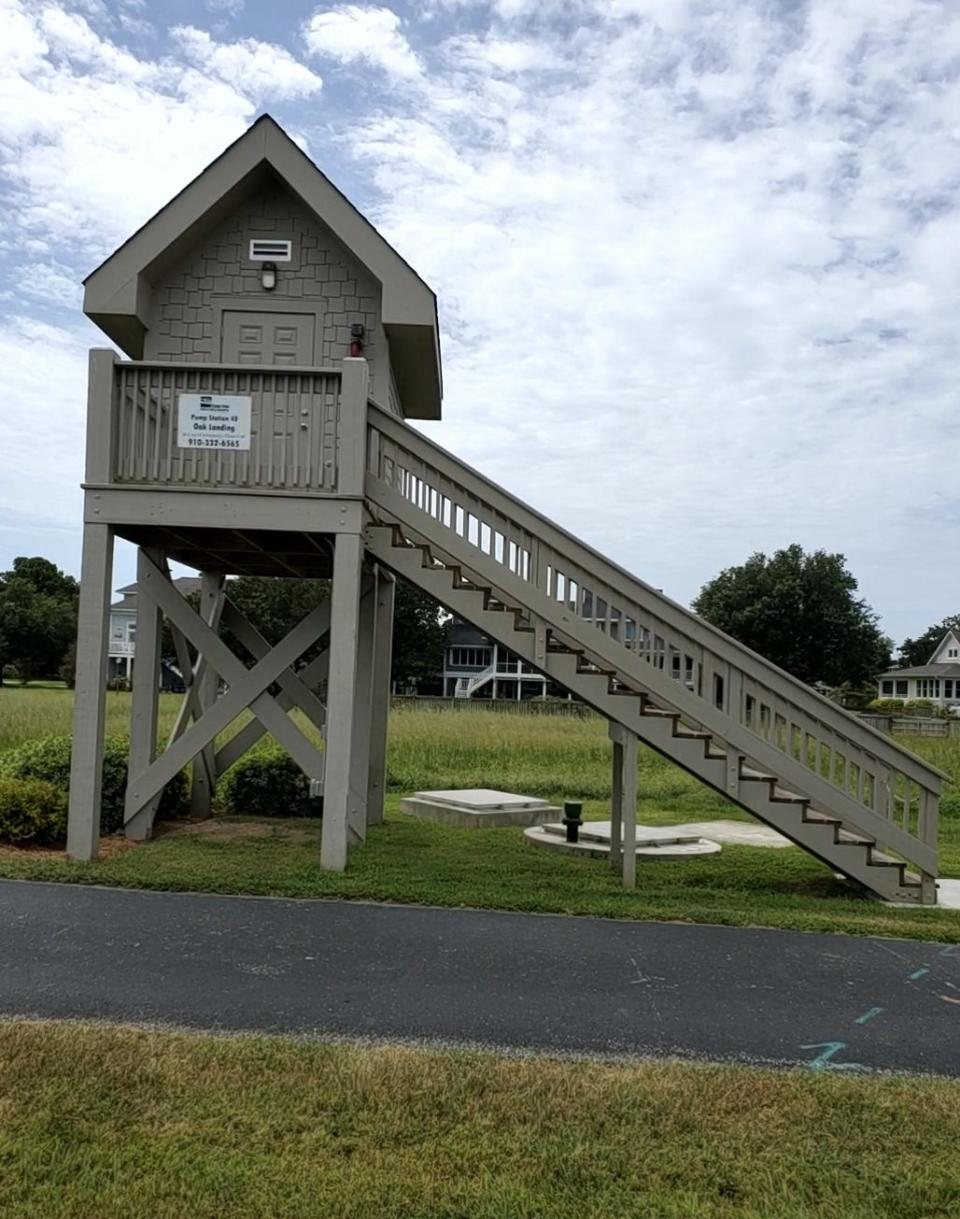
"Every piece we touch, we're mitigating for those risks," he said, adding that's especially true in low-lying areas, like along the riverfront in downtown Wilmington and around the Intracoastal Waterway.
While the long-term future looks daunting, McSmith said there is a silver lining. The seas aren't rising by a foot in one year, but by a few millimeters. That gives officials time to plan for what's coming down the pike.
"We believe we have time to mitigate these risks over time and by wise investments," McSmith said.
But Cahoon said there's only so much engineers and technology can do to protect coastal communities, especially those right along the oceanfront or in inland low-lying areas.
"We've got major issues coming, and there are no quick or easy solutions," he said. "It's a wake-up call that we don't have as much time as we think we have, and we better start planning for it."
Reporter Gareth McGrath can be reached at GMcGrath@Gannett.com or @GarethMcGrathSN on Twitter. This story was produced with financial support from 1Earth Fund and the Prentice Foundation. The USA TODAY Network maintains full editorial control of the work.
This article originally appeared on Wilmington StarNews: High tide flooding along NC coast expected to increase in coming years

