Unwelcome Christmas surprise: From Asheville to Wilmington, drought grips North Carolina
With a resurgent Covid-19 virus dominating the headlines and increasingly many facets of people's lives again, it's probably been easy to overlook a situation that's been sneaking up on the state for several weeks.
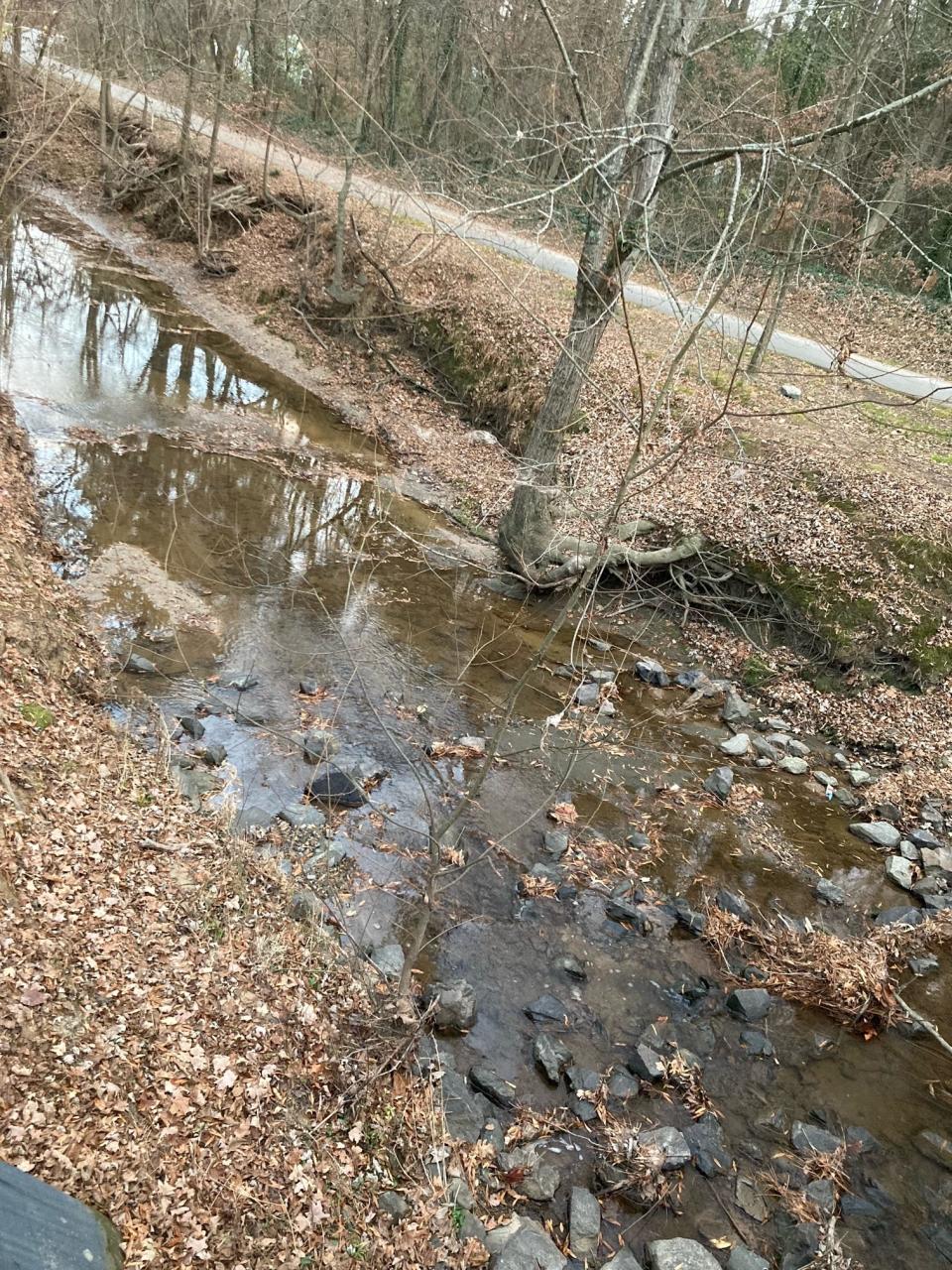
An extended period of abnormally dry weather, accompanied by above-normal temperatures in many areas, has left almost all of North Carolina in drought. And early projections tied to the La Nina weather system that's taken hold in the equatorial Pacific show it could continue into 2022, when the dry conditions could become more than just a mild annoyance.
State Climatologist Dr. Kathie Dello said 2021 has been "a year of whiplash" when it came to the wet stuff.
More: A new weather station aims to collect data as hurricanes make landfall. Will it survive?
"We had a very wet start to the year, dried out for most of spring, and then had some big events peppered throughout the summer," she said. "But these past few months have been relentlessly dry."
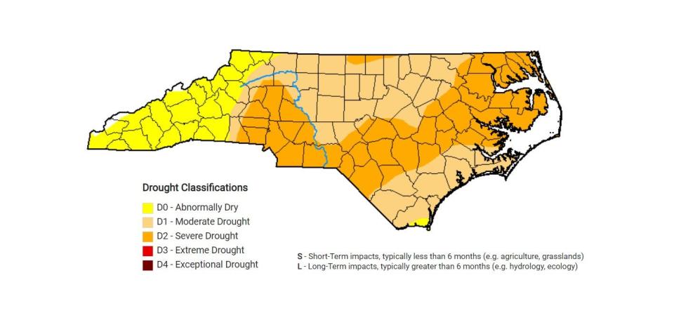
The latest N.C. drought map shows all of the state, aside fringe areas of some western counties, in drought, with the situation getting progressively worse as you move from west to east.
A belt of "severe drought" extends from roughly Statesville through Charlotte and the Fayetteville area into Northeastern North Carolina. Severe drought, according to the U.S. Drought Monitor, means water users should eliminate nonessential uses of water and prepare for possible mandatory water restrictions.
More: How dying coral reefs brought Prince William and a Wilmington native together
Like the rest of the state, rainfall has proven to be consistently inconsistent in the Wilmington area in 2021. Tim Armstrong, a meteorologist with the National Weather Service's Wilmington office, said Southeastern North Carolina has been in and out of drought twice this year, with the first dry period running from roughly March through May.
"After the wet summer we had, rain abruptly stopped in late September," he said. "Parts of the Cape Fear region were officially identified as "abnormally dry" starting in early October, with drought starting in early November."
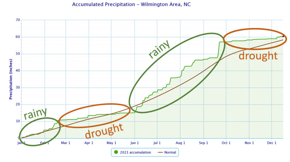
According to the weather service, Wilmington saw 1.14 inches of rain in October, 24% of normal amounts. It got worse in November, with 0.73 inches of rain falling last month, less than 21% of normal November levels. December isn't doing much to help things out with 1.45 inches of rain falling at Wilmington International Airport through Dec. 20, 62% of normal levels through Dec. 20.
It's a similar picture on the other side of the state. According to AccuWeather, Asheville has received only 23% of its normal rainfall since Nov. 1, with about 1.49 inches compared to a normal of just over 6 inches for the six-week period.
Climate change to blame?
According to NASA, La Nina is expected to stick around until at least spring 2022 in the Northern Hemisphere. La Nina is where trade winds that generally push warm water westward along the equator from South America to Asia are even stronger than usual. Off the U.S. West Coast, that leads to an increase in cold seawater rising to the surface from the depths to replace the displaced water.
More: Dire climate report is a call to action. What individuals can do to make a difference
It also pushes the jet stream northward. Dello said North Carolina tends to tilt warm and dry in a La Nina year. But last year also was a La Nina winter, and it brought above-normal precipitation to the state.

"El Nino and La Nina can give us some clues to what the winter might look like, but it's never a sure bet," Dello said.
But, she added, what is all but certain is that the human-induced actions are continuing to warm the planet and increasing temperatures, which tends to exacerbate drought conditions. According to the latest United Nations' Intergovernmental Panel on Climate Change report, "global warming of 1.5 degrees Celsius (2.7 Fahrenheit) and 2 degrees Celsius (3.6 F) will be exceeded during the 21st century unless deep reductions in carbon dioxide and other greenhouse gas emissions occur in the coming decades."
Although many countries, including the U.S., made promises at the recent U.N. global environmental meeting in Glasgow, Scotland, to dramatically reduce their greenhouse gas emissions in the coming years and decades, history shows that many of those promises go unfulfilled.
More: North Carolina wants to pivot to a green energy grid, getting there could be a bumpy ride
Spring worries on tap?
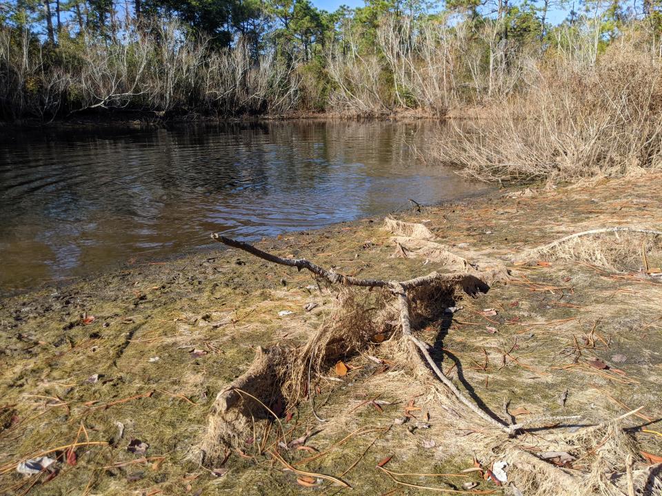
With most lawns, fields and forests brown and dormant these days and low temperatures keeping down evaporation rates, current impacts from the dry weather are largely cosmetic. Several farmers and state agricultural officials said groundwater tables also remain relatively healthy, with impacts on wells largely negligible so far.
But Dello and Armstrong warned that could change quickly in the spring when agricultural and residential needs for water intensify as the growing season starts and temperatures increase.
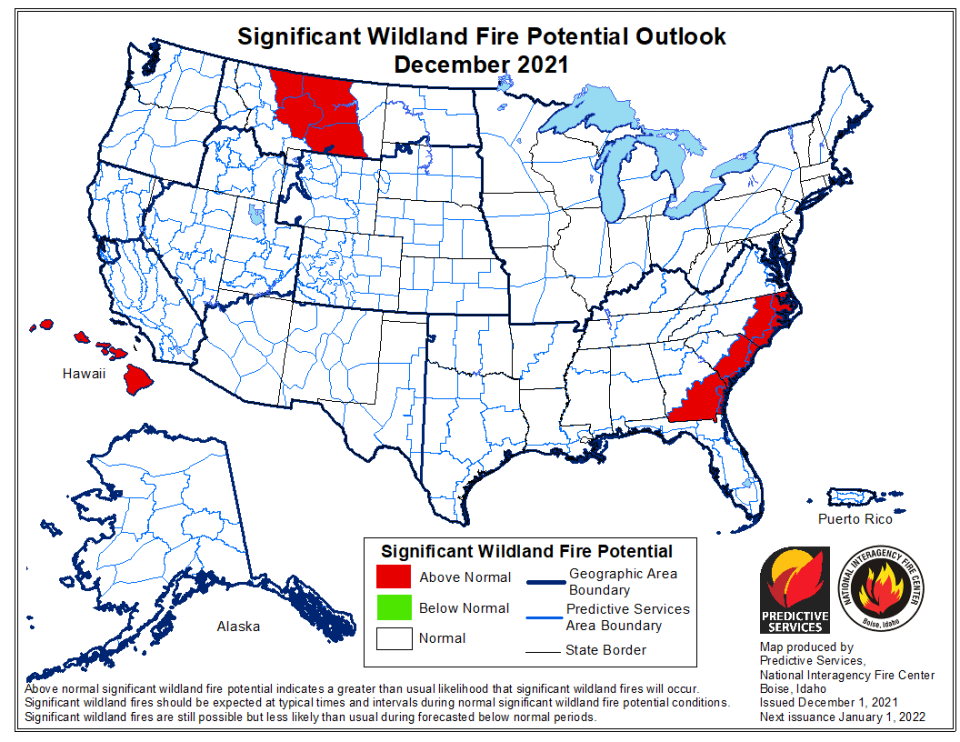
A more immediate impact from the dry weather could be an increased threat of wildfires. According to the National Interagency Fire Center, the dry weather permeating through much of the Southeast has left areas of eastern North Carolina, South Carolina and Georgia facing an "above normal" threat of wildfires.
More: NC Answers: Is the Carolina panther still lurking in the shadows?
That increased threat prompted many town and counties in Eastern North Carolina to adopt outdoor burning bans in late November, although most of those were rescinded after a series of showers moved through the region in early December.
Officials said it was too early to tell what impact the current dry conditions could have on any prescribed burns, which are intentionally set fires to help create a healthier natural environment. According to the N.C. Wildlife Resources Commission, controlled burning is commonly conducted between January and March, when most trees are less active metabolically.
More: What ancient trees from New Bern to Wilmington are telling us about future flooding events
Reporter Gareth McGrath can be reached at GMcGrath@Gannett.com or @GarethMcGrathSN on Twitter. This story was produced with financial support from 1Earth Fund and the Prentice Foundation. The USA TODAY Network maintains full editorial control of the work.
This article originally appeared on Wilmington StarNews: Drought grips North Carolina from Asheville to Wilmington

