US to get walloped with coast-to-coast winter storm this week
Large parts of the United States will be walloped by a historic, late winter storm in the coming days, with possible record snowfall in some places.
A slew of weather warnings, watches and advisories were issued across 22 states by the National Weather Service (NWS) on Tuesday.
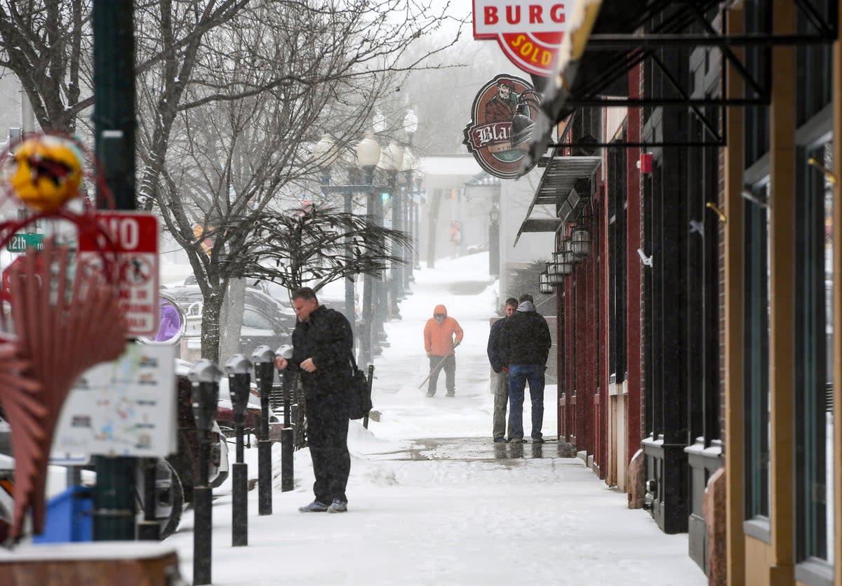
Up to two feet of snow is possible in parts of the midwest, particularly across southern Minnesota, and a high chance of more than eight inches from South Dakota east through Minnesota, Wisconsin and Michigan.
The snowfall will be accompanied by bitterly cold temperatures and treacherous blizzard conditions.
The NWS Minneapolis-St Paul warned of “life-threatening travel conditions” late Wednesday and into Thursday, with power outages and downed trees also possible.
There would be one-two punch of heavy snowfall in the midwestern cities, according to NWS, with a lull in the middle.
The first round would begin on Tuesday afternoon and last into the early hours of Wednesday, dropping four to eight inches.
The second round would bring more severe impacts from Wednesday afternoon into Thursday morning. Heavy snowfall and winds gusting to 35-45mph would make an additional foot of snow likely.
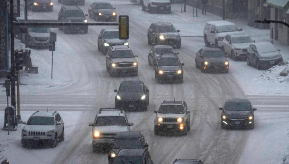
The February record of 13.8 inches of snow from a single storm in Minneapolis “is likely to be smashed,” reported AccuWeather meteorologist Matt Benz.
In the US West, one to two feet of snow is expected at higher elevations in mountain ranges while flurries mixed with rain will impact interior valleys.
Moderate to heavy rain, as well as thunderstorms, were forecast along the Pacific Northwest on Tuesday. As temperatures drop overnight, there is possibly of light snow in central California valleys on Wednesday.
Snow had already begun to fall across stretches of the plains on Tuesday and by Thursday, much of central New England will see snow streaming in.
A historic winter storm is set to begin later today and last through Thursday. In addition to heavy snow with impressive totals, gusty winds will cause significant travel impacts. Here's a thread with the current forecast and updated graphics (1/5) #mnwx #wiwx pic.twitter.com/Syn07Gc4Ak
— NWS Twin Cities (@NWSTwinCities) February 21, 2023
More than 12 inches of snow is likely for high elevations in the Adirondacks and the Green and White Mountains, with lighter accumulations of up to four inches across upstate New York and central New England.
Freezing rain or sleety conditions will drive across southern New England before easing off by Friday.
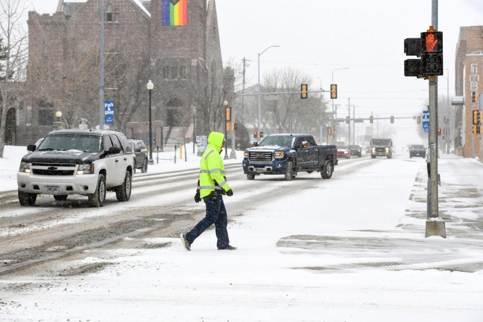
Travel woes were already beginning to mount up at US airports. There were 430 delays and 43 cancellations being reported by FlightAware’s Misery Map late on Tuesday afternoon. The major problems were taking place at New York area airports along with Minneapolis, Boston and Denver.
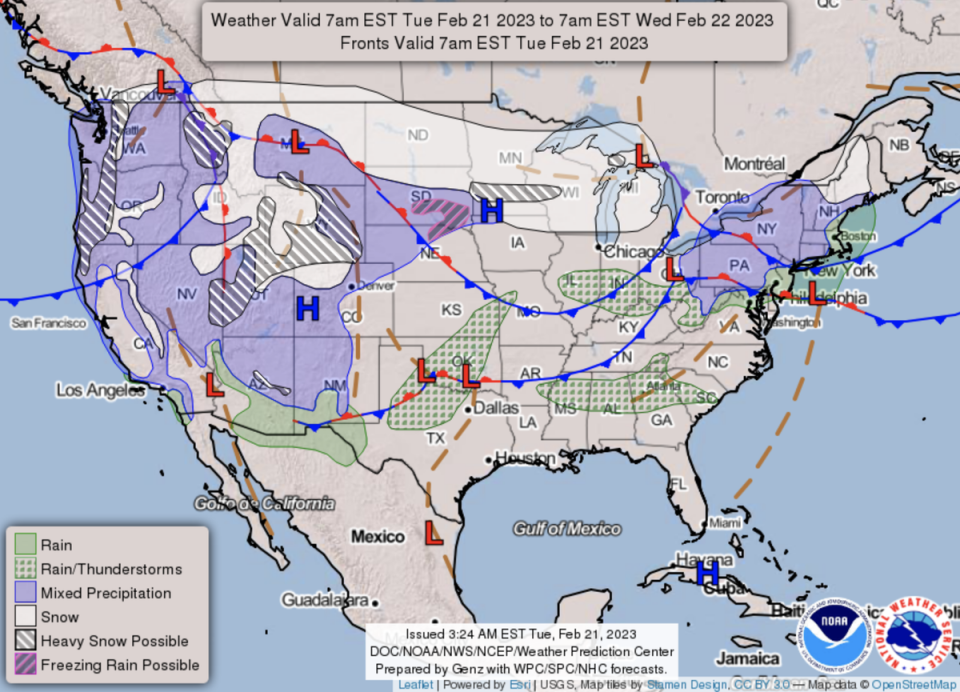
Aside from the snowfall, there is a slight risk of excessive rainfall from northeast Missouri into northern Illinois, northern Indiana, and southern Michigan and some spots of flash flooding.
Parts of the west and High Plains will experience very strong winds of 50-60 mph, and as high as 80 mph in some locations. The risk of weather that can spark fires will be elevated across the southern High Plains through Wednesday.
Beside the glut of precarious weather conditions, there will be wide variations in February temperatures.
Its everyone ready??? SECOND DAY in a row: #MarathonFL tied the daily high temperature record for today.
A riding will continue to promote warm, dry, and calm weather conditions, with nil (Pops) through the rest of the week.#FLKeys #FLwx pic.twitter.com/IG40YN4fEB— NWS Key West (@NWSKeyWest) February 21, 2023
Many record-tying or record-breaking highs can be expected particularly for the Ohio and Tennessee valleys, where temperatures will climb above 70 degrees Fahrenheit.
Closer to the Gulf Coast and Florida, highs will soar into the 80s. In Marathon, Florida, the daily high temperature record was tied for the second day in a row as it hit 86F.
On the flipside, record lows will be possible in the west, with temperatures in the 30s and 40s for the Pacific Northwest and 50s in California. Bitterly cold wind chills, some 20-30 degrees below zero, are expected for the Northern Plains.
