USGS, international partners conduct fishery assessments on lakes Michigan and Huron
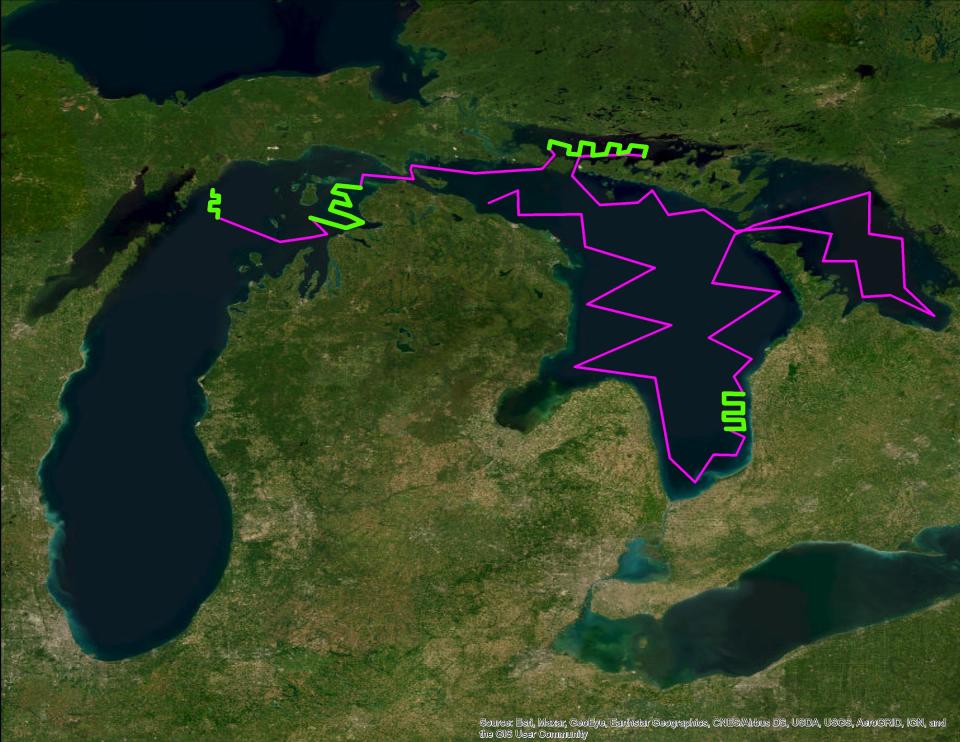
CHARLEVOIX— The U.S. Geological Survey is using an autonomous surface vehicle on lakes Michigan and Huron from late-July through September to improve fishery surveys in cooperation with several partners in both the U.S. and Canada.
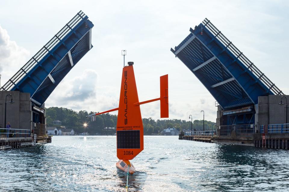
On July 19, a wind and solar-powered uncrewed surface vehicle called a Saildrone Explorer was launched on Lake Michigan out of Charlevoix. The vehicle is equipped with several environmental sensors both under and above the water, including a fisheries echosounder that uses sound to detect fish, operated by Saildrone, Inc.
The saildrone will operate in northern Lake Michigan and throughout Lake Huron through the end of September.
“Technologies like Saildrone are helping us to more accurately monitor fish abundances, which gives the states and tribes better information to help manage the Great Lakes fishery,” said Dr. Peter Esselman, USGS fishery biologist. “The great advantage of a wind-powered drone is that it can stay on the water collecting data 24 hours a day for months at a time, greatly expanding the amount of water we can monitor for fish. The drone moves slowly and is not dangerous, but we encourage boaters to maintain safe distances from the saildrone to ensure a successful mission.”
Subscribe: Check out our latest offers and read the local news that matters to you
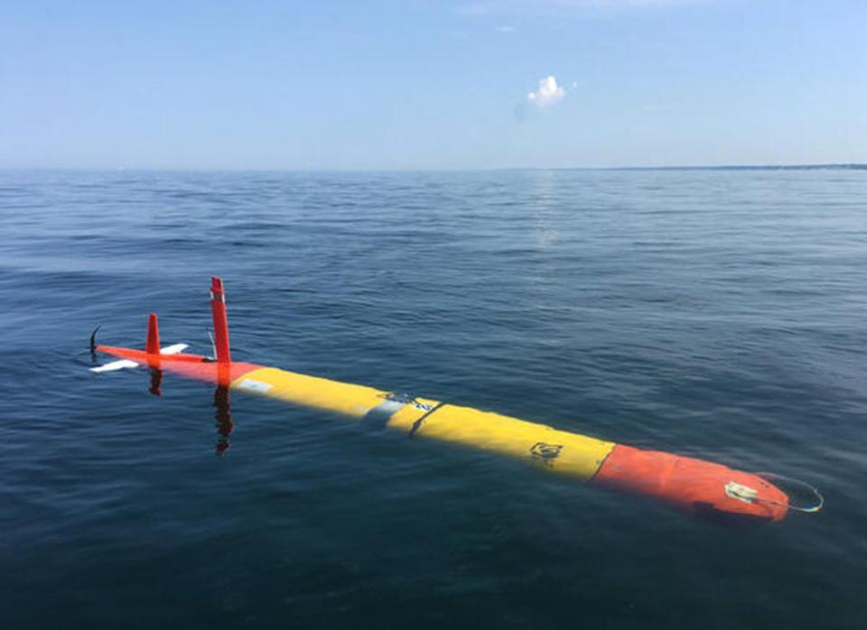
In addition to the saildrone, a long-range autonomous underwater vehicle (LRAUV) will be deployed out of various harbors along Lake Michigan’s eastern shoreline, from Frankfort down to Benton Harbor, throughout the month of August. The LRAUV is operated by the Monterey Bay Aquarium Research Institute and will travel at 25 to 50 meters water depth, also mapping fish distributions.
Partners on these studies include the Michigan Department of Natural Resources, Wisconsin Department of Natural Resources, and the Ontario Ministry of Natural Resources and Forestry.
"These experiments using advanced technologies and autonomous vehicles are just one part of a multi-year effort by USGS and fishery management partners across the Great Lakes to improve fishery science in support of the $7 billion Great Lakes fishery," said Commissioner Jim McKane, chair of the Great Lakes Fishery Commission. "This is what 21st century science looks like, and it's happening now here in the Great Lakes thanks to strong collaborative partnerships."
Notices regarding both autonomous vehicles have been provided to mariners via the U.S. Coast Guard. The acoustic technology used in the study is not hazardous to people or animals and will not interfere with sonar, communications equipment, or similar electronics. Boaters are asked to maintain a safe distance of 1,500 feet from the saildrone.
This article originally appeared on The Petoskey News-Review: USGS, international partners conduct fishery assessments on lakes Michigan and Huron

