A Utah snowpack for the records means flooding. And it is here already

A cold front will move into northern Utah late Wednesday into Thursday, dropping rain at lower elevations and, yes, more snow in the mountains.
The changing weather pattern puts the brakes on temperatures in the 70s, giving some respite as a cooler climate takes hold for next couple days before it inches back up into another warming trend next week.
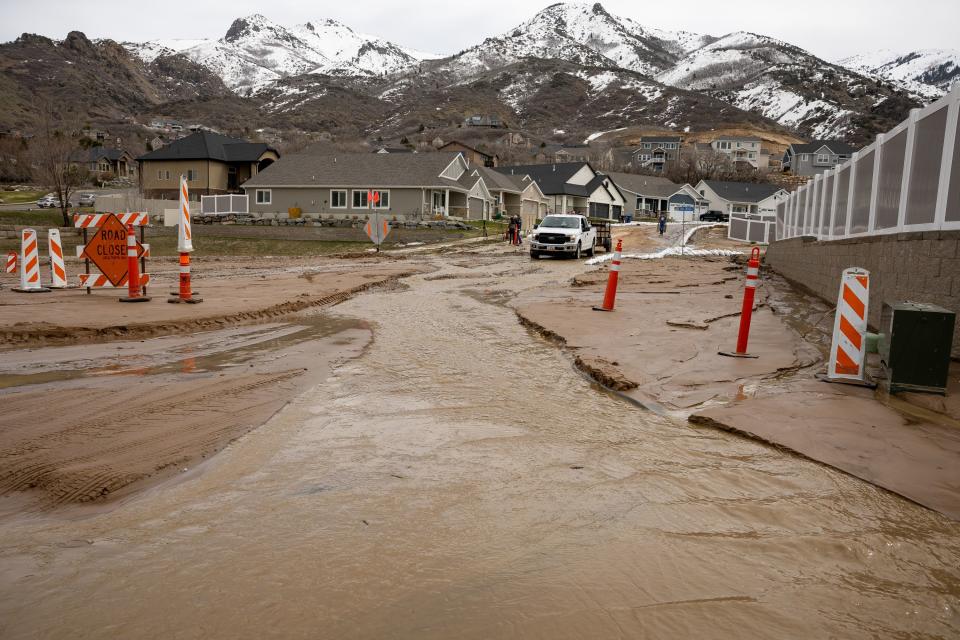
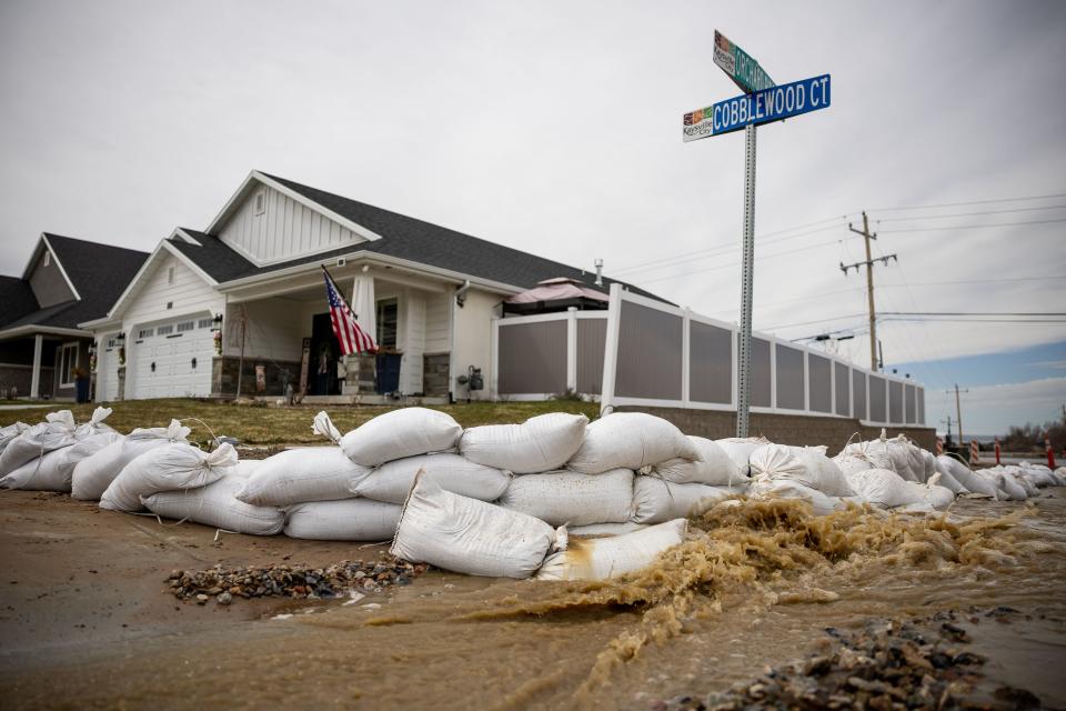
Spot flooding is already happening in multiple Utah communities as a result of overwhelmed infrastructure such as storm drains failing to function, causing the evacuation of multiple homes in Kaysville.
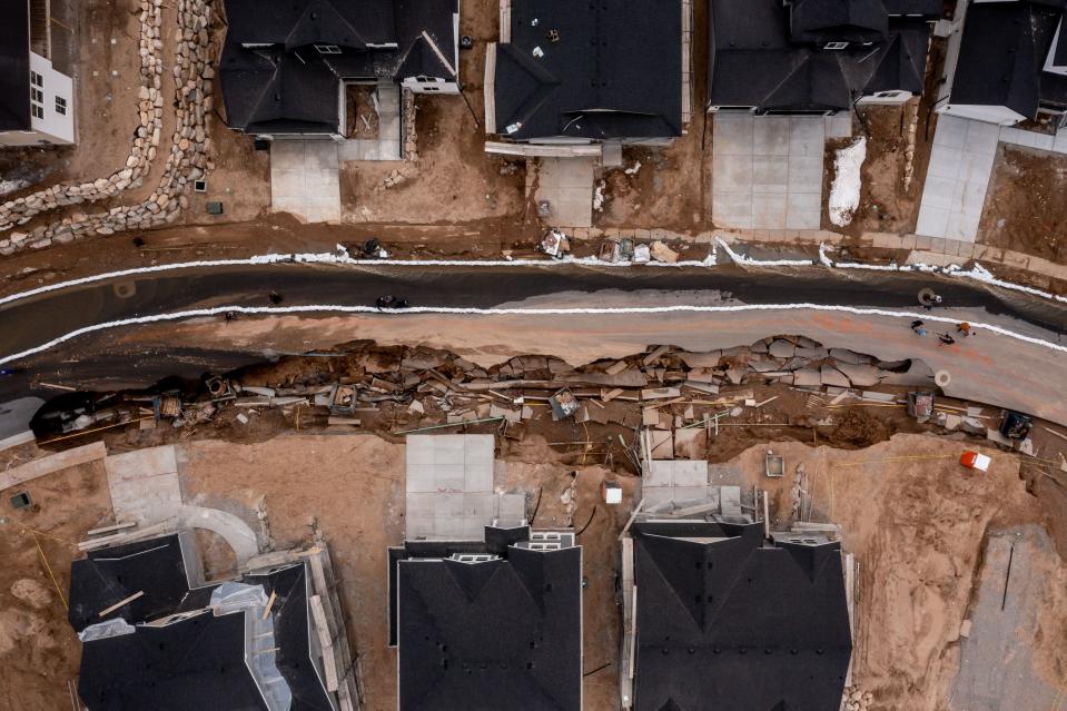
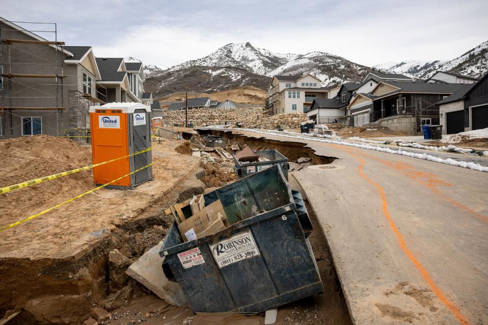
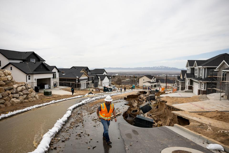
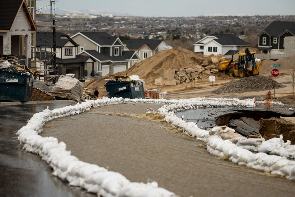
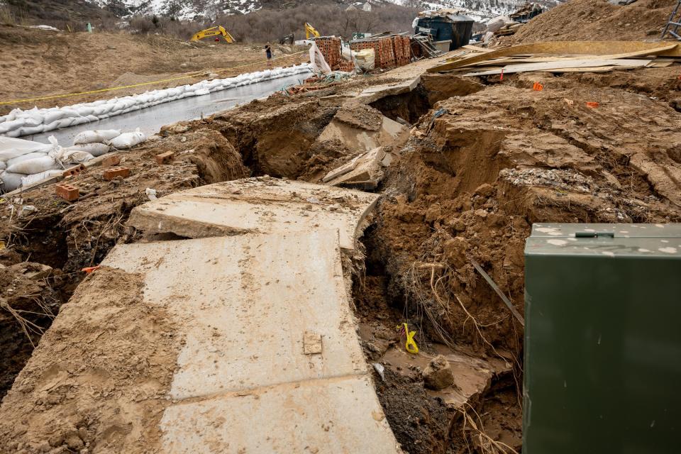
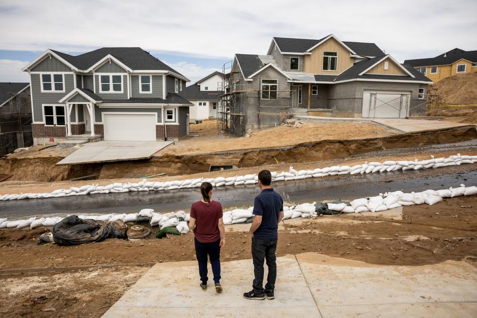
Orchard Ridge Estates, a newly built subdivision nestled in the foothills above Kaysville, received the brunt of the flooding.
“At about 3:30 this morning, we woke to the fire department banging on our doors and trying to get our attention with lights in our windows,” said Jayna Howard, an Orchard Ridge resident.
Evacuation was optional in Howard’s part of the neighborhood, but she said she worried she wouldn’t be able to make it out if the flooding continued. “The way it looked was quite threatening. It sounded like a river and it was rolling down the street.”
Public works crews, construction workers and volunteers from nearby neighborhoods gathered Wednesday morning to place sandbags along the street, trudging through ankle-deep water and avoiding the major road erosions.
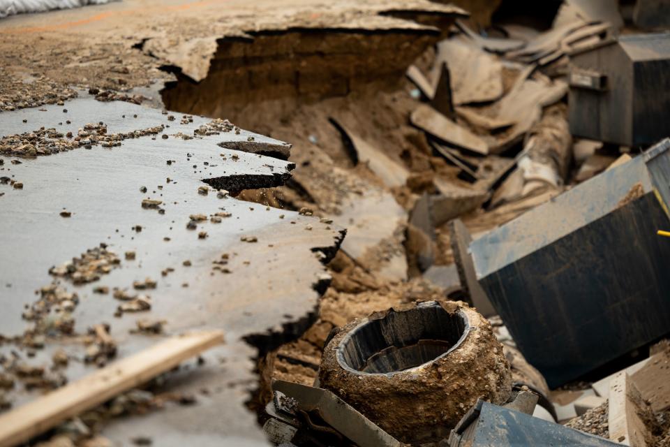
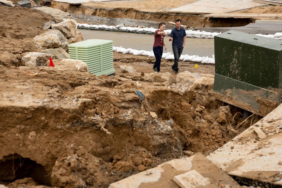
Jeff and Kate Harris planned to move into the Orchard Ridge neighborhood on Wednesday, only to find out that morning that the road in front of their new home had collapsed.
“Our belongings were in the garage already,” Kate Harris said. “So we went to bed so happy and on such a high, and to wake up to this is just such a low.”
After the initial shock — which Jeff Harris said lasted “several hours” — the couple said they were grateful that neighbors who they barely knew were up late trying to divert the water from their house.
“It’s kind of a strange way to meet everybody, but we created some bonds,” Kate Harris said.
Related
And that wasn’t all.
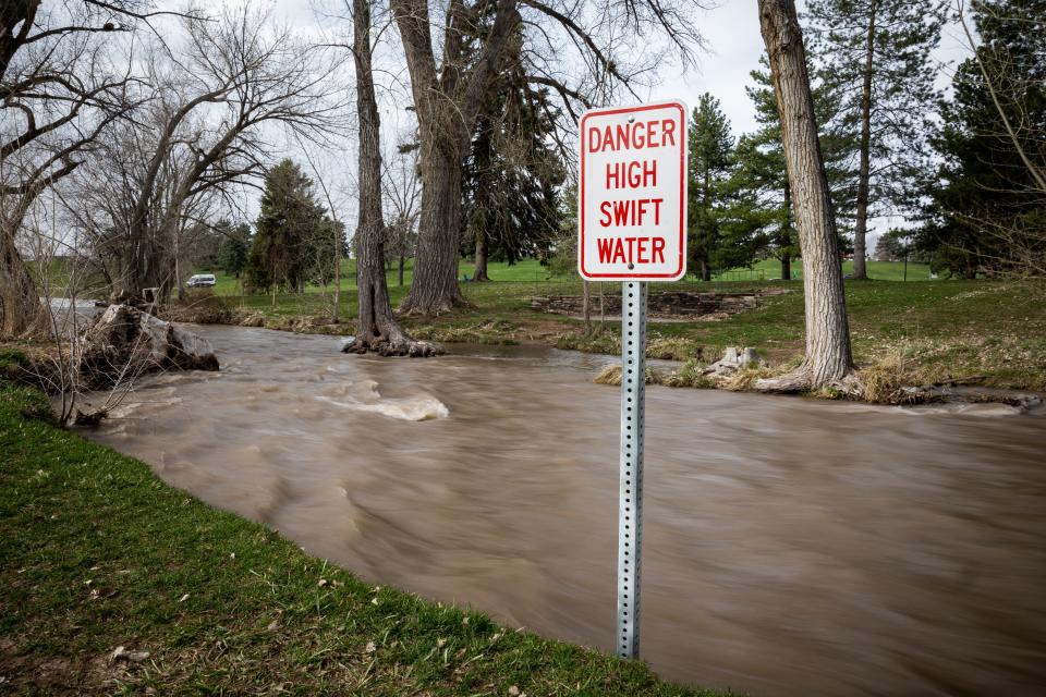
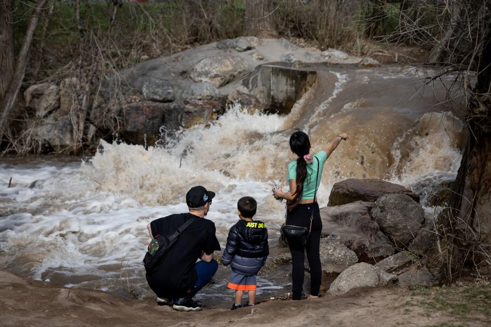
In Salt Lake City, Salt Lake County Flood Control division director Kade Moncur said the Wasatch Hollow Retention Basin has a clogged outlet 25 feet below the water, forcing crews to reroute that water back to Emigration Creek. The urbanized flooding resulted in the closure of 1700 South between 1500 East and 1700 East.
In North Ogden, flooding led to the closure of Fruitland Drive at 1700 North, with a sandbag brigade plugging flows where they can.
Wednesday night, Sugar House residents were also evacuated as water surged down their street.
Michael Wessler, meteorologist with the National Weather Service in Salt Lake City, said stream flow forecasters are keeping watch on three particularly troublesome areas: Emigration Creek, Silver Creek in the Heber City area, and the Weber River in Weber County.
The agency issued a flood advisory for areas along Salt Lake City’s East Bench and downstream of Emigration Creek that is in effect through noon Thursday.
A River Flood Advisory has been issued for portions of Salt Lake City's East Bench and areas downstream along Emigration Creek. This advisory stands through 12 PM Thursday where it will either expire or be continued based on the latest information available. #utwx
— NWS Salt Lake City (@NWSSaltLakeCity) April 12, 2023
No creeks or rivers have reached flood stage yet, and most of the flooding being experienced in urban settings is the result of runoff compromised by clogged storm drains or other infrastructure that needs to be cleared of debris.
More snow to come
Wessler said this kind of snowmelt is what they want to see: lower and mid-elevation snow coming off the mountains in a slow march while the higher elevation snow waits backstage.
“So, big picture is we’ve had this string of warm days where we’ve started to melt the low and mid-elevation snowpack. One of the key factors to this melt is that the overnight low temperatures have been temperatures that have remained above freezing.”
He added the freezing temperatures remain in play for the high elevation snow, which is why this cold front won’t deliver a dreaded rain on snow event that would accelerate the melt and more potential for flooding.
The coming rain, however, is another headache for public works directors and first responders as they hope to minimize the impacts and galvanize volunteers for sandbagging.
As tempting as it might be for warm weather enthusiasts and sun worshippers, what Utah does not want to see is a sudden, severe spike in temperatures to bring the record snowpack down all at once. That is what happened in 1983 when a river roared down State Street in Salt Lake City and flooding along the Wasatch Front and elsewhere was rampant.
Related
Utah’s big snowpack
After more than two decades of drought, the dread that comes with a dwindling Great Salt Lake and severe curtailments of water, especially in the secondary water arena, Utah and much of the West abruptly embraced a stellar winter. While one good year won’t erase the enduring drought, it does help. How much snow did Utah actually see?
The latest Utah Snow Survey report released by the U.S. Natural Resources Conservation Service provides these details:
• Nine of Utah’s 16 major basins have record-high snow water equivalent: Duchesne (191% of normal), Northeastern Uintas (172% of normal), Weber-Ogden (208% of normal), Provo-Utah Lake-Jordan (216% of normal), Tooele Valley-Vernon Creek (237% of normal), Southeastern Utah (282% of normal), Price-San Rafael (205% of normal), Lower Sevier (280% of normal), and Beaver (202% of normal). While not a record high, southwestern Utah is at a whopping 331% of normal for snow water equivalent.
• A few noteworthy SNOTEL (measurement) sites are: Ben Lomond Peak, in first place for Utah with 81.8 inches of snow water equivalent. In second and third place are the two sites in Little Cottonwood Canyon: Atwater (71.9 inches of snow water equivalent) and Snowbird (68.8inches of snow water equivalent).
• 32 SNOTEL sites have at least double the amount of snow water equivalent that they would have at their typical (median) peak and 45 of Utah’s SNOTEL sites have more than 100 inches of snow depth, with seven of those deeper than 150 inches.
126 sites are reporting the deepest snow depths ever measured at those locations.