‘I’ve never seen anything like that.’ The reasons why Eta flooded South Florida so badly
After wading through knee-high water to get from her Jeep to her newly rented apartment at Venetian Gardens in Hialeah on Monday, Evgeniya Ignatushchenko had a sinking feeling.
The residential complex’s parking lot was flooded and surrounding streets looked like lakes and canals that evoked the watery Italian city of Venice, namesake of her complex. She took a deep breath and opened the door to the rental she hadn’t even moved into yet.
“The floor was wet. I smelled mold. I could see that water had gotten inside because of the marks on the cardboard boxes I had left here,” said Ignatushchenko, who sold her house in Miami Springs and rented the two-bedroom apartment to be closer to her mobile nail service clients.
“I’ve never seen anything like that,” she said. “Last week the condominium association assured me it was impossible for water to get inside, but it did.”
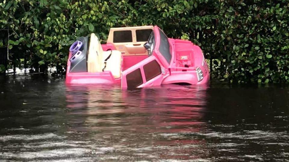
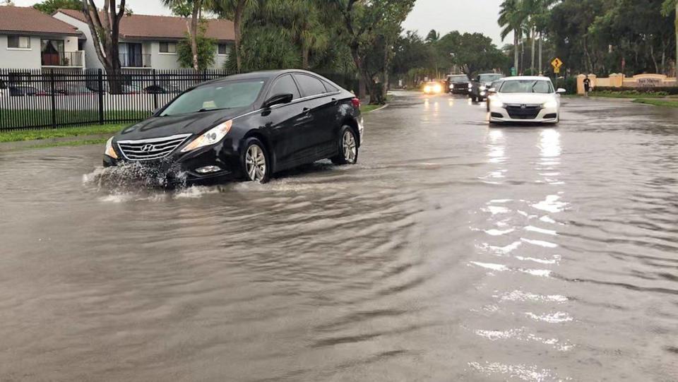
The bulk of Tropical Storm Eta’s drenching rains fell overnight on Sunday, marking a dark slash of intense rainfall over northern Miami-Dade and southern Broward on the weather maps. The rain — more than 16 inches of it in some places — overflowed canals and retention ponds, turned roads into paddleboard territory and flooded a handful of neighborhoods, homes and apartments like Ignatushchenko’s.
One month, 30 inches of rain
South Florida is no stranger to flooding, but Eta’s floodwaters soaked neighborhoods that usually stay dry and set fresh and scary high water marks in some new areas. Why?
Experts say it’s a combination of things. For one, the “dry season” that typically starts in mid-October has been anything but. The ground was already soaked before Eta left Cuba. For another, the couple feet of storm surge that came with Eta was enough to push up Biscayne Bay along the coast and slow water from draining out to sea like it normally does.
A third factor is climate change, and how it’s straining the 72-year-old drainage system designed to keep South Florida dry. It’s not clear yet how much of an effect rising seas played in Eta’s floods, but everyone agrees it’s going to play a role in the future.
Larger flood-control systems managed by the South Florida Water Management District, including dozens of canals, floodgates and pumps, worked as expected. A week ahead of the storm, the district started lowering canals to make room for what was expected to be extremely heavy rainfall, said district spokesman Randy Smith. South Florida’s aging drainage system is destined to handle about six to eight inches of rain a day.
“Counties and cities were also working a week ahead of this storm to reduce the water in their canals, but we did get 14 to 18 inches of rain and that’s enough to overwhelm some local systems,” he said. “What we saw was that some flood control systems just weren’t able to handle that volume.”
For places like west Broward, home to Pablo Santos, the meteorologist in charge at the Miami office of the National Weather Service, Eta’s deluge flooded his subdivision so much he had to use a big truck to leave his home.
“Living here 20 years, I have never seen the flooding that I saw,” he said. “If I tried to get my Prius through it, water is going to get inside the car.”
Santos said the biggest factor in Eta’s flood was the 30 inches of rain the region has seen since mid-October when the dry season was supposed to start. Miami and Fort Lauderdale normally see about 60 inches of rain in an entire year.
“In effect, we have not had a dry season. The water table was already very high, in some areas right at ground level. And all this rain comes it has nowhere to go,” he said. “Does it mean there’s something wrong here? No, it means that every system has a limit.”
The role of sea level rise
Smith said it’s hard to say if Eta’s rains were turbocharged by a warming climate, but said flood control in all of South Florida, at even the highest level at the District, is becoming more challenging because of climate change and sea level rise.
“There are going to be changes made to the flood control system in South Florida as a result of sea level rise,” he said. “There are several agencies, the federal government, the state and the counties here in Florida that are working together to look at sea level rise and climate change studies because we need to incorporate that into our strategies,” he said.
Jayantha Obeysekera, a former chief modeler with the district and current director of Florida International University’s Sea Level Solutions Center, said he saw that some gates were closed for four or five hours during the storm, holding water inland. If the district had opened them, he said, more water may have washed in — not out.
“What happens is as the rain is falling the water management district is trying to get the water out, the canals are rising. At some point, the ocean levels are higher than the ground levels so they cannot open the control structures,” Obeysekara said. “The question is, is this a sign of things to come in the future because of climate change.”
Obeysekera would argue yes. He championed a 2009 report spelling out the potential implications of sea level rise on the already aging system that highlighted at least 20 coastal control structures where there were fewer than six inches between the water levels on either side.
At that point, the report warned of anywhere between 5 and 20 inches of sea rise by 2060. Now, predictions for South Florida call for 17 to 31 inches by then.
Two weeks ago, the water management district sent a letter to all of Florida’s U.S. senators and representatives asking for help funding a re-evaluation of the system to factor in explosive population growth and sea level rise.
“As I write this letter, there are C&SF coastal structures at risk and many of these structures cannot be operated during high water events like king tides to provide flood protection for South Florida residents,” wrote Drew Bartlett, executive director of the water management district.
The district has estimated that upgrading the system to account for climate change could cost $550 million in the next decade alone.
And sea level rise isn’t the only way climate change will affect South Florida’s flood control system. Besides tropical storms and hurricanes, which could get slower, stronger and wetter on a warmer planet, climate change could also affect rainfall.
A new paper published Tuesday in the American Geophysical Union journal Earth’s Future found that climate change could make extreme rain events more likely and more severe by 2079 if greenhouse gas emissions go unchecked.
Daniel Swain, a UCLA climate scientist and lead author of the paper, said that climate change will lead to different impacts for different areas when it comes to rain. Some places, like South Florida, might see more rain overall. Others, like Arizona, might see less. But his paper found that the most extreme rain events, like Hurricane Harvey in Houston in 2017, could become more likely everywhere.
That means when the rain does come, it’s more likely to overload the system like Eta did to South Florida.
Swain is quick to point out that this research doesn’t account for sea level rise, which makes all the difference in coastal South Florida. The wetter rainstorms of the future would fall on soggier ground as sea level rise pushes groundwater levels up and high tide flooding in.
“People who didn’t flood in this event but were just on the cusp of flooding likely will flood in an event like this in the future,” Swain said.
And in places that regularly flood, the flooding could get worse.
Shirley Jackson, who lives in the Glorietta Gardens apartment complex in Opa-Locka, wore knee-high boots to cross what looked like a canal on Tuesday to reach the entrance area of the complex where the mailboxes are located.
“This happens every time we get a lot of rain. I’ve been here for 27 years and it’s just getting worse and worse. And who knows what’s in this water, because it smells like sewage if you ask me,” she said, as a U.S. Postal Service truck entered the complex, creating a wake that splashed on the side of a building.
Ground floor units at the complex frequently get covered with water, but this time it’s taking longer for the floodwaters to recede, she said.
A pump failure in Miami
In Miami Beach, the new flood control systems also handled the storm well. From Sunday afternoon to Monday afternoon the city got about 7 inches of rain, the equivalent to a 1-in-5 year storm.
That’s the standard much of the city’s new raised roads and flood pumps were built to handle, so the newer areas fared well and the places still awaiting improvements — like North Bay Road and parts of West Ave — experienced flooding.
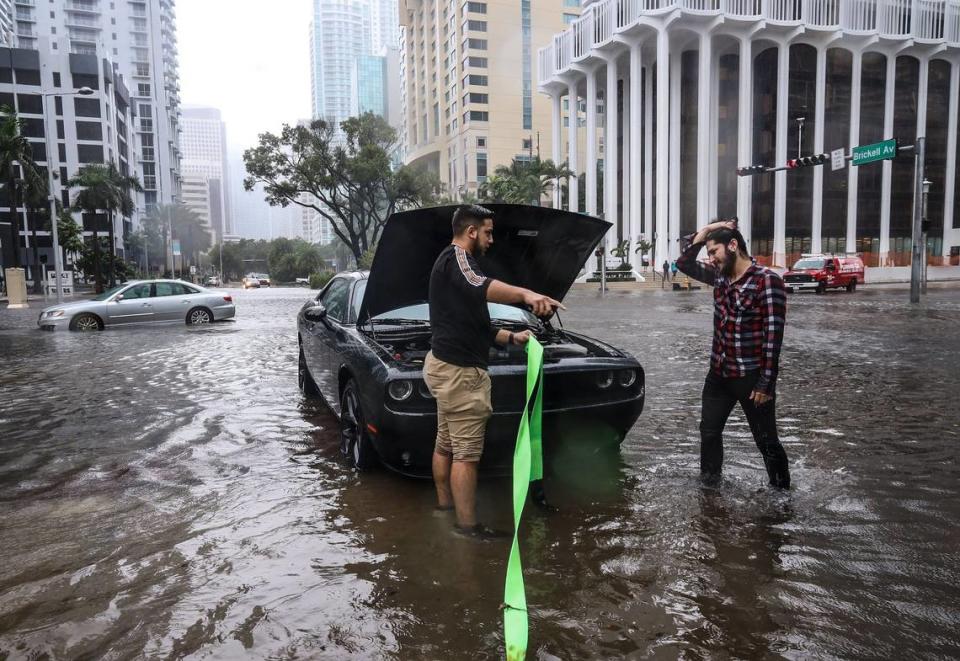
The one notable pump failure in the region was in Miami, where Eta left more than 14 inches of standing water in the ritzy Brickell neighborhood Monday morning, enough to swamp a handful of cars in intersections. The foot of floodwater called into question exactly how effective the city’s new multimillion-dollar flood pumps are, and it turned out that the one on Brickell Avenue, closest to the deepest flooding, wasn’t turned on during the storm.
Alan Dodd, Miami’s chief resilience officer, said the pump has been undergoing a $260,000 repair effort since late October. He said the pump, which was built by the Florida Department of Transportation and turned over to Miami six years ago, should be fixed in about two weeks.
Miami used seven temporary pumps and six vacuum trucks to help dry the city, but by Wednesday some streets in the north end of the city still had standing water.
Dodd said Eta’s flooding confirmed what the city already knew: Miami is going to need many more permanent pumps in the future. Where they go will be guided by the city’s upcoming stormwater master plan. The draft is set to be released next month.
“What we saw during this storm event confirmed a lot of what the models predicted,” Dodd said. “That tells us that the model is accurate, and when we look at our future needs we’re going to need more capacity throughout the system.”

