LIVE UPDATES: Tornado Watch issued for majority of region
LIVE UPDATES: 10:30 p.m.
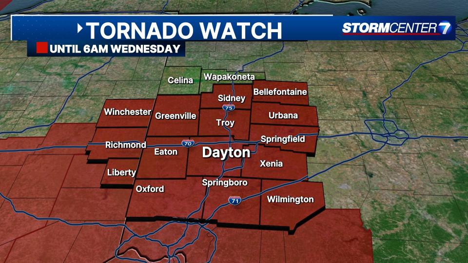
A Tornado Watch has been issued for all counties in the Miami Valley except Auglaize and Mercer until 6 a.m.
QUICK-LOOK FORECAST:
Severe thunderstorms possible tonight
Threats include damaging winds, hail, and even tornadoes
Much colder air arrives tomorrow
>> TRACK THE LATEST CONDITIONS: Live Doppler 7 Radar
Storm Center 7 Chief Meteorologist Austin Chaney continues to track this system. He will have the latest updates tonight at 11 p.m. on News Center 7.
>>Rare enhanced risk for severe storms with damaging winds, hail, tornadoes tonight; What to expect
DETAILED FORECAST:
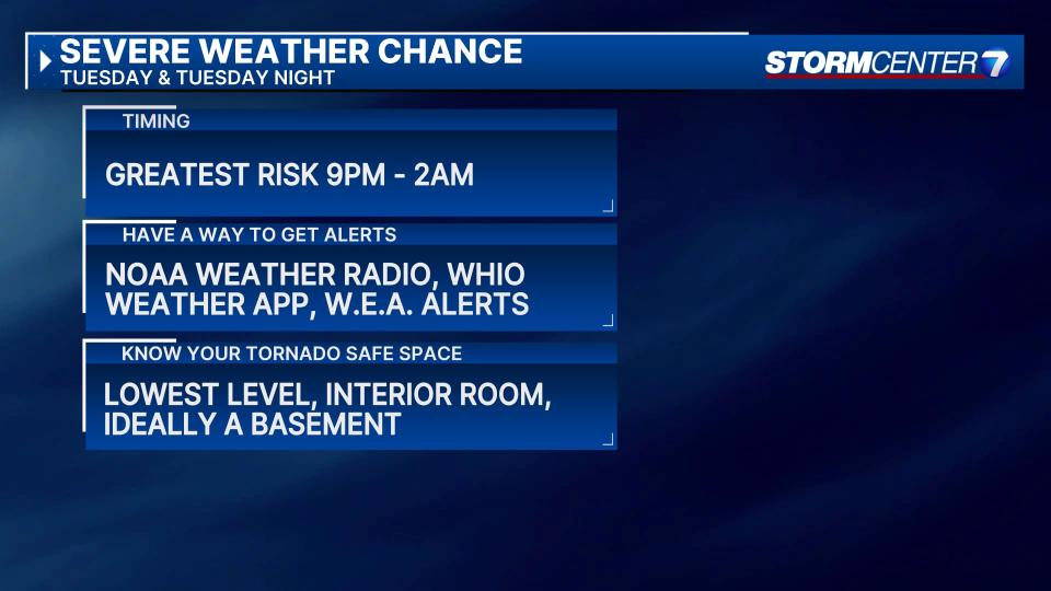
TUESDAY: Storm Tracking Alert for severe thunderstorms overnight. Storms may fire up around or after 9 p.m. The risk for severe storms will continue through the early morning hours of Wednesday.
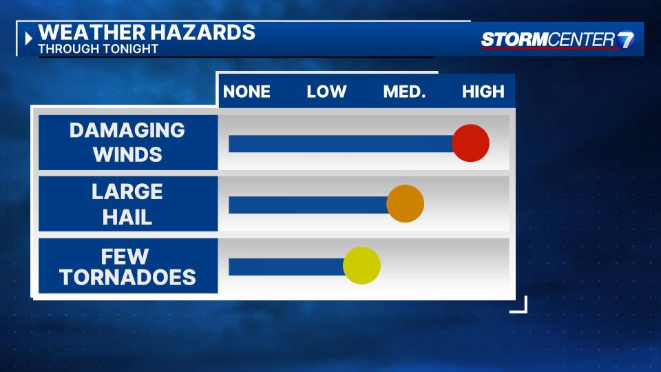
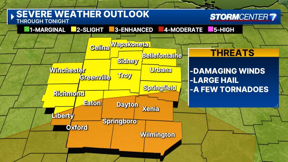
Damaging winds, hail, and even a few tornadoes are possible tonight. The Storm Prediction Center has areas generally along and south of I-70 in a level 3/5 risk, 2/5 risk further north. These storms look to move through as individual storm cells, or clusters of storms... not one line of storms.
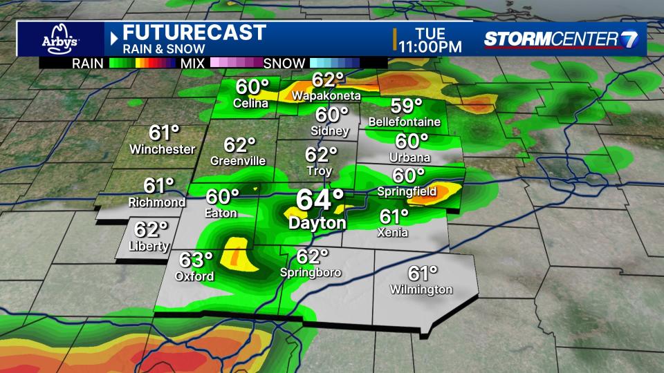
Some areas may deal with more than one strong storm, while others may stay dry. The bottom line is that scattered severe storms are expected tonight, and you need a way to be alerted/woken up in the event of severe weather.
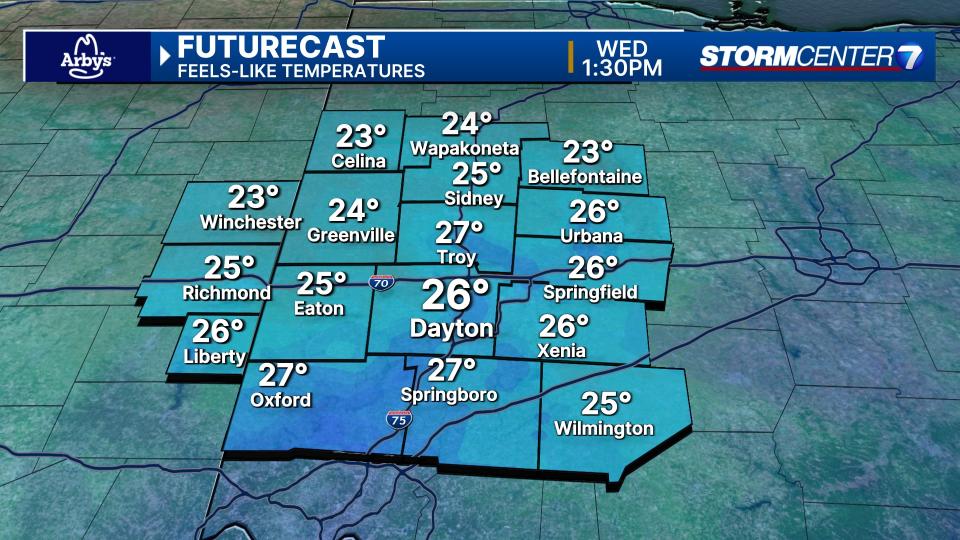
WEDNESDAY: Rain and even a few storms may be lingering early Wednesday morning. Wednesday’s high temperature of 60 degrees occurs in the morning. Temperatures drop sharply into the afternoon. We’ll be in the low 30s with wind chills in the teens and 20s Wednesday afternoon. Snow showers are possible across the northern Miami Valley.
THURSDAY: Sunny behind Wednesday’s cold front. Cooler with highs in the upper 30s to lower 40s.
FRIDAY: Increasing clouds with a chance for a stray shower or two by Friday evening and overnight. Mild with highs near 50.
SATURDAY: Partly cloudy and mild with highs near 60 degrees.
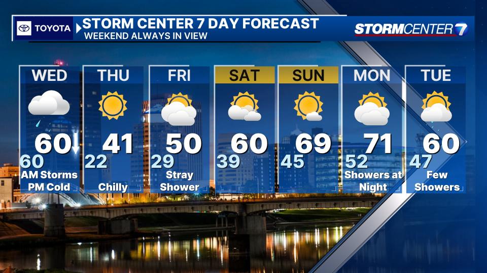
SUNDAY: Mostly sunny, warm, and breezy. Highs climbing to the upper 60s.
MONDAY: Increasing clouds but still warm and breezy. Low 70s for highs! A few showers are possible at night.
TUESDAY: A slight chance for showers. Otherwise mostly cloudy with a high around 60.

