What is ARkStorm? No, a megaflood is not going to sink California this week
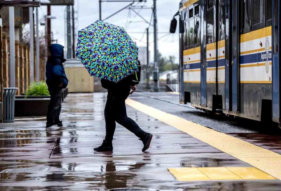
Rain is expected this week, as an atmospheric river rolls over California, but don’t expect a “megaflood.”
The California Governor’s Office of Emergency Services is warning people of false rumors online about a megaflood called the “ARkStorm” coming to California. It debunked a viral video — that was “full of misinformation” — where a user said the ARkStorm has a 30% chance of happening within the next 30 years and causing the “worst natural disaster in world history.”
“Residents have nothing to fear,” a spokesman with CalOES said in the video posted on X.
Cal OES reacts to some misinformation going viral right now.
Stay aware and alert this storm season and remember to only get your emergency information from official sources like https://t.co/RopTmXbifC. #StayStormInformed pic.twitter.com/Nb9CYKPiHK— California Governor's Office of Emergency Services (@Cal_OES) January 26, 2024
This comes as meteorologists are forecasting an atmospheric river to make landfall on the West Coast at the end of January or start of February.
An atmospheric river is an area in the atmosphere that carries water vapors outside of the tropics, according to the National Oceanic and Atmospheric Administration. When these so-called “rivers in the sky” make landfall, they drop rain and snow.
What is ARkStorm?
ARkStorm is a hypothetical disaster-preparedness scenario developed by scientists at agencies including the U.S. Geological Survey, Daniel Swain, a climate scientist at the University of California, Los Angeles said on a livestream on Friday.
California is susceptible to occasional yet extraordinarily large floods, according to Swain’s blog post from 2022.
“Such floods don’t happen every year; in fact, in the past they didn’t even occur every lifetime,” Swain said.
Swain noted that an ARkStorm 2.0 scenario is possible in a lifetime as climate change increases the risk of a megaflood — but it’s not something that is likely this week.
He explained that the last time the state experienced a megaflood was from 1861 to 1862.
Also known as the “Great Flood of 1862,” a series of rain hit along the West Coast. California, especially San Francisco and Sacramento, was inundated, with the cities recording 34 and 37 inches of rain, respectively, in two months, according to NOAA.
“The flooding was exacerbated by warm rainfall in the mountains, causing significant snow melt to flow into communities,” NOAA said. “Sacramento’s streets and sidewalks were under water, and farms within the Central Valley were completely flooded.”
This event led to the creation of ARkStorm as an extreme storm and flood scenario in 2011, Swain said, under the guide of scientists from organizations such as the USGS, UC system and Desert Research Institute.
If you're interested in learning more about #ARkStorm 2.0--which is a hypothetical but plausible extreme storm & flood scenario for California (not something that's happening next week!)--check out my 2022 blog post discussing our peer-reviewed paper: https://t.co/P0tajwZ4Dx
— Dr. Daniel Swain (@Weather_West) January 25, 2024
Named after atmospheric river for “AR,” 1,000 for “k” and storm, ARkStorm is projected as a 1-in-1000-year event, according to the USGS.
“The ARkStorm storm is patterned after the 1861-62 historical events but uses modern modeling methods and data from large storms in 1969 and 1986,” the agency said on its website. “The ARkStorm draws heat and moisture from the tropical Pacific, forming a series of Atmospheric Rivers (ARs) that approach the ferocity of hurricanes and then slam into the U.S. West Coast over several weeks.”
It was created to help boost visibility of a flood threat and increase preparedness, it said.
Should Californians be worried about a megaflood?
Latest forecasts are not showing any storms of the magnitude of an “ARkStorm,” Courtney Carpenter, warning coordination meteorologist with the National Weather Service, told The Sacramento Bee.
Along with the video, another post on X went viral with a user, who is not a meteorologist, warning California residents about the ARkStorm possibly developing in the Pacific that will result in “multiple feet of rain.”
Other users added context that the cited sources were not verifiable and Swain replied to the thread, denying the speculation.
“There is not currently any indication that an extreme flood event anywhere near this magnitude is on the horizon, despite the upcoming wet to very wet pattern in CA and the possibly elevated flood risk during that period,” he said.
On his Friday livestream, Swain said talk of the ARkStorm comes up just about every year as misinformation.
While it can happen, ARkStorm is not a specific storm. And, he said, it’s not what’s happening soon.
“We should not be worried about a scenario that looks anything like that research-driven study,” Carpenter said. With the upcoming storms, she said Californians can expect precipitation typical to those in the winter season.
You can still take steps to stay ready in case of a powerful storm.
CalOES advises people to prepare in case of natural disasters, like a big flood. This includes signing up for alerts, making a family emergency plan and getting weather and emergency updates from official accounts, such as CalOES.
What’s coming to California this week?
The National Weather Service’s Climate Prediction Center is forecasting an atmospheric river to douse California with above-normal amounts of precipitation starting this week.
California may also see potential flooding and landslides from heavy rain, snow in the Sierra and Klamath ranges, and high winds up to 35 mph during this time.
Cory Baggett, a meteorologist with the Climate Prediction Center told The Bee last week that the agency is forecasting a 60% or higher chance of heavy precipitation across the state.
“The heavy rain will work southward as the week progresses,” Baggett said. “It will start along the California border with Oregon and move southward as the (atmospheric river) event progresses, bringing the heavy rain with it.”
Carpenter said that residents can expect a weak to moderate atmospheric river storm starting Wednesday to Friday.
During this period, the Northern California coast and into Shasta County can expect around 4 to 6 inches of rain, Carpenter said. For Valley locations, forecasts show rainfall totals from 1.5 to 3 inches of rain.
Mountain areas may see 2 to 5 inches of rainfall below the snow line, she said.
The snow levels are expected to start above 6000 feet for Wednesday and will lower to 4000 to 5000 feet by Friday. The NWS office is forecasting 1 to 2 feet of snow.
Southern California could get less rainfall during this storm event, a range of 1 to 3 inches along the coast and 1 to 2 inches as you head inland, Carpenter said Monday.
For the Central Coast, including Monterey Bay and San Luis Obispo, there could be about 2 to 5 inches of rain.
Carpenter advises people who live in low-lying areas or regions that are prone to flooding to pay attention to the forecast and stay safe. For up-to-date information on the weather, she said people should follow their local National Weather Service office or CalOES for preparedness information.
“Just follow a trusted source, not something random you see on social media,” she said.
What do you want to know about life in Sacramento? Ask our service journalism team your top-of-mind questions in the module below or email servicejournalists@sacbee.com.

