Walking RI: Trolley line left its mark at Lincoln's Lime Rock Preserve
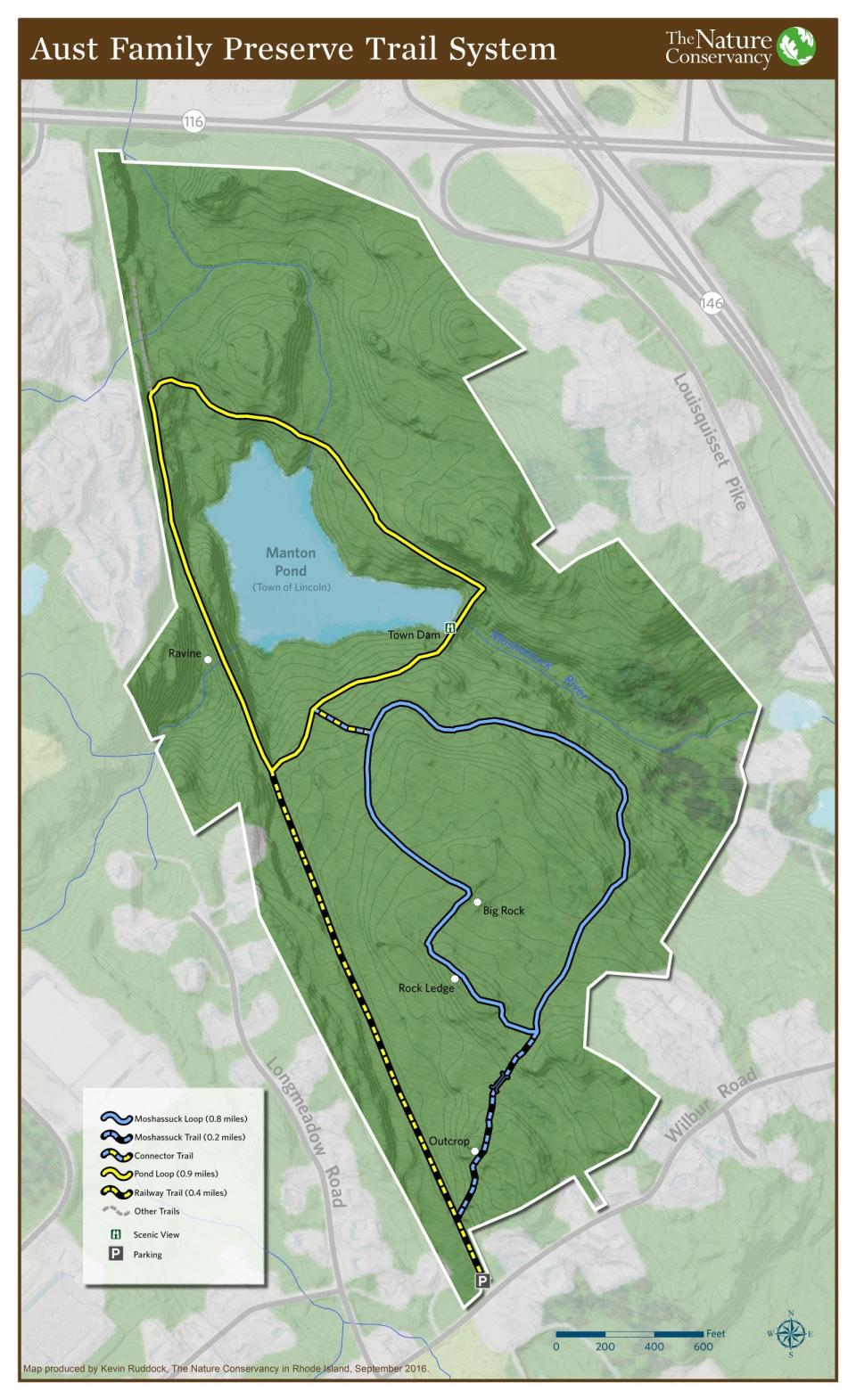
LINCOLN — Ramrod straight, the wide dirt path runs across a raised berm high above a reservoir on one side and a deep ravine on the other. One section of the trail cuts through a gorge blasted from granite ledges.
I’ve hiked on similar abandoned beds built for railroads that once chugged across the state, but this was different. Historians think the straight-as-an-arrow path along the western edge of the Lime Rock Preserve actually was laid out for an electric trolley line. The trolley cars carried commuters from Providence to Woonsocket, and then to Burrillville.
Besides the vestiges of the trolley, hikers also can see other manmade sights in the preserve, including an earthen dam built more than a hundred years ago to create the Manton Reservoir for downriver mills.
Walking RI: Mingle with birds, beavers, mink and more at Exeter's Fisherville Brook refuge
Walking RI: Start your day on the right foot with a hike at Cranston's Curran State Park
Among the natural features in the 135-acre sanctuary are the limestone deposits and outcroppings that were once mined. The minerals also sweeten the soil and nurture a wide variety of rare trees, plants and flowers.
The Lime Rock Preserve is also known as the Aust Family Preserve, named for Carolyn and Clifford Aust, who, along with Thomas Capron, were supporters of The Nature Conservancy (TNC), which acquired the property in 1986. The Houghton, Knowles, Plante and Wilbur families contributed land to the preserve, and the Conklin Limestone Company, which runs a nearby quarry, donated mineral rights.
From the trailhead off Wilbur Road, the old trolley line is visible and runs north through the woods. But I decided to save that for later and set out on the blue-blazed loop trail on the right that took me northeast by climbing a few wooden steps and then up a small hillside. A bright-red cardinal perched on a beech tree branch on the side of the path that crossed stone walls and, at one point, some plank bridges over a muddy area. At a fork, I went right on the yellow-blazed trail that skirted the eastern edge of the preserve. Through the trees on the right, I spotted a few houses.
Walking RI: The haunting legacy of Tiverton's Fort Barton Woods
Walking RI: Ninigret National Wildlife Refuge harbors naval, tribal history
The trail leveled off and then descended gently down a ridgeline. At a junction, I stayed right to pick up the yellow-blazed trail and soon caught a glimpse of a body of water through the trees. I walked to the edge of the pond and saw off to the right a 50-yard-long earthen berm built to hold back a stream and fill a depression in the land.
Pond is the source of the Moshassuck River
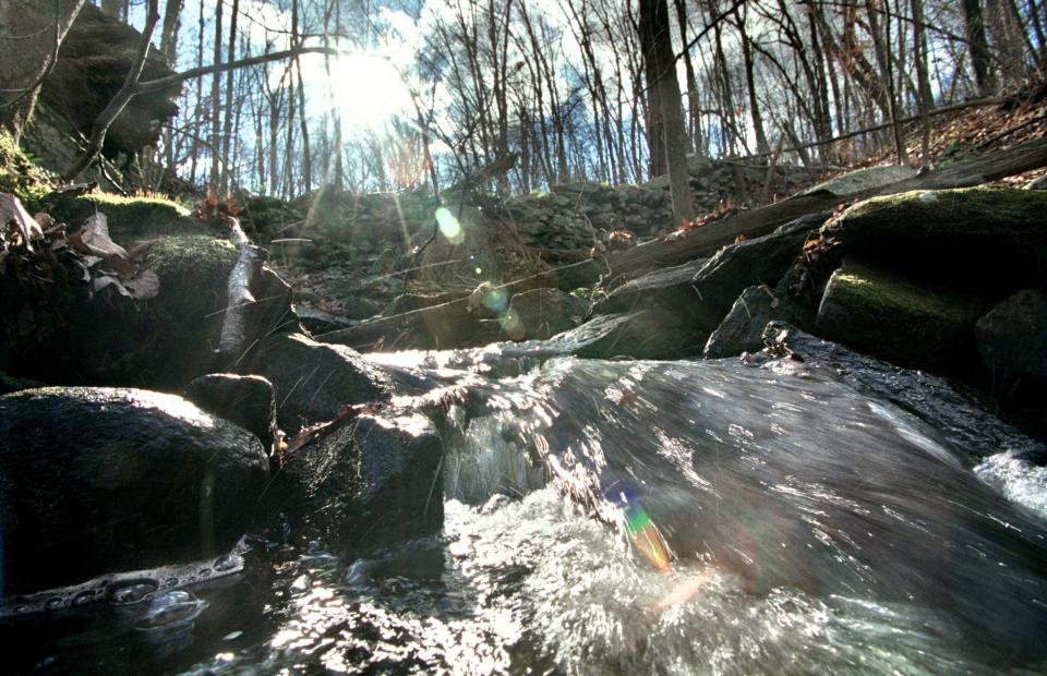
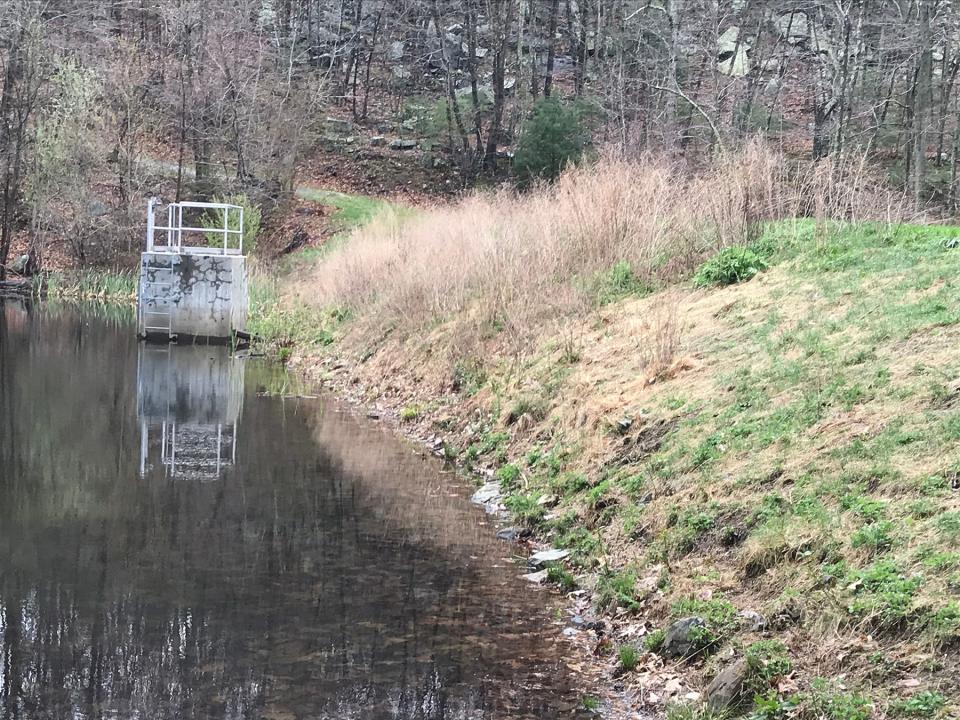
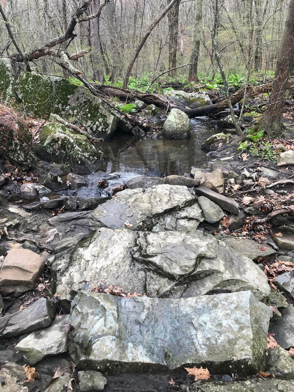
I explored the grass-covered dam and saw that water flows through a square cement gatehouse just offshore and passes through a culvert at the bottom of the dike to form the Moshassuck River, lined with dense green ferns and skunk cabbage. The river runs south for about 9 miles to Providence, where it converges with the Woonasquatucket River to form the Providence River. Many mills were built on the river’s banks downstream and fueled the Industrial Revolution.
Walking RI: Visit A Civil War grave and remnants of a bygone RI railroad in Hopkinton
Walking RI: Family-friendly hiking at a former Girl Scout camp in Westerly
The dam was built about 1900 to create a water supply for the mills, especially during dry periods when additional water flow was needed to turn the mills’ turbines or for dyeing and making textiles.
Over the years, the bottom of the dike deteriorated, leaked badly and failed safety standards. The state listed the dam as “high hazard,” and it was rebuilt in 2011. The water level in the reservoir was lowered several feet. The Town of Lincoln owns the dam and a fringe of land around the reservoir.
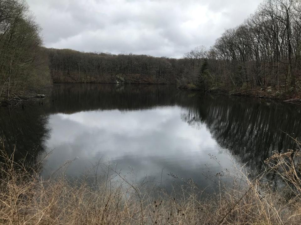
I walked to the middle of the dike, which was about 20 feet high, and surveyed the surroundings. Looking west to the far end of the reservoir, I could see the causeway for the trolley line and a high vertical rock ledge rising from the water level. Mallard ducks swam across the water.
At the northern end of the dam, I followed the yellow-blazed trail again and climbed a small hill on a road that once may have been a cart path, a sign of the property’s past as a farming area.
Walking RI: Looking for a great birdwatching spot? Try this former Navy site in North Kingstown
Walking RI: Immigrant war hero's legacy lives on at Glocester preserve
There are ledges on the right, and I spotted partially buried outcroppings of white rocks, flecked with black. Dolomitic marble and limestone were quarried in the area starting in the 1600s, when Thomas and Gregory Dexter began a mining operation along what is now Route 146.
Later, the Conklin Limestone Company mined the land for limestone. It was used in a type of plaster and mortar as a construction material for a type of house called a stone-ender, with massive stone chimneys built of fieldstones and the mortar. The Eleazer Arnold House on Great Road in Lincoln is an example of that type of structure.
Limestone in soil supports 30+ rare plant species
The limestone in the ground also created a rich, calcareous soil that enhances the growth of plants, flowers, vegetation and forests. Botanists have studied Lime Rock and found more than 30 rare plant species.
I continued on the trail that crossed a stone slab bridge, perhaps built to carry farm wagons, over a small, feeder stream to the reservoir and reached a junction with the trolley bed. The flat path to the right runs off the property, so I went left and headed south.
Walking RI: A step-by-step guide to beautiful Stepstone Falls
Walking RI: Best place for a hike and osprey spotting? Try the Great Swamp in South Kingstown
A line of condominiums appeared through the trees on the right, and I passed through a gorge cut from ledges. I came to the huge outcropping on the left that I saw from the dam, which provided a sweeping view of the reservoir. On the right is a deep ravine, and you can see how the bed for trolley cars was built on the raised berm
Just ahead, a stream comes in from the west in the valley and runs under the berm through a tunnel built of stone. The engineering is impressive.
Walking RI: Retracing Thoreau's 1854 hike through Providence
Walking RI: Rediscover Providence's Roger Williams Park on a serene hike around its ponds
At another junction, I turned left on the blue-blazed trail, which wound up and down hillsides. The path cut through a stone wall and over some boardwalks over wet areas. After passing a few huge outcroppings and boulders, the path turned right before heading back downhill to the trailhead.
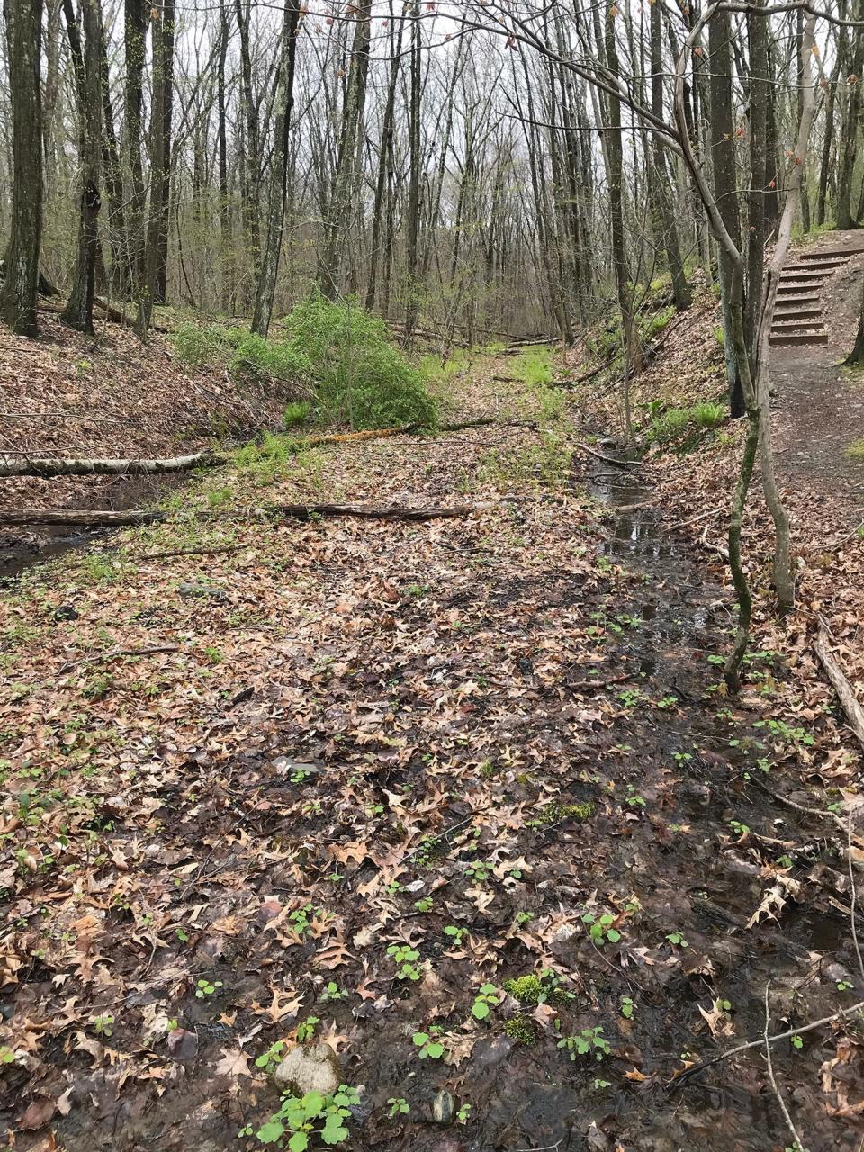
I wanted to explore a bit more, so I walked north under oaks on the yellow-blazed trolley bed along a wide, wet trench, with drainage ditches on the sides. The bed gets so muddy in this section that the trail was rerouted just to the left and runs for a couple hundred yards before rejoining the flat, dry trolley bed.
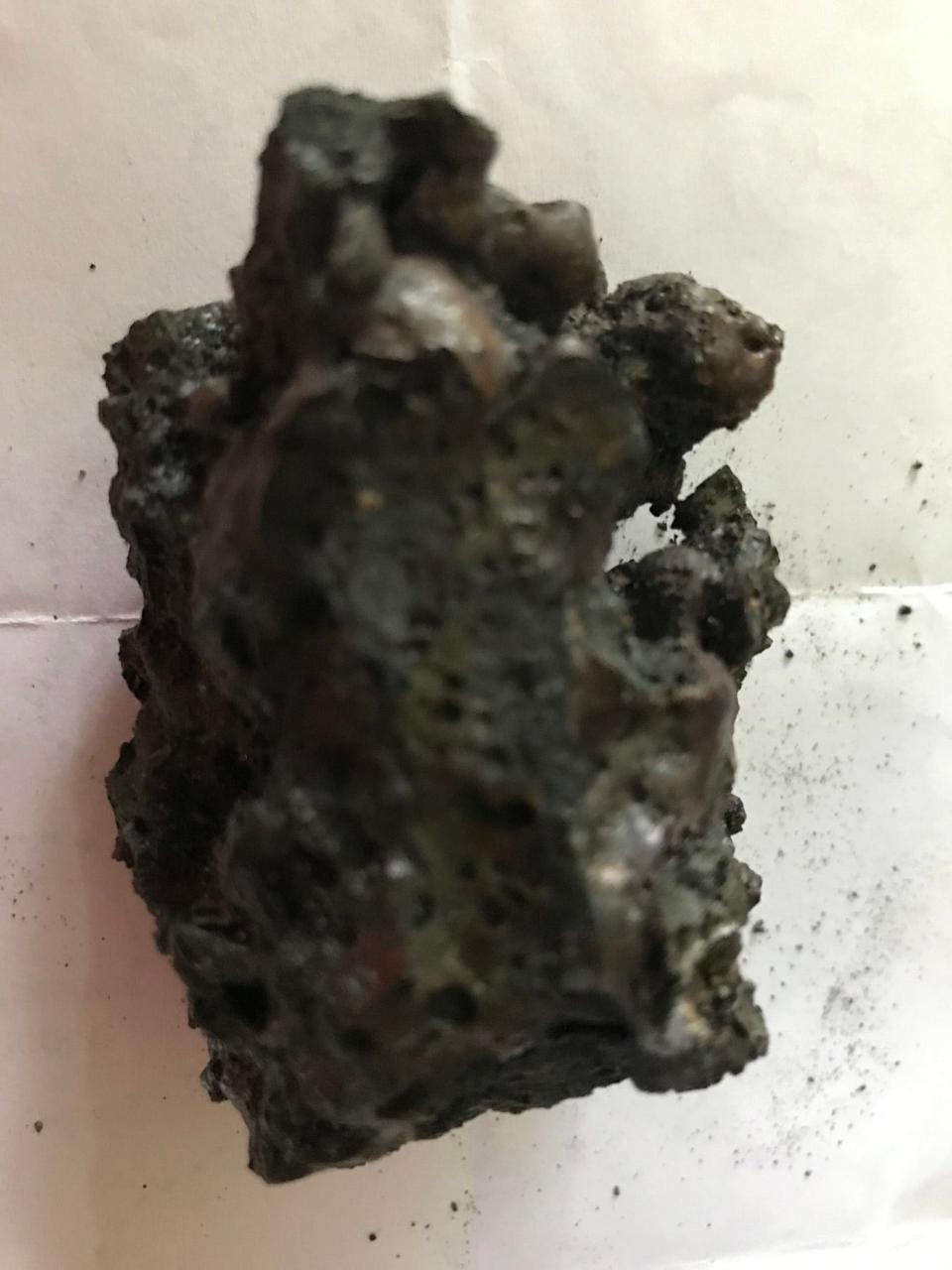
What are those curious black rocks on the former trolley bed?
Along the path, I found chunks of black rocks and wasn’t quite sure why they were there. I learned later some hikers call them “clinkers,” a conglomerate of minerals left after coal is burned off, and suggested they were left by a railroad.
But there’s little evidence that a train ran through the preserve.
Greg Gerritt, founder of Friends of the Moshassuck, a group dedicated to preserving the river, called the nuggets “slag” and said they were created by an ironworks in Providence and used in the construction of the trolley bed. Local landowners say the trolley originally crossed a trestle near the pond. It was later filled in, perhaps with the black rocks that still can be found along the route.
Walking RI: Hunt for RI's rare state rock at Cumberland's Blackall/Ballou Preserve
Walking RI: Column's readers and fans share their RI trail wisdom
Tim Mooney, marketing and communications manager for the Rhode Island chapter of The Nature Conservancy, has researched maps of the preserve and found no evidence of a railroad line. But he did find a commuter trolley line that ran from Providence to Woonsocket with an extension to Burrillville. He said the line was run by the Woonsocket Street Railway Company or the Providence & Burrillville Street Railway Company, or perhaps both.
The trolley line was built in 1908 and the cars traveled at 35 miles per hour. The line was abandoned in 1932.
Any remains of the rails, tracks or ties in the bed or the posts that carried the electric lines seem to be long gone.
Walking RI: 5 great hikes with ocean views
Walking RI: Coastal views and prime bird-watching at Tiverton's Emilie Ruecker preserve
Walking RI: Retracing an Aussie Walkabout in George Washington Management Area
I followed the trench and trail north until I reached the intersection with the blue-blazed trail I took earlier, turned east on it and headed back to where I'd started.
In all, I hiked 3.5 miles over a little less than two hours.
I enjoyed the exercise and the walk through history. I learned a lot, but I’m sure there’s more to know about the dike, reservoir, trolley line, limestone and the mysterious black rocks. If you have any information, please pass it along.
The history is worth sharing and preserving.
Trail Tip
The Nature Conservancy posts these guidelines:
• Stay on marked trails.
• Keep dogs on leashes.
• Visit from one hour before sunrise to one hour after sunset.
• Wear long pants and socks to avoid ticks.
• Carry out trash.
• Do not camp overnight or ride bikes, motorized vehicles or horses.
• Do not remove living material or disturb vegetation.
Walking RI: Hollywood wow factor on Hopkinton trail
Walking RI: 5 best family-friendly hikes around RI for nature lovers
Walking RI: Bay views and WWII history at Beavertail State Park

John Kostrzewa, a former assistant managing editor/business at The Providence Journal, welcomes email at johnekostrzewa@gmail.com.
This article originally appeared on The Providence Journal: Hike along the path of a trolley line at Lincoln's Lime Rock Preserve

