Want to practice some rock climbing? Head to Connors Farm in Smithfield: Walking RI
SMITHFIELD — A narrow stream winds through an oak forest at the foot of a steep hill covered with ledges, boulders and outcroppings.
It’s a picturesque sight. But for the farmers who worked the land here years ago, the brook was essential to their livelihood.
They built a stone dam across the brook with a gate that could be closed to flood a natural cranberry bog.
Downstream, they erected an earthen dike to hold back water flowing in the brook to form a small farm pond to water dairy cows and crops.
Walking RI: Leave the noise behind at a wooded retreat in Richmond
Walking RI: Follow in the footsteps of Trappist monks in Cumberland
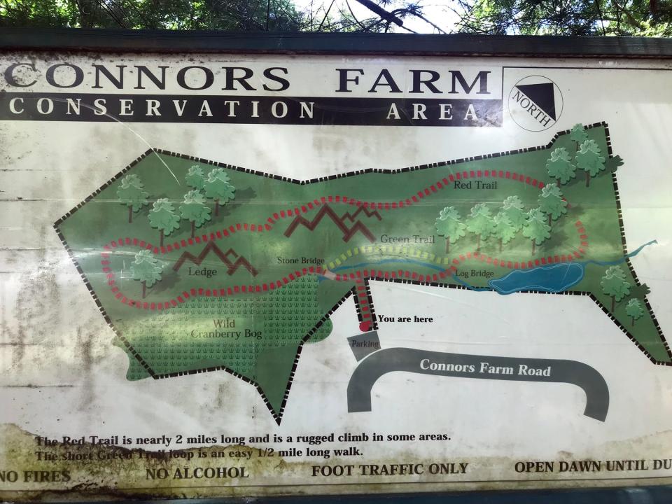
The meandering stream and the remnants of farm life along its banks are just some of the interesting features of the Connors Farm Conservation Area, a preserved patch of woods surrounded by houses that was once farmed by the Connors, Comstock and Mowry families.
They used the land around them to build a life for themselves and their families.
The Smithfield Conservation Commission now manages the 66-acre preserve, and the Smithfield Land Trust owns the abutting 43-acre Jim Russell Preserve.
I set out to explore the preserves from a trailhead off Connors Farm Drive. The start of the trail passes through what was once an apple orchard, one of many stands of fruit trees that once dotted the landscape.
Walking RI: Tillinghast Pond's trails are part of something special and well worth a visit
Walking RI: Trolley line left its mark at Lincoln's Lime Rock Preserve
Walking RI: 5 great hikes with ocean views
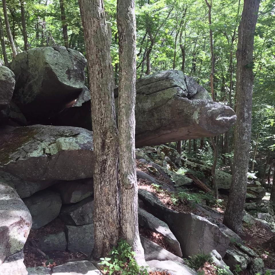
The short path descends slightly to a T-intersection. Straight ahead and rising about 100 feet is a steep slope with rocks, boulders and ledges that seem to spill out of the hillside. The rugged terrain is sometimes used by rock climbers to practice their skills.
At the base of the hill is an unnamed stream, thickly overgrown and hidden in some places, that slowly flows east across the preserve.
Remnants of a former cranberry bog
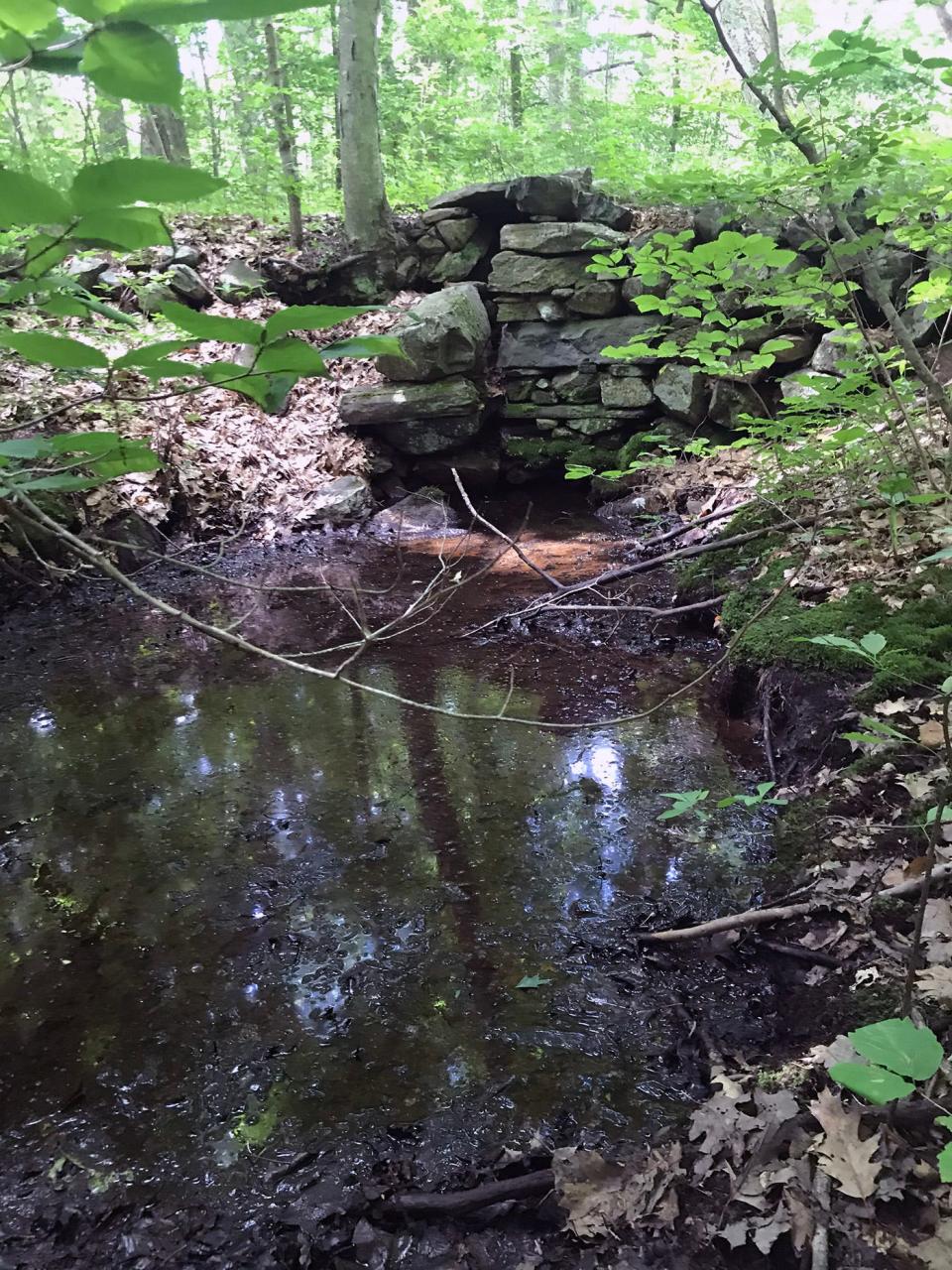
At the T-junction, I went left on a flat, red-blazed trail that was wide enough to be a wagon road when the land was cultivated. I soon came to a wide, stone slab bridge above a dam built of round stones with a gap where the water from the stream flowed through. An extensive area southwest of the dam was once a natural cranberry bog that was flooded by blocking the gap in the dam with wooden planks.
I tried to explore the lowlands and bog, but they are now covered with dense foliage and almost impenetrable to walk through.
Walking RI: Mingle with birds, beavers, mink and more at Exeter's Fisherville Brook refuge
Walking RI: Start your day on the right foot with a hike at Cranston's Curran State Park
Walking RI: At Trustom Pond in South Kingstown, silence is golden
I once associated cranberry bogs with wetlands on Cape Cod. But on an earlier hike at Steere Farm in Glocester, I spotted the remains of a small stone dam with a gate to control water flow to a cranberry bog. Later, I read that several bogs were planted and commercially harvested in Rhode Island. In 1855, Abel T. Sampson planted a bog in Coventry that was later expanded to become one of the largest in the state.
The trail through Connors Farm crossed the stone slab bridge before heading northeast and uphill on a steep grade, with a 20-foot ledge wall on the right. Eventually, the trail flattened, passed through a grove of beech trees and went east on a ridgeline above the rocky hillside. At one point, there were ledges on both sides of the path.
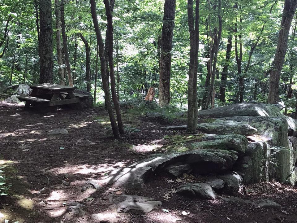
A bit later, I came to a clearing with a picnic table perched on a lookout ledge above the rocky hill that I had seen at the start of the trail. I noted a long, thin slab of rock that pointed like a finger about 10 feet out above the hillside.
I learned later that years ago, trees harvested on the hilltop were slid down long chutes to the road below to be carried off the property.
Walking RI: Ninigret National Wildlife Refuge harbors naval, tribal history
Walking RI: Looking for a great birdwatching spot? Try this former Navy site in North Kingstown
At Jim Russell Preserve, stone walls, ledges, caves and outcroppings
Continuing east, I reached a junction that opened on the left for a trail through the Jim Russell Preserve, named for the family that sold the property to the land trust. I took the yellow-blazed trail through a flat area that wound under pine trees and by stone walls on land that at one time was probably farmed. The trail, and some of the paths through Connors Farm, were cut by Boy Scouts for Eagle Service projects.
I followed the trail all the way to Burlingame Road and a small trailhead with spots for a couple of cars.
Retracing my steps, I took the yellow-blazed trail southeast down a hillside to an intersection with a blue-blazed trail, passing stone walls, ledges, caves and outcroppings.
Walking RI: Immigrant war hero's legacy lives on at Glocester preserve
Walking RI: A step-by-step guide to beautiful Stepstone Falls
Walking RI: Coastal views and prime bird-watching at Tiverton's Emilie Ruecker preserve
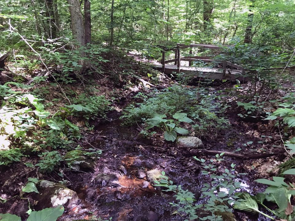
I took the blue-blazed trail to the edge of a small, still pond covered with weeds. I walked along the top of an earthen dike, built to hold back a stream to form the pond, and realized it was the same brook I had crossed at the start of the hike. I inspected the dike and found a culvert through the base of it, and just offshore, what looked like a concrete footing that may have been built as a gate to stop water from flowing through.
This area was where Leo Connors’ family built a farmhouse and garage and raised dairy cows and sometimes turkeys during holiday seasons. The pond may have been built to water the livestock.
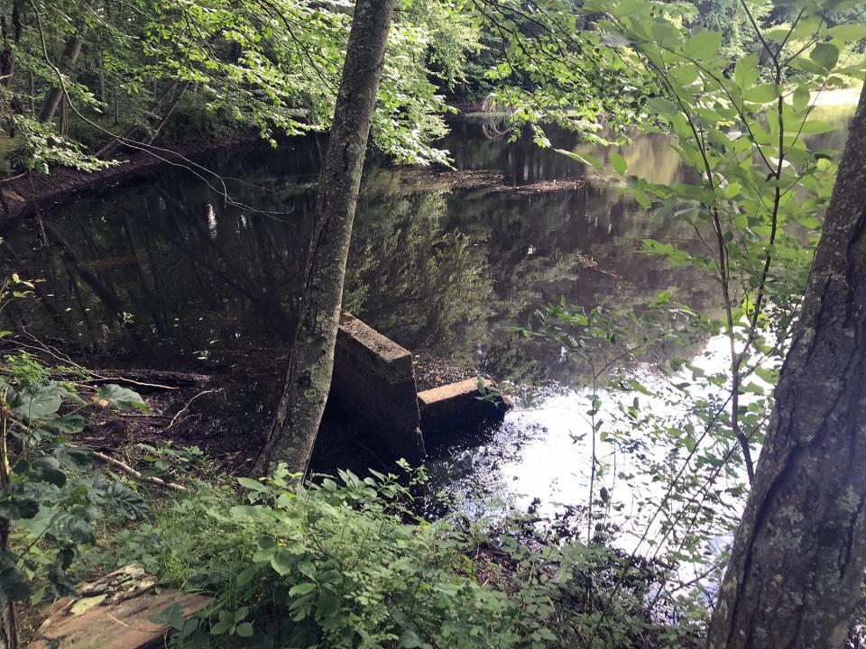
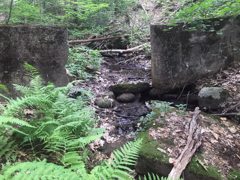
I followed the path west along the edge of the pond and saw a duck box just offshore. The trail crossed a wooden bridge over the stream, and I decided to bushwhack a bit by following its banks. It was tough going through the thick underbrush, but my reward was finding a long concrete wall built across the stream with a square gap in the middle that must have been for a gate to hold back the water. It was a different type of construction than the stone dam I had passed earlier and seemed to have been built much later. I’m not sure who built it or why. It may have been an updated version of a dam to flood a cranberry bog.
Walking RI: Best place for a hike and osprey spotting? Try the Great Swamp in South Kingstown
Walking RI: Trestle Trail in Coventry is a great spot for fitness training
I learned later that the Civilian Conservation Corps built public works projects in the area in the 1930s, and the dam may have been some type of water control.
After studying the structure, I found a shallow spot in the stream and crossed to find a green-blazed trail. It followed the brook west and took me to the stone bridge near where I started my hike.
In all, I walked about 3.5 miles over two hours.
A poetic conclusion to a picturesque stroll
Before I left, I studied the stone dam again and noticed a plaque tacked to a stone that I had missed earlier. It was inscribed with the poem, “Spring Planting,” by Laurence J. Sasso Jr., the town poet who grew up near Connors Farm, played there as a boy and still lives nearby. When I contacted him, he helped me understand the history of the farmland and told some great stories, including one about the time he and his friends built a raft to cross the cranberry bog. It sank about 10 feet out.
Walking RI: Take in the fragile beauty of Warren's Touisset Marsh during a coastal hike
Walking RI: Coastal views and prime bird-watching at Tiverton's Emilie Ruecker preserve
Walking RI: Retracing an Aussie Walkabout in George Washington Management Area
His poem is about regeneration and celebrates those who work the rich soil. One stanza reads:
“We place faith in the darkest dirt
And somehow it always works.
Our labor isn’t wasted or denied
Life rises from the thing that died.”
It was a nice touch to cap off an interesting walk with a look back into the history of those who once lived and worked there.

Trail Tip
Hikers should always carry plenty of water, especially during summer hikes, to replenish what they lose through perspiration. Veteran hikers recommend carrying two liters of water and stopping regularly to take a drink. Don’t wait until you are thirsty.
John Kostrzewa, a former assistant managing editor/business at The Providence Journal, welcomes email at johnekostrzewa@gmail.com.
This article originally appeared on The Providence Journal: Rock climbing and hiking at Smithfield's Connors Farm

