Want real-time air quality data for New Hampshire? You can find it here.
Several air quality warnings have been issued across the state so far this summer as a result of the unprecedented Canadian wildfires. The fires began in June and now number around 1,000.
Their smoke – a mixture of air pollutants produced when wood and other organic materials burn – has made its way on several occasions to the Northeast. Skies have appeared hazy and with hues of red and orange, as smoke particles scatter light differently.

The conditions have prompted environmental officials in New Hampshire to disseminate alerts about poor air quality and how it can impact sensitive populations. An Air Quality Action Day is publicly issued when unhealthy levels of ground-level ozone or particle pollution are forecast.
The New Hampshire Department of Environmental Services maintains a map of current air quality data, accessible to the general public on its website. Color-coded according to the Environmental Protection Agency’s Air Quality Index, the map shows real-time monitoring data for both ground-level ozone and particle pollution.
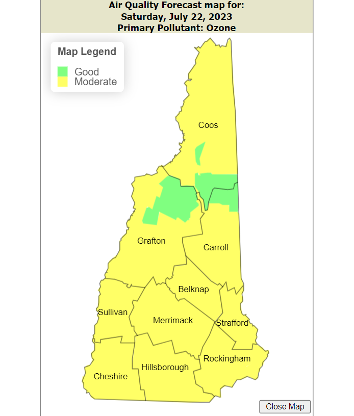
Ground-level ozone is commonly called summertime smog and forms when pollutants react chemically in the presence of sunlight. Fine particle pollution, both solid and liquid particles, are monitored year-round and are associated with numerous serious health effects.
DES operates the majority of air monitoring sites around the state, and its real-time map and associated table are updated every hour. In addition, the Appalachian Mountain Club maintains three monitors in northern New Hampshire and the Hubbard Brook Research Foundation maintains one station in cooperation with the EPA.
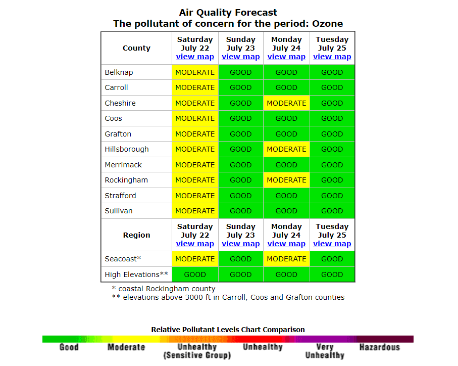
DES also provides an air monitoring forecast, showing a county-by-county breakdown over a period of several days. People can also call 1-800-935-SMOG for more information.
Sensitive populations and poor air quality
There are six classifications for air quality: good, moderate, unhealthy for sensitive groups, unhealthy, very unhealthy, and hazardous.
When the state declares an Air Quality Action Day, officials advise “sensitive individuals” to take precaution by limiting prolonged outdoor exertion. These groups include children and older adults; anyone with lung disease such as asthma, emphysema, and bronchitis; and people who are active outdoors. In some cases, even healthy individuals may experience mild health effects and should consider limiting strenuous or prolonged outdoor activities, the state says.
Find out more about NH air quality
This story was originally published by New Hampshire Bulletin
This article originally appeared on Portsmouth Herald: Want real-time air quality data for New Hampshire? Find it here.

