Warm California storm could bring flooding to areas along Sacramento River, Interstate 5
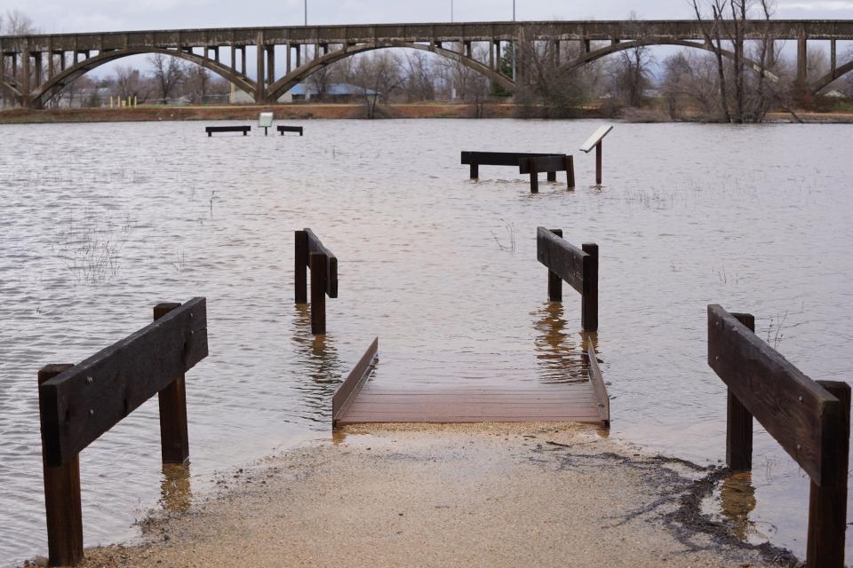
A warm storm bringing heavy rain and melting snow could cause Sacramento Valley waterways to flood this week.
The National Weather Service issued a flood watch that started Thursday afternoon and continues until Sunday morning for low-lying and urban areas, from Shasta Lake in the north to Stockton in the south.
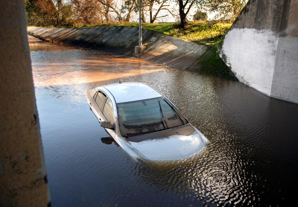
Flooding and rock and mud slides could block traffic on parts of Interstate 5, Highway 99 and other Northern California roads, according to the California Department of Transportation.
“The entire Sacramento River is expected to rise at least into early next week.” said meteorologist Scott Rowe at the weather service’s Sacramento branch. The Sacramento River will likely reach just below the flood stage this weekend, but that could change quickly and water levels rise if most of the rain expected comes all at once.
Areas most likely to flood are located on the Sacramento Valley floor, but foothill communities located below 4,000 feet could see flooding too. Places at risk include those near creeks and small tributaries, urban communities and areas with poor drainage ― especially where snow is blocking drains and culverts, the weather service reported.
Rowe said Wednesday he expected heaviest rains to fall late Thursday night into Friday, possibly lasting until Saturday morning. Redding could get up to 4 inches of rain by Tuesday, he said. Other parts of the north Sacramento Valley, including Shasta Dam and Shasta Lake, could get up to 6 inches.
Strong winds up to 40 mph in Redding and 50 mph in Chico could spread further rain and flood waters.
Communities most at risk of flooding in the northern part of the valley include Cottonwood Creek in southwestern Shasta County and other small tributaries, Rowe said. Those tributaries tend to flood faster than larger ones, so communities have less warning when flooding is imminent.
The rain gets lighter in the southern Sacramento Valley, Rowe said. The Stockton area could get up to 3 inches of rain by Tuesday.
However, as rainwater flows into the river and moves south, flood risk increases, he said. Places most at risk for flooding this week include the Tehama Bridge at Los Molinos and Vina Woodson Bridge east of Corning, both in Tehama County.
Farther south, the Sacramento River will likely spill over weirs built to help control flooding, especially at the Sutter Bypass west of Marysville and in Sacramento at the Fremont Weir between Woodland and the Sacramento Airport ― an area used for rice farming and other agriculture.
The rains will send water down the river all at once, Rowe said. No slow-melting snow will fall below the 3,500-foot mark.
Parts of I-5, Highway 99 could flood
Motorists on Sacramento Valley roads should watch for flooding, and for rock and mud slides, especially near waterways, Caltrans District 2 spokesman Christopher Woodward said.
Areas to watch carefully include Highway 99 southeast of Red Bluff, near Dairyville; and I-5 near South Ave. in Corning, he said. Highway 70 in the Feather River Canyon near Oroville is closed due to slides this week.
Motorists should never try to drive through water, Woodward said. “It doesn’t take much to move (lose control of) your vehicle if you get into water. You don’t know if the road is washed out underneath the water, so what you think is a foot of water could be three feet.”
Floodwater may also contain debris, like tree limbs and rocks, he said.
Motorists should call 911 if they see flooding or an obstruction on a road and there are no police or Caltrans workers on site, Woodward said.
He also suggests people check road conditions before they go at Caltrans QuickMap website: quickmap.dot.ca.gov
More:How to treat trees for snow damage, broken limbs
Jessica Skropanic is a features reporter for the Record Searchlight/USA Today Network. She covers science, arts, social issues and news stories. Follow her on Twitter @RS_JSkropanic and on Facebook. Join Jessica in the Get Out! Nor Cal recreation Facebook group. To support and sustain this work, please subscribe today. Thank you.
This article originally appeared on Redding Record Searchlight: Interstate 5, Sacramento River could flood during California storm

