Warmer, dry conditions to expand to East Coast into early October
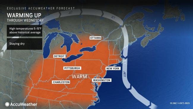


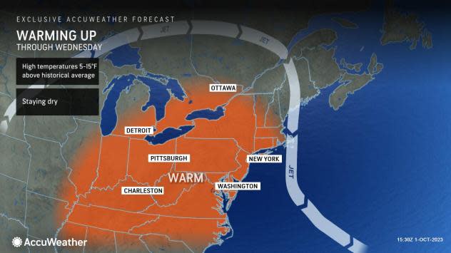
Areas along the Eastern Seaboard that have been enduring relentless rain, low clouds and chilly conditions will have a string of brighter and warmer days ahead as a vast sea of sunshine will expand from the Mississippi Valley through much of the first week of October, AccuWeather meteorologists say.
The same zone of high pressure and bulge in the jet stream responsible for building warmth over the Great Plains and Mississippi Valley into the start of October will broaden and shift eastward into the new week.
 |
At the core of the warmth, record-high temperatures, some dating back to the late 1800s, will be broken over parts of the Upper Midwest into early week. While the warmth will not be quite as extreme in the East, many areas will have extended warm and dry fall conditions.
People will have plenty of opportunities to get out and enjoy the conditions, catch up on outdoor projects, prepare for the upcoming winter season or clean up after recent storms.
For example, in New York City, the period from Sunday to at least Thursday will feature sunny days with highs in the mid-70s to near 80 in the wake of widespread flooding. The historical average for high temperatures into early October trends downward into the upper 60s. So, temperature departures will trend to nearly 10 degrees above the historical average by Wednesday.
In portions of the Great Lakes region and over the central and southern Appalachians, which typically experience more robust cooldowns in October, temperatures may reach 10-15 degrees above the historical average and even locally 20 degrees above.
Three hundred miles to the northwest of New York City, in Buffalo, New York, temperatures will soar into the 80s on Tuesday, Wednesday and Thursday and will challenge the daily record high each day. On Wednesday the high could challenge the record of 87 from 1951, which is also the second highest temperature recorded in Buffalo in October. A high in the mid-60s is typical for early October in Buffalo. Even in mid-July, when the daily historical average is highest in Buffalo, the average is just 81 degrees.
 |
Even Boston will experience multiple dry days with highs in the 70s to even above 80 this week. Temperatures will reach at least the low to mid-80s in Philadelphia and Washington, D.C., on Sunday, Monday, Tuesday and Wednesday, which is 5-10 degrees above the historical average.
Farther across the interior, temperatures will also peak above 80 degrees in Pittsburgh from Sunday to Thursday, which is about 10 degrees above average early October levels.
Many areas of the Southeast, including Atlanta and Charlotte, can expect a long stretch of dry and pleasantly warm conditions through much of the week. Daytime highs will range from the low to mid-80s, with low humidity. Much of the Great Lakes and Ohio Valley will actually be warmer than parts of the Southeast by the middle of the week.
Some rain may creep in from the Atlantic near the coasts of the Carolinas and Georgia later in the week. Clouds and rain may arrive in Charleston, South Carolina, as early as Thursday.
For those thinking about spending time on the beach along the East Coast this week, conditions will improve into early week with a gradual reduction in rough seas and above-normal tides. Forecasters still urge caution due to recent stormy conditions over the past couple of weeks, as the sand beneath the surf may have been washed away and could contain sharp objects and other debris. Rip currents are always present even in relatively tame surf conditions.
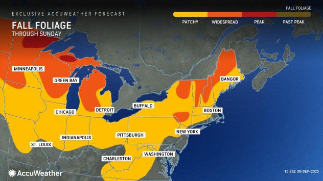
The warmer and drier conditions should slow down the progression of fall leaf color a bit, which got off to an early start due to recent cloudy, cool and damp conditions in September.
 |
Those traveling through the Appalachians and through some of the river valleys across the interior early this week may encounter patchy early-morning fog. Flight delays are possible where fog persists for a few hours in the morning, especially at smaller, regional airports.
The chance of some showers and spotty thunderstorms will increase during the second half of this week from west to east. However, it is possible that a squeeze play with a storm offshore over the Atlantic and a front to the west continue an extended period of dry, sunny and warm conditions from near the Appalachians to parts of the East Coast later this week and into the first full weekend of October.
Want next-level safety, ad-free? Unlock advanced, hyperlocal severe weather alerts when you subscribe to Premium+ on the AccuWeather app. AccuWeather Alerts™ are prompted by our expert meteorologists who monitor and analyze dangerous weather risks 24/7 to keep you and your family safer.
