Wayne County residents invited to open house for new FEMA flood maps
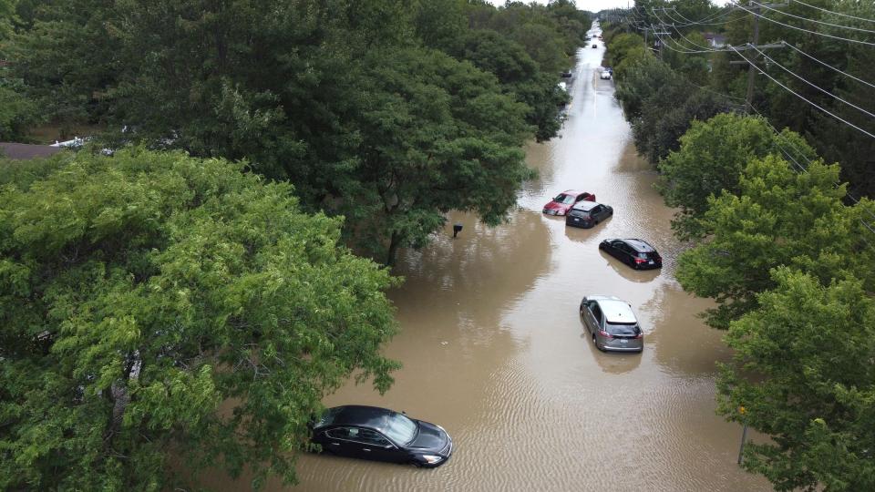
For many Michiganders, the sound of rain triggers nothing but anxiety — memories flood of submerged basements, lost valuables and spreading mold.
Residents of the Jefferson Chalmers neighborhood have struggled for years against severe flooding and sewage backups caused by the surrounding inner city waterway, fighting for federal recognition of the climate disaster they experience every rainfall.

Wayne County residents are invited to an informational open house on the Federal Emergency Management Agency’s recently completed Flood Insurance Rate Maps and Study. Class action lawsuits continue after a Free Press investigation found hundreds of thousands of damage claims filed by residents of Wayne, Oakland and Macomb Counties were unfairly denied by FEMA.
More: Thousands of Detroit flood victims still waiting for aid 9 months later
The open house, hosted at Wayne County Community College next Tuesday, will review the flood risk and insurance standards and include time for residents to view where their homes sit on the new maps.
Once officially adopted, the maps will serve as the basis for flood insurance ratings and protections under the National Flood Insurance Program.
More: Floods in metro Detroit bear hallmarks of human-caused climate change, scientists say
The preliminary maps come after years of FEMA re-analyzing the geographic and topographical landscape of Michigan after a nonprofit report found more than 142 million homes across the country at risk of flood within FEMA’s Special Flood Hazard Area maps.
More: It's deja vu all over again for metro Detroit flood victims despite past promises
The study by Brooklyn-based First Street Foundation identified 70% more properties, almost 400,000 within Michigan, more at risk than FEMA identified.
First Street’s evaluation identified 39,744 parcels within Detroit, 11,916 in Warren, and 9,448 in Grand Rapids in flood zones not highlighted by FEMA, making residents in those areas liable for damages that should fall under federal insurance aid.
"Ghost streams," historic streams and wetlands buried by urban development, were identified throughout the Jefferson Chalmers neighborhood by a resident in 2015; FEMA consequently identified a larger portion of the neighborhood qualifiable as floodplains.
FEMA's Flood Map Open House will be hosted at Wayne County Community College's Curtis L. Ivery Downtown Campus Frank Hayden Room, located at 1001 W Fort St., on Tuesday, January 30 from 5 p.m. to 7 p.m.
This article originally appeared on Detroit Free Press: Wayne County residents invited to open house for new FEMA flood maps

