Weather permitting: Another 'I' storm retired, rainy weekend approaches Fayetteville area
Ida, we hardly knew ya.
The World Meteorological Association has officially retired Ida as a storm name.
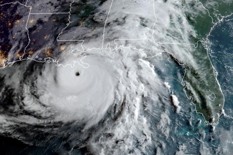
That's not surprising, given that Ida was one of the 10 most destructive hurricanes to ever hit the United States. Ida, who joined the hurricane name list after Irma was retired, made the most of its one appearance. With a confirmed death toll of 55 and damages exceeding $75 billion, Ida ranked behind only Katrina, Harvey, Maria and Sandy.
The WMA is responsible for naming storms and retiring storm names. It also sets up the six-year rotation of storm names. Over the years, 94 storm names have been retired, but names beginning with the letter "I" top the list with 13.The replacement for Ida will be Imani, beginning in 2027. And for 2022, the "I" name is male — Ian.
From the editor: The Fayetteville Observer newsroom will be out in the community next week
Still, this leaves the WMA with a bit of a problem: just how many "I" names are left out there? It didn't seem to be much of a concern early on. Until the year 2000, only two "I" storms were retired: Ionne (which hit North Carolina in 1955) and Inez (1966).
The 21st century saw a rash of devastating "I" storms. Iris, Isidore, Isabelle and Ivan hit in consecutive years, and Ike arrived a few years later. The next decade saw Igor, Irene, Ingrid and Irma. In the 2020s, half the retired storm names have been "I"'s — Iota and Ida.
The current active "I" names: Ian, Idalia, Isaac, Imelda, Isaias (remember that one?) and the newly added Imani.
The good news: If another "I" storm is retired there are still plenty of names to pick from. How about Ivy? Or Isley? Maybe they can borrow Izzy from the Pacific storm list?
If all else fails, my personal favorite is Ignatz, the brick-tossing mouse from the old Krazy Kat comic. He could use a comeback.
What's Happening? 10 things happening this weekend in the Fayetteville area
The weekend: Meanwhile, the Cape Fear region will see increasing rain chances Friday through the weekend. A frontal boundary will stall just south of the region, and several weak systems will travel along the boundary.
Dry air at the surface should keep Fayetteville rain-free on Friday, with a high of about 75. Light rain will reach the region after midnight and linger into Saturday. After that, it looks like a weak CAD setup, with light rain and clouds reinforcing a cooling trend through the weekend. Saturday will be gloomy, with highs of about 70.
Sunday will be a bit trickier, depending on the strength of the CAD. Fayetteville could top 80 if clouds retreat. Otherwise, mid-70s will be about the best we can do. Look for a potential for showers in the late afternoon
Down the road: The CAD will dissolve ... eventually. Look for clearing skies and warmer temperatures to start the work week. Highs in Fayetteville will nudge back into the mid-80s, lows in the mid-60s. Then we'll be watching another frontal boundary arriving by mid-week.
Got a weather question? Chick Jacobs can be reached at ncweatherhound@gmail.com or NCWeatherhound on Twitter.
This article originally appeared on The Fayetteville Observer: Another 'I' storm retired, rainy weather approaches Fayetteville area

