Weather Permitting: Fall is on its way in Fayetteville. Here's what to expect this weekend.
The last weekend of summer in the Cape Fear region will confirm what the calendar says — fall is on the way.
A stout Canadian high-pressure system will be setting up over the Carolinas this weekend, with cooler temperatures and much drier air. The result: the Cape Fear region's first taste of fall.
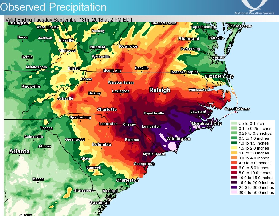
It's a far cry from conditions five years ago on this date. In 2018, Hurricane Florence slowly slogged ashore near Wilmington, bringing wind and record rainfall for much of the southern region. In spots across Bladen, Robeson and Columbus counties, rain was measured by the foot, rather than inches. The flooding devastated areas still recovering from Hurricane Matthew a couple of years earlier. The one-day rainfall record for North Carolina, 35.9 inches, was recorded just northwest of Elizabethtown in Bladen County.
Forty-two people died in North Carolina, with damage totaling more than $16 billion.
This weekend
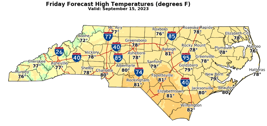
This weekend will be far more pleasant. As high pressure builds down from Canada, sunshine and temperatures in the low to mid-80s will settle over the Cape Fear region. A northerly flow from the west side of Hurricane Lee will enhance northerly winds, as well.
Highs Friday will settle at about 80 on Friday, with dew points dropping into the upper 40s. Prep football kickoffs will be near perfect: kickoff temperatures of about 72 degrees, de points in the low 50s and a light northerly breeze. Overnight lows will run about 58 in Fayetteville, cooler to the north and west.
Saturday will be sunny and mild with a high of about 85 in Fayetteville and a low near 62. Sunday may be a couple of degrees warmer as the high pressure modifies, but dew points will remain pleasant.
Next week
There's a chance of showers as a low-pressure system west of the Appalachians drops south and kicks up some Gulf moisture. That system could influence our weather next week, depending on its track. Otherwise, the beginning of fall looks sunny and seasonal.
In the tropics
Hurricane Lee continues to slide north well off the coast. Dangerous surf and rip currents will linger along the coast. Another Cape Verde system is likely to become Tropical Storm Nigel over the weekend and will bear watching as it trudges to the west-northwest.
Enjoy the weekend!
Got a weather question? Chick Jacobs can be reached at ncweatherhound@gmail.com or on NCWeatherhound X/Twitter.
This article originally appeared on The Fayetteville Observer: Fall weather coming to Fayetteville, NC

