Weather Permitting: Fayetteville area could see more snow this weekend
Let's have a quick show of hands: When it was 81 degrees on New Year's Day, how many folks really thought Fayetteville would see four inches of snow a few weeks later?
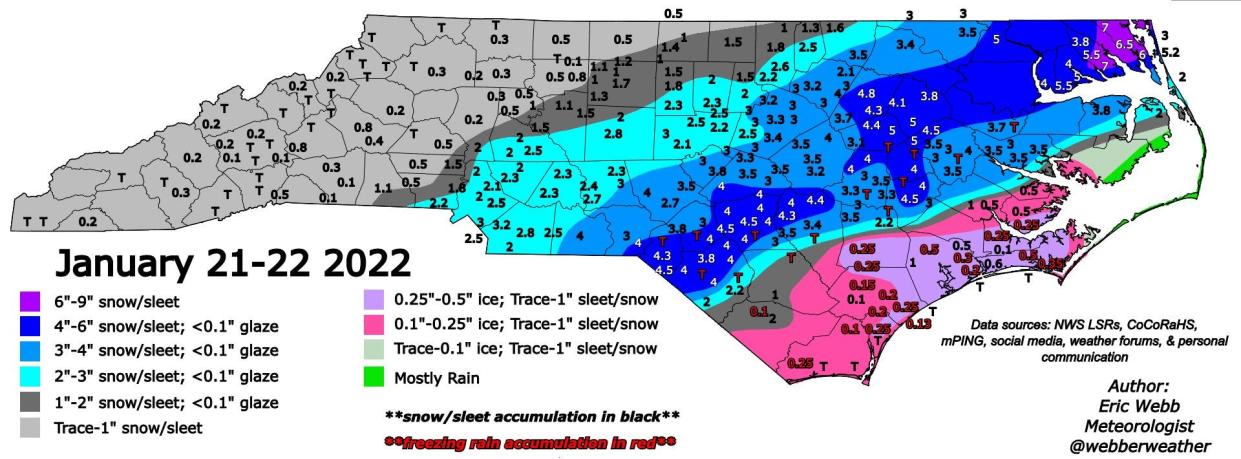
January has been unpredictable, if anything. After record-breaking warmth, Fayetteville has seen enough moisture so far this month to head off a developing drought, capped by the heaviest January snowstorm in four years.
What can we do for an encore? How about the potential for yet another weekend system?
More: Cumberland County sees nearly 5 inches of snow in some areas Saturday
Related: How do you make snow ice cream? Is it safe to eat? A guide to a frozen treat on a cold day
That's what's looming, if modeling verifies. It's a pretty sure bet the region will see more precipitation this weekend ... the question remains, just what kind?
Let's take a look.
Here's the setup
After a cold, snowy weekend, the Cape Fear region returns to late-January norms with temperatures climbing into the low 50s on Tuesday. That should take care of any remaining snow, though lows near freezing may continue to create icy refreezing issues early in the morning.
A dry cold front will push through later Tuesday, driving temperatures back below normal. Wednesday's highs will likely stall in the low 40s, with a low in Fayetteville of about 20. Factor in a north wind and wind chills Thursday morning will be in the low teens. Highs Thursday will barely crack 40 in most of the region.
The weekend
Plenty of uncertainty as a strong trough digs into the South from the Midwest. As it approaches, modeling projects that it will develop low pressure off the Carolinas. Depending on strength and location, this low could spin moisture back over the Carolinas.
A couple of notes: first, there's no consensus yet where this low might form. Too close and we all get cold rain. Too far offshore and what little precipitation that falls may be to our east.
Also: the cold over the region won't be as entrenched as last weekend. So warm nose snow-eating could break the hearts of winter weather fans.
But, if things set up right, this type of system produces some of the most impressive snow events for the Sandhills. It's a delicate dance, with many stumbles possible. Stay tuned!
Got a weather question? Chick Jacobs can be reached at ncweatherhound@gmail.com or NCWeatherhound on Twitter.
This article originally appeared on The Fayetteville Observer: Fayetteville, NC weather: Snow possible this weekend

