Weather Permitting: Prepare for plenty of rain in Fayetteville this weekend
The weather this week across the Cape Fear region has been delightful for late May.
This weekend, we pay the piper.
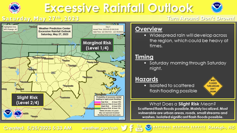
A sprawling, soggy low-pressure system will slog ashore in the Carolinas, making a mess of Memorial Day weekend plans. Saturday will be especially soggy, with the Storm Prediction Center putting the region at a slight risk for excessive rainfall and gusty wind.
Here's the setup
We'll have a weak cold front slide through the Cape Fear region today, but you likely won't notice. Things will remain coolish for late May, with a high in Fayetteville of about 78. A brisk northeast wind will continue into Friday, with low temperatures in the upper 50s for the region.
On Friday the Cape Fear region will be stuck between two wind gradients: One well to the north, the other an offshore low near Florida. Between the two, a strong northeast fetch will develop, with clouds and a possible light shower or two to the east. Highs Friday will probably stall in the low 70s, and wind gusts up to 30 mph are possible.
By Friday evening, things get interesting. A cutoff low should develop to the west as the offshore low moves north. Depending on timing and strength, the cutoff low should draw the deepening offshore low toward the coast overnight. Currently, the expectation is for the low to come ashore in the Carolinas on Saturday, with a plume of moisture preceding it.
That sets the stage for a cool, raw, soggy Saturday. No matter where the low comes ashore (current projections range from Beaufort, South Carolina, to the Emerald Coast) there will be plenty of rain for the region. We're not talking about any potential for tropical activity, just what would, in the winter, be considered a nor'easter.
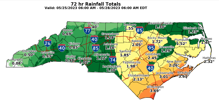
Temperatures across the region may well hold in the mid-60s, with a northeast wind gusting up to 40 mph in the afternoon. Total rainfall will depend on where the low arrives and how slowly it crawls across the Carolinas, but more than 2 inches of total rainfall isn't out of the question.
Saturday and Sunday have the potential of being surprisingly chilly, especially for areas just north of us. As the clouds and northeast wind persist a cold air-damming (CAD) scenario will set up into the Piedmont. Fayetteville is projected to see a high in the low 70s, but don't be surprised if we don't bust several degrees cooler if the CAD persists. Light rain remains possible well into Sunday afternoon as well.
Memorial Day should see the wind and clouds ease as low pressure finally moves away. Highs in Fayetteville should return to the upper 70s, if clouds cooperate.
Down the road
The end of May and early June look a bit more pleasant. The region will return to the mid-80s by mid-week, and there's a chance Fayetteville will see 90 degrees by week's end.
It's a brief change, however. Early June should see a return of cooler Canadian air over the Carolinas, holding off summer's heat for a bit longer.
Keep an umbrella handy and have a great weekend!
Got a weather question? Chick Jacobs can be reached at ncweatherhound@gmail.com or NCWeatherhound on Twitter.
This article originally appeared on The Fayetteville Observer: Fayetteville, NC weather forecast: Plenty of rain on the horizon

