Weather Permitting: Snow, but not as much as last weekend, expected in Fayetteville area
Another swath of snow is coming to the Cape Fear region this weekend.
It won't be nearly as impressive as last weekend's event, but in Fayetteville, any snow is news. And this time, there's no ice involved — at least until everything refreezes Sunday morning.
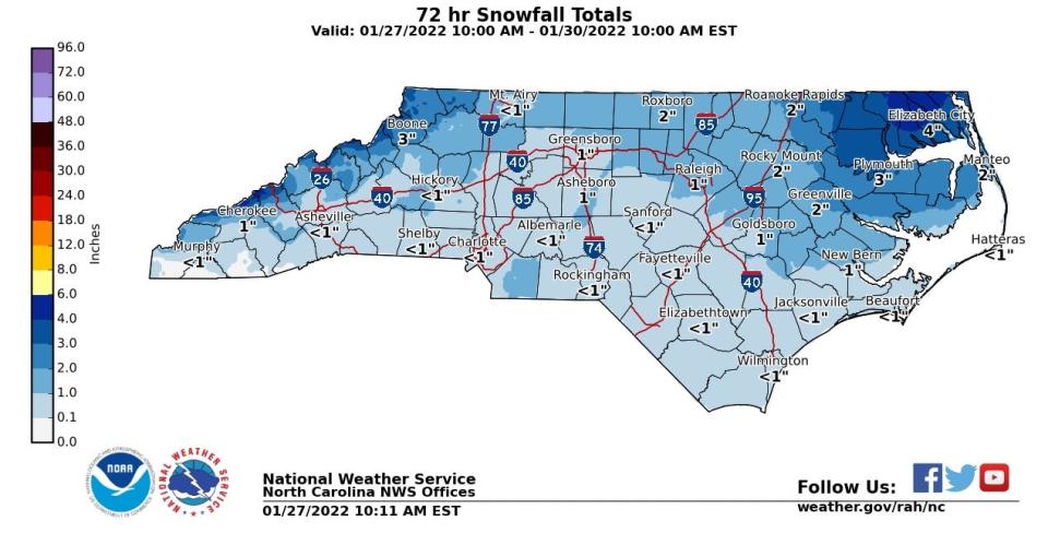
The snow is the result of a potent upper level low well to our northwest. As it passes it will use meager amounts of moisture to crank out as much as a couple of inches of snow in the north and western region. Fayetteville will see less, unless there's a last-minute change in direction or moisture content.
Here's the setup: After a chilly Thursday, temperatures will moderate a bit Friday. Look for highs of about 50 in Fayetteville, with increasing clouds during the day. A weak low pressure system well offshore will provide moisture, leading to light rain Friday night.
This is where this event and last week's differ. Temperatures over the Cape Fear region were a good 15 degrees colder last week, so this early rainfall was nearly all snow. This time, cold air won't arrive until early Saturday, by which time most of the moisture will have moved on.
That leaves the region with a chance of flurries into early Saturday as a second low passes to the north. There's a chance it will produce snow bands, especially to the west. However, we've seen this show before. These systems generally provide a quick feast of snow in the Piedmont and Foothills, with table scraps for our neck of the woods.
Highs Saturday will stay below 40, then crash into the low to mid-20s. Sunday morning will see considerable re-freezing on walkways and roads before noon. Highs Sunday will nudge into the low 40s, then back into the 20s overnight to re-re-freeze any lingering moisture.
Down the road: After three weekends of wintry weather, the Cape Fear region gets a reprieve next week. The southern ridge returns, pushing temperatures above early February averages. Look for Fayetteville to top 50 Monday, 55 on Tuesday and hit the low to mid-60s by Wednesday.
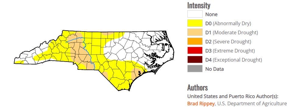
Drought update: The wintry weather this month has been a boon to easing drought conditions in the region. The Cape Fear region has picked up widespread 4-to-5 inches of precipitation, with a bit more coming this weekend.
As a result, Fayetteville has improved from a Level 2 drought to "abnormally dry." With the potential for more in February, frozen or just cold rain, things appear to be much improved.
Got a weather question? Chick Jacobs can be reached at ncweatherhound@gmail.com or NCWeatherhound on Twitter.
This article originally appeared on The Fayetteville Observer: Weather Permitting: Snow expected in Fayetteville area

