Weather service says Friday storms spawned two tornadoes in Vanderburgh County
EVANSVILLE − The National Weather Service says last Friday's severe storms spawned a pair of tornadoes that caused damage in Vanderburgh County.
A third tornado was confirmed in Spencer County, Indiana. In Western Kentucky, officials suspect a tornado touched down near Smith Mills in Henderson County, and two others formed in Union County.
The storms happened in a 12-hour window of severe weather that included everything from torrential rain to damaging wind gusts in the Tri-State. Several tornado warnings were issued during the lunch hour for Vanderburgh, Posey, Gibson, Henderson, Union and Warrick counties as the final line of storms moved through.
A National Weather Service storm survey team inspected damage in Vanderburgh County on Tuesday and found evidence of two tornadoes:
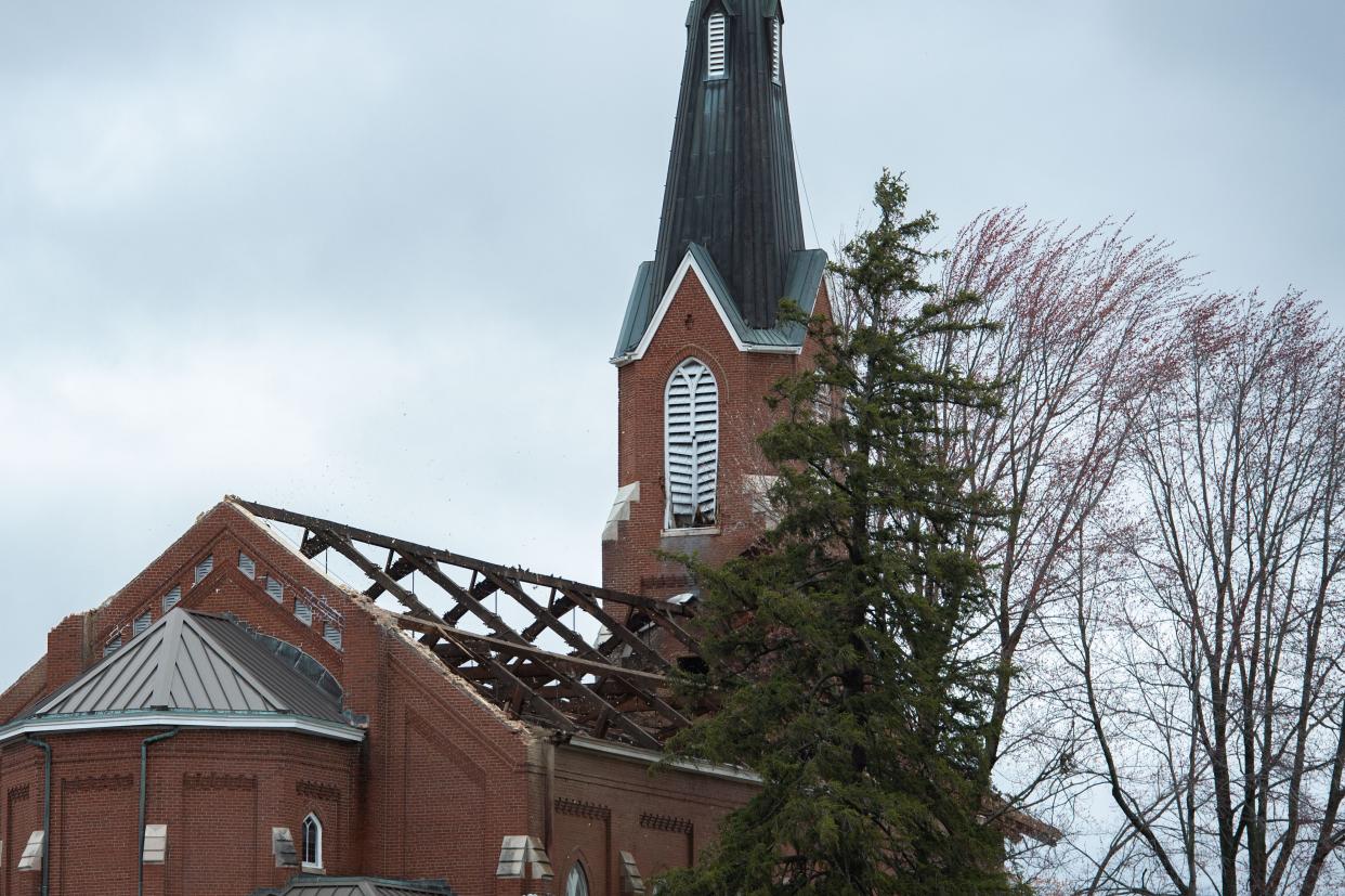
An EF-1 tornado (winds of 86-110 mph) in the St. Joseph area of northwestern Vanderburgh County.
An EF-0 tornado (winds of 65-85 mph) northwest of Darmstadt in northern Vanderburgh County.
The EF-1 tornado tore the roof off the St. Joseph Catholic Church near the intersection of St. Wendel and St. Joseph roads. Weather service officials said that tornado had peak winds of 100 mph, was 100 yards wide at its largest, and was on the ground for 2.4 miles and two minutes.
The weather service report noted people were inside the church.
"A gathering of people inside the church for a funeral received warning of the tornado and safely sheltered in the church’s basement as the tornado passed," the report states.
The tornado near Darmstadt, rated EF-0, was weaker and smaller. Its peak winds were likely 80 mph, it was on the ground for 1.9 miles and was 50 yards wide at its largest point. It, too, was on the ground for two minutes.
The weather service noted the Darmstadt tornado "produced several downed large tree limbs and minor roof and fascia damage to a few homes along Darmstadt Road and Old Princeton Road."
The tornado in Spencer County, Indiana, was an EF-1 twister with peak winds of 95 mph. It was 100 yards wide at its largest point and was on the ground for five minutes and 5.6 miles from just southeast of Dale to just west of Ferdinand.
The weather service has not yet posted information on the three tornadoes in Henderson and Union counties in Kentucky,
The low-pressure area associated with the storm was unusually powerful. The National Weather Service office in Paducah, Kentucky, recorded a pressure of 980.2 mb around 10:15 a.m. Friday, the lowest it's ever recorded at the site. It was even lower in Evansville, where the weather service recorded a pressure reading of 976 mb. That level of pressure is what meteorologists typically see in a Category 2 hurricane. The previous record low pressure for the city, 979.7 mb, was set in February 1926.
The weather service reported 3.73 inches of rain from the storm at Evansville Regional Airport.
This article was updated at 10 a.m. on March 8, 2023, to correct the wind-speed levels for EF-0 and EF-1 tornadoes.
This article originally appeared on Evansville Courier & Press: Tornadoes damaged St. Joseph Catholic Church near Evansville, Indiana

