A wedge of Arctic air will flood over North America next week
A big pattern change will bring on the chill across much of North America heading into the middle of November.
We’re used to seeing unusually cold temperatures cover one half of the country or the other, but a stopped-up atmospheric pattern will send Arctic air plunging southward over just about everyone in Canada and the U.S. next week.
MUST SEE: ‘Coinciding crises’ increase the urgency for action on climate health impacts
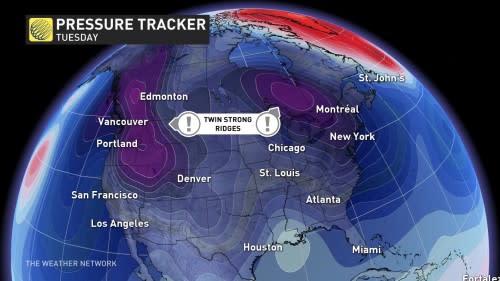
A change in patterns this weekend will allow us to greet the new workweek with two ridges of high pressure on either side of Canada. This upper-level traffic jam will force a broad trough to swoop south over Canada, dipping deep into the United States.
Unusually cold weather will follow this trough across most of North America, allowing just about everyone from the West Coast to the eastern seaboard to see below-seasonal temperatures next week.
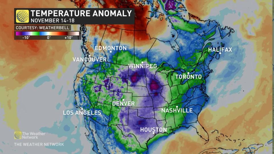
Temperatures will come in below normal for just about everyone across Canada at some point next week, with temperatures falling 2°C below normal in Vancouver, 5°C below normal in Winnipeg, and a slight one-degree off of seasonal back east in Halifax.
DON’T MISS: Here's how to protect your joints while exercising outdoors this winter
But it won’t stop at the border.
It’ll be even chillier down in the United States, where Las Vegas could see temperatures coming in 8°C below normal for the middle of November. Even Dallas is going to get in on the chill, where a daytime high of 8°C would fall 11 degrees below seasonal for this time of the year.
This widespread spate of colder-than-normal temperatures could stick around for a while, too, stretching well beyond next week as the upper-level pattern struggles to right itself again.
Stay tuned to The Weather Network for the latest on conditions across the country.

