Week ends with significant snowfall, treacherous travel in Quebec
All eyes are on a significant late week storm, which threatens widespread impacts over Quebec on Friday. Special weather statements are already in effect, warning of heavy snowfall and difficult travel conditions. Drivers are already being urged to consider modifying or postponing non-essential travel plans.
"As temperatures will be near the freezing mark, heavy and sticky snow is expected," says Environment and Climate Change Canada (ECCC) in the statement for Montreal.
DON'T MISS: Blizzard, twisters likely as 3,000 km-long storm eyes Canada, U.S.
A strong low-pressure system will spread snow over southern Quebec on Friday morning, moving east through central sections of the province later in the day.
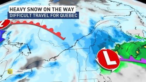
There is a lot uncertainty still in exactly how much snow will accumulate because of the track and development of a secondary low stateside. Temperatures are also close to the freezing mark, so the snow may be wet and may not all accumulate.
Regardless, the snow is expected to fall quickly, making for hazardous travel conditions.
"If you plan to travel or keep up your travel plans, plan more time and be extra cautious," warns ECCC.
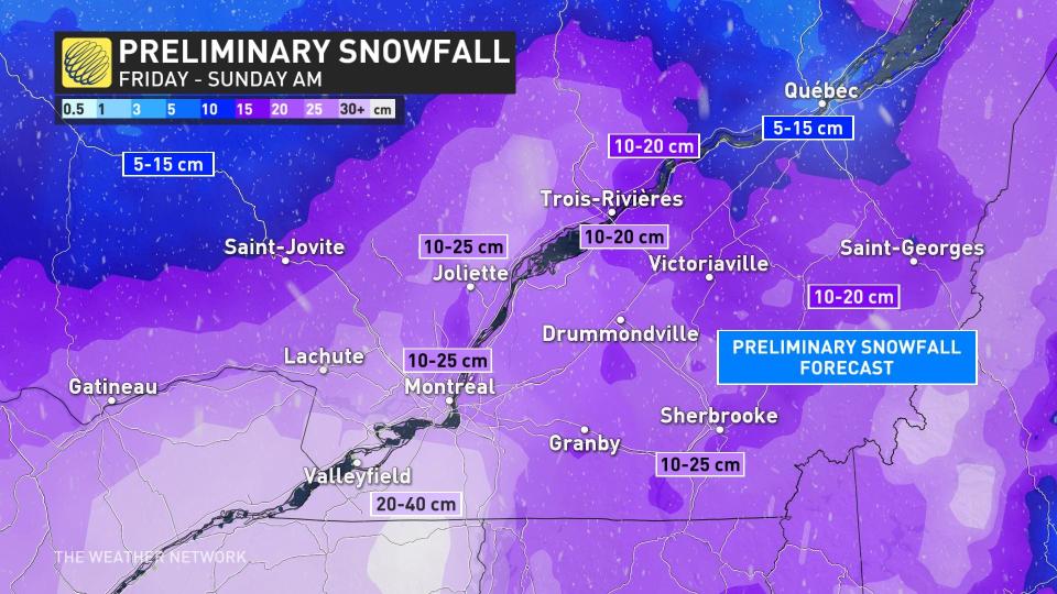
Currently, in and around the Metro Montreal area, there is the potential for 10-25 cm of snow along with the Eastern Townships. There are lesser amounts forecast towards Quebec City with 5-15 cm possible there.
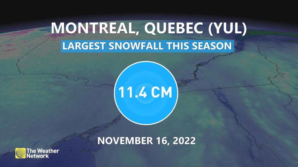
This will likely be the biggest snowfall of the season so far for communities like Montreal. Prior to this storm, 11.4 cm of snow had fallen in the city back on November 16.
Check back for the latest on the forecast across Quebec.

