Late-week storm to end California's dry stretch, bring travel-disrupting rain & snow


- Oops!Something went wrong.Please try again later.
The quiet weather that Californians enjoyed over the Christmas holiday has come to an end during the run-up to New Year's festivities this weekend, as a storm packed with moisture comes ashore, say AccuWeather meteorologists.
The storm is expected to bring a period of travel-disrupting rain to the coast and lower elevations, which can impact holiday season travel by air and car, including around the Los Angeles and San Francisco Bay areas. The wet weather also means snow for some higher elevations and caps what has been an exceptionally wet year in the Golden State.
"This storm will bring in colder air compared to recent ones," said AccuWeather Senior Meteorologist Heather Zehr. "This will cause snow levels to go down in the Sierra Nevada mountain range."
 |
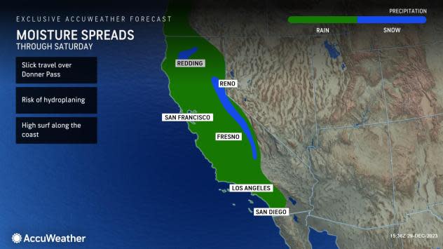
The last week of 2023 will end on an active note through Saturday, as moisture from the storm moves through California. The first raindrops arrived Thursday night in the northwestern corner of the state and will continue spreading farther south and inland into Saturday morning.
Because the center of the storm will head into southwestern Canada, the system will not hit with the strength of recent storms, sparing the West Coast of strong winds and heavy precipitation. Despite that, AccuWeather meteorologists are still forecasting some locally heavy rain and snow while large waves will pound the coast.
"A band of locally heavy rain lasting for several hours in any one spot will press inland to end the week and start the weekend," said Zehr. "Rainfall totals will be somewhat limited by the short time frame the precipitation can fall but can still be noteworthy."
Rainfall will tally at least an inch from California's Central Coast region north through the Bay Area, the Sacramento Valley and much of the northwestern part of the state. The heaviest amounts, as much as 2 or 3 inches, can occur in a few spots along the coast north of San Francisco; it is here where the concern for localized flooding on roads and smaller streams is greatest.
 |
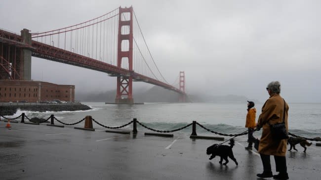
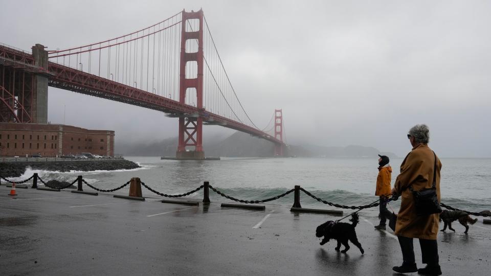
People walk their dogs during a break between rain showers near the Golden Gate Bridge and Fort Point in San Francisco, Tuesday, Dec. 19, 2023. (AP Photo/Eric Risberg) |
Because most of the energy from the storm will be moving north, rainfall amounts farther south and inland will taper significantly. For Los Angeles and much of the L.A. Basin from Friday night into Saturday, rainfall will total less than half of an inch while San Diego will record even less, perhaps just a few hundredths of an inch. Despite the forecast for light rain, any precipitation can slow travel and increase the risk of hydroplaning.
The stormy pattern will also lead to rounds of heavy surf along California's southern and central coastline through Sunday. AccuWeather meteorologists urge people spending time near the beach to use extra caution for sneaker waves and overwash that can create dangerous conditions. Large waves roared ashore on Thursday, injuring several people and triggering flooding.
Farther inland over the state's southeastern deserts and the rest of the Great Basin region, including Las Vegas, nary a raindrop is expected.
In California's mountain ranges, especially the Sierra Nevada, the precipitation will primarily fall as snow on Saturday. While heavy snow is not anticipated, amounts up to a foot are possible along the Sierra crest above 6,500 feet. Several inches of snow can still accumulate for slightly lower elevations where people live and drive, including along Interstate 80's Donner Pass.
 |
"Snow amounts at pass level will be much less, at just a few inches," added Zehr. "However, there will still be enough snow to create slippery travel conditions.
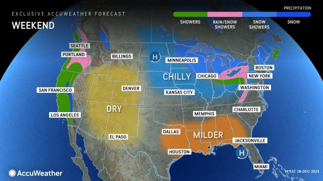
A weaker storm could also impact the state to close out 2023 from Sunday into Monday, but its fate is less certain than the storm moving in late this week.
"A compact storm tracking across the Pacific seems likely to take a track much farther south for the end of the year," said Zehr. "This storm has a chance to bring rain around the Bay Area on Sunday night, including for New Year's celebrations, while any rain around L.A. would hold off until after midnight."
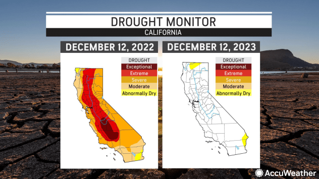
Regardless of how much rain falls into the weekend, the year will go down as a wet one for the Golden State. This is mostly due to several atmospheric river events, when multiple storms packed with moisture moved ashore from the Pacific. Beginning in late 2022, these events completely eliminated multiyear drought conditions in California, refilled reservoirs and blanketed the mountains with feet of snow.
 |
In Downtown Los Angeles, 2023 packed roughly double the amount of rain typically received in a year. As of Dec. 29, 28.71 inches of rain has fallen versus the year-to-date historical average of 14.02 inches. Most of the rest of the state has recorded precipitation amounts at 120 to 150 percent of average.
However, the wet season that will extend into next year has gotten off to a slower start. From Oct. 1, the start of the wet season, through Thursday, San Francisco and L.A. are below the historical average for rainfall, at 63 and 70 percent of average, respectively.
 |
In the Sierra, the snowpack is well below the historical average because the storms so far this season haven't packed much snow or have come in with warmer air. For the entire range, the amount of snow currently on the ground is less than one-third of what is typical for late December.
Fortunately, for government, agricultural and recreational interests that rely on the rain and snow, the forecast for El Niño conditions to persist through the rest of the winter and into the spring means that chances are good that additional, moisture-packed storms will move ashore in the coming months.
Want next-level safety, ad-free? Unlock advanced, hyperlocal severe weather alerts when you subscribe to Premium+ on the AccuWeather app. AccuWeather Alerts™ are prompted by our expert meteorologists who monitor and analyze dangerous weather risks 24/7 to keep you and your family safer.
