What were those bubble-like clouds over Wayne & Holmes counties? Mammatus explained
This story has been updated with new information.
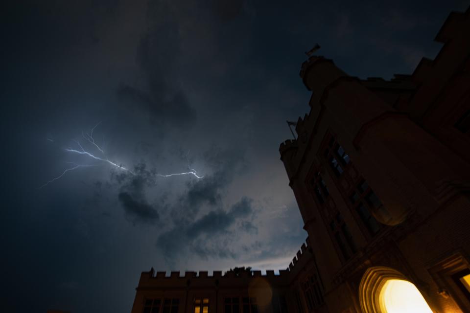
Another round of storms battered some Ohio communities Wednesday evening with heavy but brief rainfalls, 60 mph gusts and a confirmed tornado while producing picturesque bubble-like clouds at sunset.
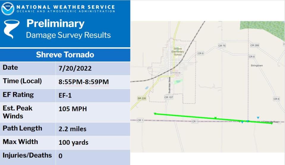
Straight-line winds coupled with an EF1 tornado felled trees and some power lines with winds at 105 mph south of Shreve along the Wayne County and Holmes County border for 2.2 miles, the National Weather Service said in a preliminary report.
More precise wind speeds and specific touchdown location and path will be confirmed in the final report, according to an NWS spokesperson.
May storms: Outside help is welcomed to help with storm cleanup.
Cooperative crews and those from AEP and FirstEnergy worked overnight and early Thursday morning to restore power.
Nearly two dozen customers were without electricity as of Friday morning across Wayne and Holmes counties, according to the cooperative, AEP and FirstEnergy.
Centerville Road was closed Thursday in both Wayne and Holmes counties while utility companies made repairs, said Brock Yoder, a supervisor with the Wayne County Engineer's Office.
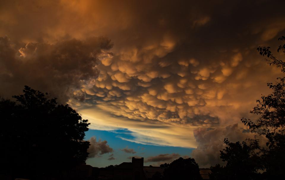
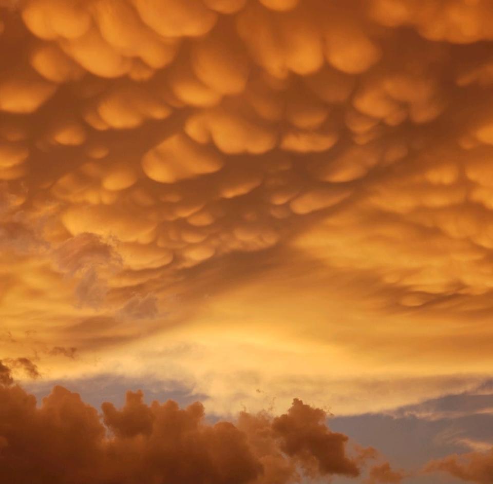
Bubble-like clouds
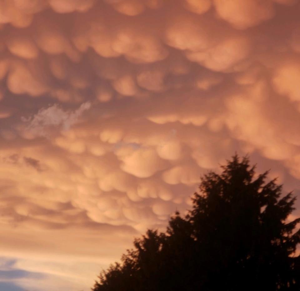
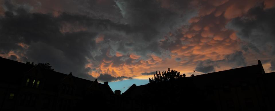
Rolling clouds filled the sky like an upside-down bubble bath burnt orange from the setting sun.
But what were these clouds?
The technical term is mammatus, which is derived from Latin for udder or breast, according to Merriam-Webster Dictionary.
Price of gas: Ohio Gas prices could fall further, providing some relief for strained budgets
Described as the "drooping underside ... of a cumulonimbus cloud," according to weather.gov, pouches hung from the bottom of clouds providing an unusual sky that inspired some people to take pictures and share them on social media.
"Mammatus most often are seen hanging from the anvil of a severe thunderstorm, but do not produce severe weather," the website notes. They can also form with other cloud types and without severe weather.
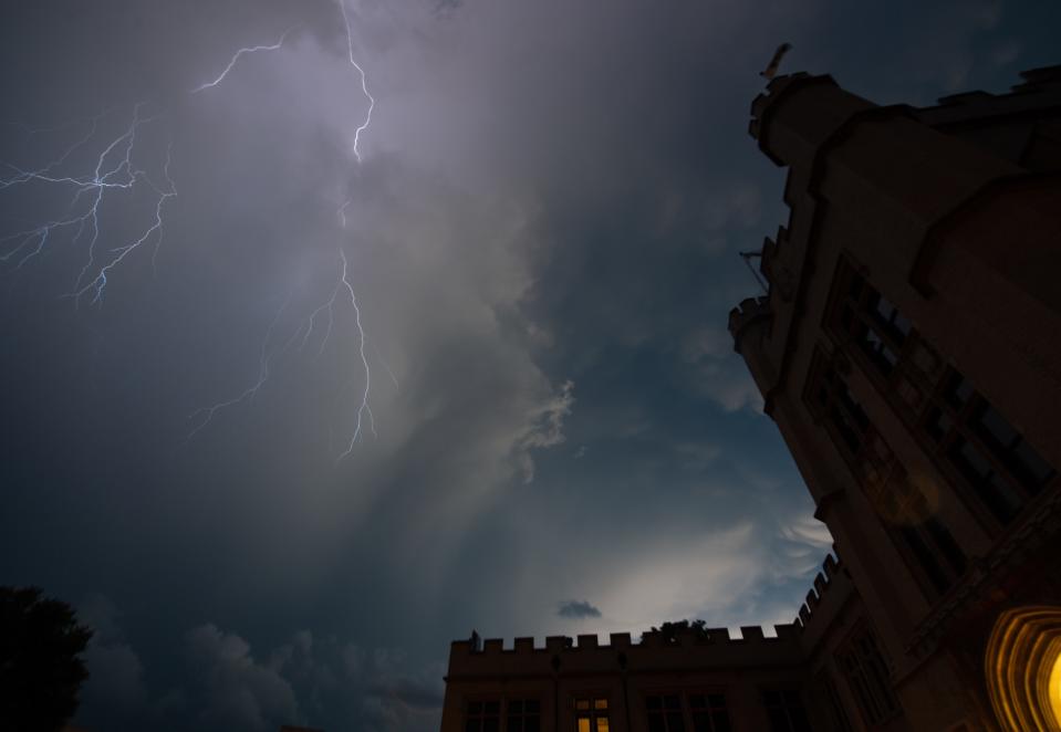
These clouds can bring hail, rain and lightning as was seen in Wayne and Holmes counties.
A tornado warning had been issued for the area just before 9 p.m. and expired by 9:30 p.m.
Reach Bryce by email at bbuyakie@gannett.com
On Twitter: @Bryce_Buyakie
This article originally appeared on The Daily Record: Mammatus clouds spotted in Wayne and Holmes counties during storms

