Western U.S. heat wave brings smoke, fire danger to South Dakota: 'Pretty crispy, dry'
The smoky sunsets that have dusked South Dakota this past week might be beautiful, but they portend a fire risk at home and across the western U.S.
The National Oceanic and Atmospheric Administration issued a Red Flag Warning for a large portion of South Dakota on Thursday due to an eastbound cold front that's bringing hot and windy conditions to the region.
The Fire Weather Watch for areas along the James River Valley have been upgraded to a Red Flag Warning, in effect today from 11 am to 8 pm CDT. pic.twitter.com/59mzIozG4E
— NWS Sioux Falls (@NWSSiouxFalls) September 8, 2022
"Right now, we have a Red Flag Warning for the James River Valley. That would be from Mitchell, to the Missouri River, to Yankton and southwest South Dakota as well," Peter Rogers, Warning Coordination Meteorologist with the National Weather Service, said.
Darren Clabo, state fire meteorologist with South Dakota Mines in Rapid City, pointed out the state's rural areas are at increased fire risk due to the excessive temperatures.
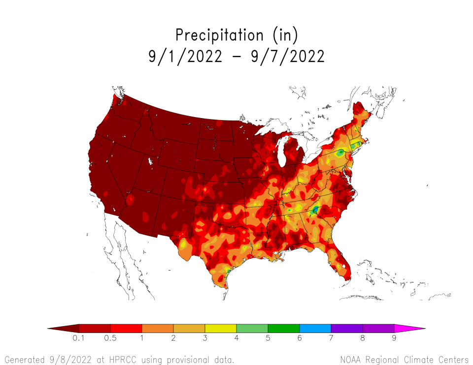
Of note, Clabo added the state saw little precipitation over the past seven days. The lack of rainfall and the ongoing drought resulted in cured or curing fields across South Dakota.
"We're getting to that point where our fields are pretty crispy, dry. They're going to be very, very receptive to ignitions," Clabo said in a fire weather situation report Wednesday. He said the energy release component – a metric used to measure the moisture of fuels and fire danger – of the fuels is "above the 97 percentile and nearing records."
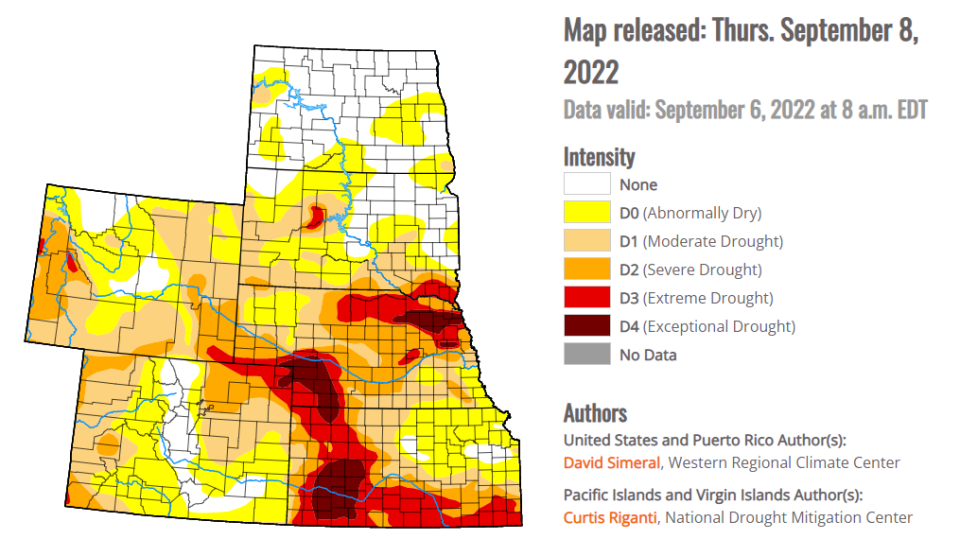
Drought conditions have gotten worse since Aug. 30
The latest U.S. Drought Monitor map shows conditions intensified across the High Plains since Aug. 30, particularly in southeast South Dakota and northeast Nebraska, where drought measurements were upgraded from "severe" to "exceptional."
As of Sept. 6, over 60 active fires in the West and Pacific Northwest have burned nearly half a million acres of land, according to the National Interagency Fire Center. The smoke from these fires, along with the heat dome, has reached the Black Hills, Pennington County Fire Administrator Jerome Harvey said.
"It was a high 90s here [Wednesday] and a lot of smoke from the fires in the intermountain west," Harvey said. He added the dryness allowed a 20-acre fire to spark southeast of Wall, South Dakota on Wednesday – close to the same spot where the 2016 Cottonwood Fire sparked and burned over 41,000 acres.
Looks like a wildfire in northeastern SD near the ND border. It's the "bright" pixel in this infrared satellite imagery. #sdfire pic.twitter.com/sPY8J0q96x
— Darren Clabo (@SDFireWeather) September 7, 2022
Great Plains Fire Information, an interagency fire group operated by public information officers, also noted a smaller fire originated east of Ardmore, Nebraska that same day.
However, Clabo said the wildfire smoke is providing a buffer for the heat and keeping temperatures lower than what traditional weather forecast models may indicate.
The fire meteorologist also said cooling temperatures and the possibility of rain between Friday and Saturday will likely decrease the fire risk in South Dakota's eastern counties.
Dominik Dausch is the agriculture and environment reporter for the Argus Leader and editor of Farm Forum. Follow him on Twitter and Facebook @DomDNP and send news tips to ddausch@gannett.com.
This article originally appeared on Sioux Falls Argus Leader: Eastward cold front bring fire danger to rural South Dakota

