More storms possible tonight after stormy afternoon
AUSTIN (KXAN) — A Severe Thunderstorm Watch continues for parts of the Hill Country until 11 p.m. for a few more strong storms possible later tonight. A severe thunderstorm with a history of producing 80 mph was moving rapidly across Mason County before 9 p.m. Hail golf ball size and larger was reported in Mason. The storm weakened slightly as it moved into western Llano County.
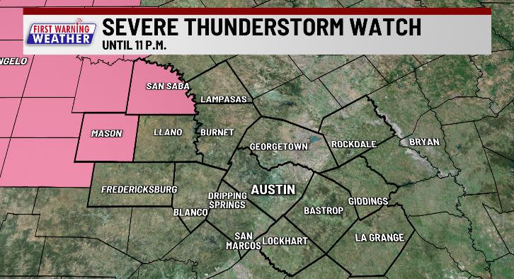
The majority of us have seen the strongest of the storms already move through but a few more storms could develop late tonight.
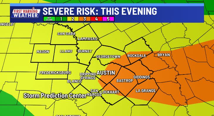
There will also be a risk for localized flooding, mainly in our northern and eastern counties, due to brief heavy downpours. Many areas received 1-2 inches of rain or more, with much of that falling in about an hour Thursday afternoon.
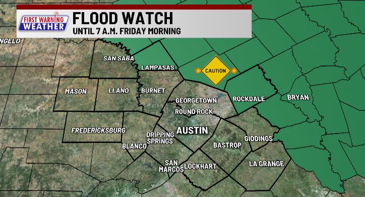
A few spotty showers/storms may linger on Friday but should be confined to counties east of the Austin-metro area. Most of us should stay dry Friday and through the weekend when afternoon highs return to the 90s.
The heat takes center stage this weekend into early next week.
NEW BLOG: May forecast: Will our rainiest month live up to it?
BLOG: Here’s when El Niño ends and La Niña begins
BLOG: La Niña Watch Issued: Here’s the impact on Central Texas
FIRST WARNING WEATHER: Stay up to date with your Central Texas forecast, sign up for our weather newsletter at kxan.com/newsletters
Stay up-to-date with the First Warning Weather team
Follow the KXAN First Warning Weather team on Facebook, Twitter and Instagram.
You can also follow our meteorologists’ individual accounts for livestreams and a little bit of what goes on behind the scenes:
Copyright 2024 Nexstar Media, Inc. All rights reserved. This material may not be published, broadcast, rewritten, or redistributed.
For the latest news, weather, sports, and streaming video, head to KXAN Austin.

