What's next for Lisa after it emerges in the Gulf of Mexico?
Hurricane Lisa made landfall in Central America late Wednesday afternoon, raising the risk for flash flooding and wind damage across several countries. But after it moves over land, there are multiple scenarios for where and how the storm could finally dissipate.
After it made landfall along the Belize coastline as a Category 1 hurricane on Wednesday, Lisa will continue to move across southern Mexico and northern Guatemala on Thursday and unleash a swath of heavy rain and gusty winds along its path.
 |
Now that the storm is inland, "Lisa is expected to quickly lose wind intensity and transition into a tropical rainstorm," AccuWeather Senior Meteorologist Adam Douty said.
This transition to a tropical rainstorm is forecast to happen as early as Thursday afternoon as Lisa is cut off from its energy supply from the warm Caribbean waters and encounters the terrain of Central America. While the current forecast track of Lisa has the cyclone skirting by some of the highest terrain of southern Mexico on Thursday as it takes a turn to the northwest, a slower turn could do some real damage to the system.
If Lisa's anticipated brisk pace and quicker northwestward turn come to fruition, then it would be more likely that the system would survive long enough to reach the Gulf of Mexico. Should Lisa slow down considerably, the cyclone may dissipate over land after its circulation is disrupted by the rugged terrain.
"If Lisa can hold together enough over land, it will emerge over the southern Gulf of Mexico as a tropical rainstorm (or perhaps a tropical depression) before completely dissipating," Douty explained.
 |
The cyclone will have rather hostile atmospheric conditions to contend with if it does manage to emerge over the southern Gulf of Mexico late this week.
"Disruptive wind shear will be on the uptick in the southern Gulf late this week and this weekend that could keep Lisa's intensity at bay," AccuWeather Senior Meteorologist Alex Sosnowski said.
This wind shear will limit Lisa's ability to move northward once in the Gulf of Mexico and may even shred its circulation apart.
"If Lisa manages to remain a trackable tropical rainstorm, it might survive long enough to loop back around and head south toward Mexico," Douty said, adding that this is not the most likely scenario.
Regardless of status, any remaining moisture from Lisa can go on to produce heavy rainfall in parts of southern Mexico into the weekend.
"There can be a secondary area of heavy rain along portions of Mexico that border the southernmost section of the Bay of Campeche," Douty added.
Residents, along with those who have interests in southern Mexico, will need to monitor the progress of Lisa in the coming days.
 |
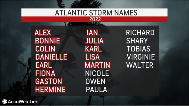
Lisa is the 12th named storm and sixth hurricane of the 2022 Atlantic hurricane season. With the development of Martin in the open Atlantic earlier this week, activity has picked up once again in the basin as the final month of hurricane season gets underway.
This is the first year that two hurricanes have simultaneously spun over the Atlantic basin at the same time in November since 2001, according to Colorado State University Meteorologist Philip Klotzbach. It's also just the third year that this has ever occurred. Two hurricanes were also observed at the same time in November 1932.
The Atlantic hurricane season officially runs from June 1 to Nov. 30.
Want next-level safety, ad-free? Unlock advanced, hyperlocal severe weather alerts when you subscribe to Premium+ on the AccuWeather app. AccuWeather Alerts™ are prompted by our expert meteorologists who monitor and analyze dangerous weather risks 24/7 to keep you and your family safer.


