What's so special about 'Quonnie' Beach? Discover its beauty in the offseason | Walking RI
WESTERLY — Quonochontaug Barrier Beach isn’t as well known as other South Country landmarks, such as Napatree Point or Misquamicut State Beach.
Like most Rhode Islanders, I’d never been there. But for years I’ve been hearing and reading intriguing stories about the Quonochontaug area, also called Quonnie.
Some people still talk about how the Hurricane of 1938 destroyed an inn and a line of shorefront houses, killing dozens of people. The cottages were never rebuilt, leaving the beach pristine.
In the 1990s, national TV exposure attracted out-of-staters to the shoreline and drove up real estate prices. TV host Regis Philbin, for example, visited and raved about Quonnie on his morning talk show. The area also was shown on the popular TV show "The X-Files," as the fictional family of one of the main characters had a summer home there.
Walking RI: 5 great hikes with ocean views
Walking RI: Hike through unique Ice Age terrain at Dr. John Champlin Glacier Park
More recently, the beach has become a flashpoint in the ongoing fight over shoreline access between local residents who say the beach walkways are private and others who argue the beach should be available to all.
After doing some research, I headed out to Quonochontaug, pronounced Kwana-Ka-Taug, for my first visit.
More: Fall bird migration is in full swing in Rhode Island. Here's the best birding spots.
Off-limits to the public in summer
As I walked out on the sand, I came to understand a bigger truth — the unspoiled, crescent-shaped beach, and the nearby inland pond and salt marsh hidden by dunes, are special places that help give Rhode Island its identity. Every resident should be able to see and share the experience, whenever they want.
'It just really blew up': Why shoreline access is emerging as a campaign issue in RI
More: Where is it legal to walk on RI beaches? You might need to tread water, scientists say
Shifting sands: Who has access to Lloyd's Beach in Little Compton?
I set out for the beach from a public parking spot diagonally across the road from the Weekapaug Yacht Club. The well-known, historic building was recently razed and is being replaced by a beautiful wooden structure that should be finished later this month.
I also noticed several green and white signs posted by local fire districts and conservation groups that govern the area. They warn that the beach access trails are private property and off-limits during the summer. Workers at the yacht club told me that a security guard is stationed there during the summer months and allows only residents and their guests with special buttons to access the beach. In the offseason, some of the walkways are open to the public.
I found a short path through the dunes on a wooden boardwalk lined with a storm fence. There were lifeguard chairs stacked on one side and a sign with rules and regulations on the other. As I was trying to figure out the sign, a young walker came by, with binoculars around his neck. I asked whether anybody could go on the beach, and he said, “It’s all about freedom, man.”
Walking RI: Hike along the Narrow River at former Girl Scout camp in North Kingstown
Walking RI: Hike the 'Big Hill' in Cumberland, where skiing was once a favorite winter pastime in RI
Walking RI: Up for a hiking challenge? Tackle this section of the North South Trail in Exeter
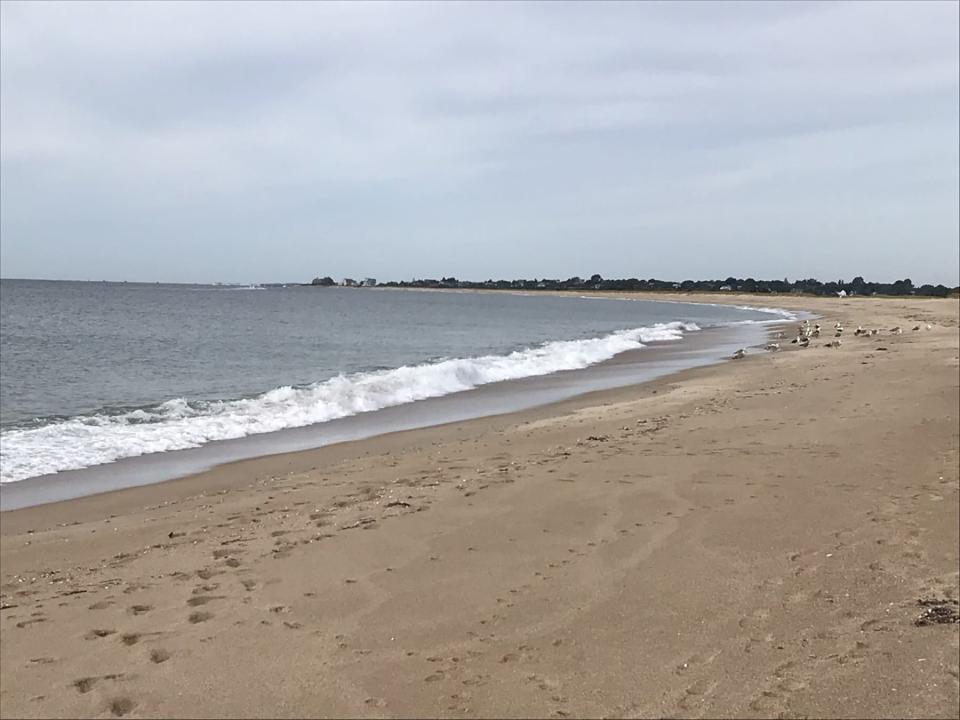
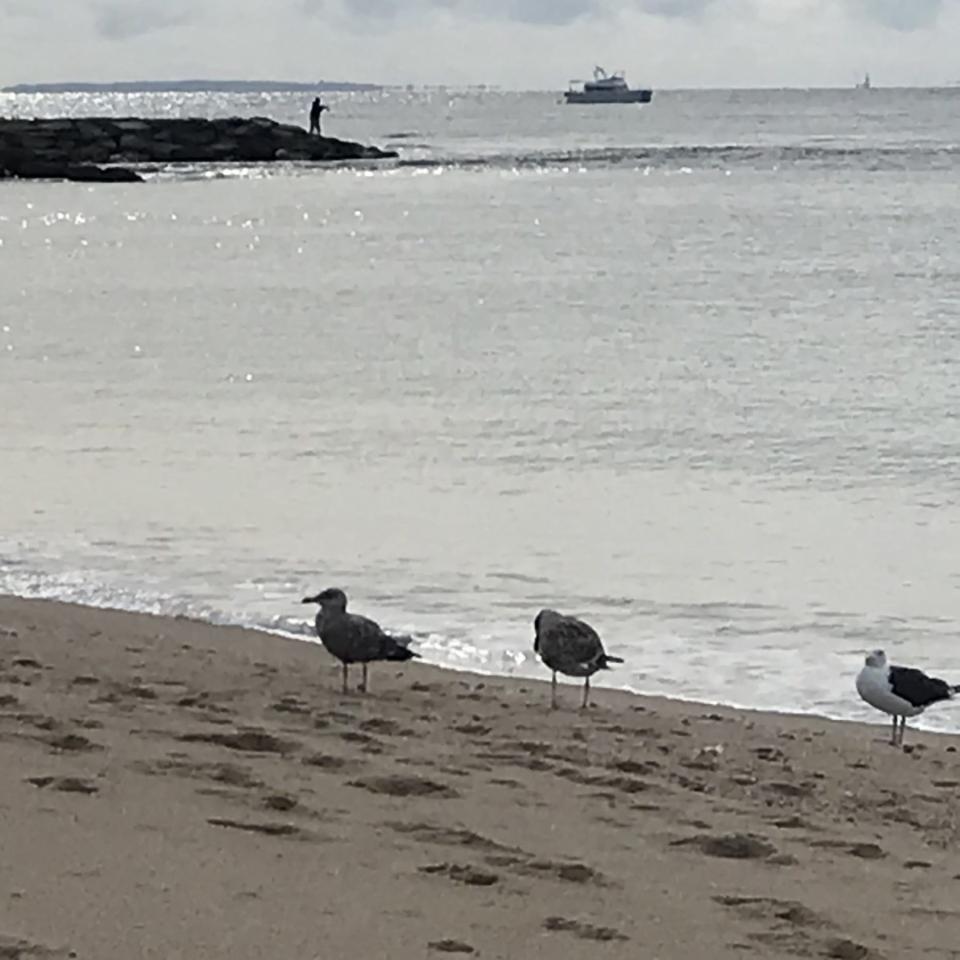
So I walked across the dune on the pathway and had my first look at Quonnie, an unbroken, 50-yard-wide strip of white sand that stretches 1.8 miles from Weekapaug Point in the west to a breachway in the east. A long sand dune rises on the left, parallel to the shoreline. The ocean’s waves crash on the beach on the right. The only soul I saw on the shore during my early-morning walk was a surf-caster with a long fishing pole who was wading in about a foot of water.
Several fishing boats cruised a few hundred yards offshore in Block Island Sound. One flat-bottomed boat nearer the beach was trailed by a flock of squawking seagulls. I also heard the drone of a single-engine airplane overhead, the blast of the horn from a ferry on the horizon and the pounding of the waves on the beach. Two sailboats slipped by silently.
Walking RI: Discover a hidden gem of forest, ponds and wetlands in Little Compton
Walking RI: Spectacular bay views and Colonial and tribal history at Mount Hope Farm
Walking RI: What's missing from Tiverton's Basket Swamp? A key tree for Native peoples
It was all quite a sight and helped me understand what had caught Philbin’s eye and also caused all the ruckus over beach access.
I began walking east at the shoreline, with a light sea breeze blowing in my face. In the clean, soft sand, I found footprints, boot prints, dog prints and bicycle tire tracks.
A dune on the left was topped with clumps of sea grass and an old, low wooden fence. Years ago, after hurricane damage, the Quonochontaug Beach Conservation Commission planted trees and other forms of vegetation to help hold the dunes in place.
Looking to the southeast, I could see the outlines of Block Island.
Halfway on my walk down the beach I crossed from Westerly into Charlestown and came across an unoccupied beach chair with a closed umbrella. I also passed a few pieces of driftwood that had washed up, spotted several horseshoe crab shells and scattered some seagulls that were standing at the water’s edge.
Walking RI: Discover why hikers and anglers love the 'wild and scenic' Beaver River
Walking RI: Want to practice some rock climbing? Head to Connors Farm in Smithfield
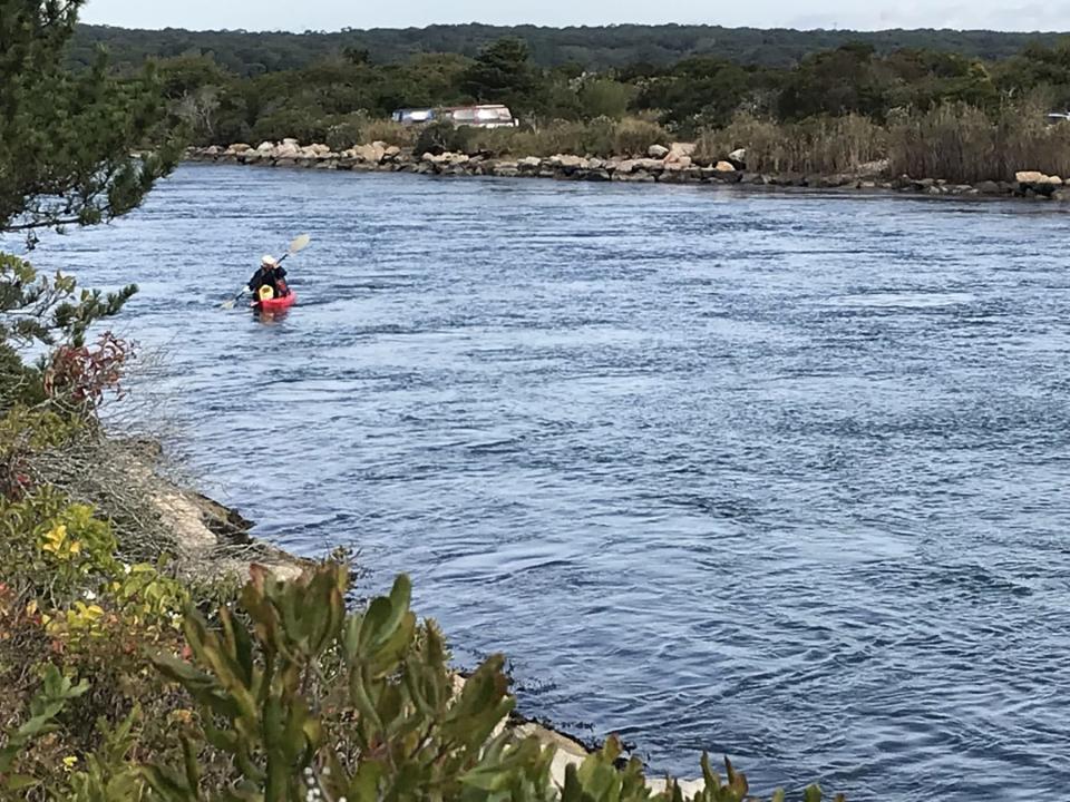
My walk took me the length of the shoreline to a wide, boulder-lined breachway. Several cormorants perched on the granite blocks. The incoming tide rushed inland through the channel between the rocks. From the tip of a jetty that jutted into the sea, a bundled-up angler cast his fishing line, hoping to hook a sea bass.
A neat line of houses is on the far side of the breachway, and I heard hammering and sawing as owners prepared the properties for winter.
As I walked north on a path along the breachway, I noted a landing across the channel where a kayaker was putting in.
Efforts to stay ahead of rising sea levels are showing promise
The tide flowed into Quonochontaug Pond, a large coastal lagoon behind the barrier beach. The pond is ringed with salt marshes that have been degraded by rising seas and climate change. A few years ago, the state and environmental partners began dumping sand dredged from the breachway on top of about 30 acres of marshland, hoping to raise the elevation above rising sea levels and protect the natural habitat. They also planted plugs of grass.
The restoration seems to be working, slowly. Plants are growing and spreading and birds and wildlife are returning.
More: One woman's amazing effort to help coastal communities defend themselves from rising seas
Walking RI: Follow in the footsteps of Trappist monks in Cumberland
Walking RI: Tillinghast Pond's trails are part of something special and well worth a visit
After studying the salt marsh, I followed a path that looped through some goldenrod, with butterflies hovering above, and then passed through low bushes and scrub pines before circling back to the beach.
I then returned to the line of dunes and walked west until I came to a pair of recreational vehicles parked behind a sign for RIMS, or Rhode Island Mobile Sportfishermen Association, which owns a strip of private land there. Just ahead, a camper sat at the top of a dune in a beach chair, sipping a cup of coffee and peering out at the ocean.
“It’s heaven,” he told me.
A few yards farther along, I passed a shack and a flat sandy area with picnic tables, which must be where more recreational vehicles park in the summer.
Walking RI: Mingle with birds, beavers, mink and more at Exeter's Fisherville Brook refuge
Walking RI: Ninigret National Wildlife Refuge harbors naval, tribal history
Along the Sand Trail, views of Quonochontaug Pond
I crossed the dune to the Sand Trail, a road that parallels the beach and offers some spectacular views north to Quonochontaug Pond. Cottages and houses line the far side of the pond, facing the ocean. The shallow salt pond is dotted with small islands and edged with coves, channels and tidal pools.
While walking down the Sand Trail, which is flanked by bushes of sea roses, two Jeeps with long fishing poles poking out the back window passed me.
From the trail, I took a spur on the right to a thin, sandy beach, where thick, white sea foam had washed up. A sign said: "Shelter Harbor Beach — Bring Sunshine — Leave Footprints."
I also noticed a stone pillar that might have once marked the entrance to a property. A forested island is just offshore but, with the incoming tide filling the salt marsh, there seemed no way to reach the island.
Walking RI: Looking for a great birdwatching spot? Try this former Navy site in North Kingstown
Walking RI: A step-by-step guide to beautiful Stepstone Falls
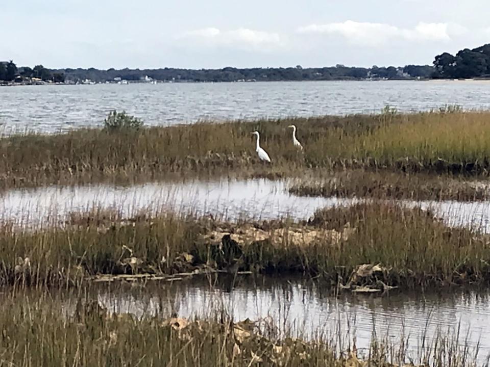
Returning to the Sand Trail, I followed some deep tire tracks in the sand for a half mile and took another side trail that led to the shore of the pond. I rested there, tired from walking through the soft sand, and watched two great egrets in the tall sea grass.
To the west, some boats bobbed in a small harbor. Beyond that stood the Weekapaug Inn, which had been relocated from the beach and rebuilt after the Hurricane of 1938.
I explored a bit and found a sign posted by the Rhode Island Department of Environmental Management that read: "Shellfish Spawner Sanctuary."
Back on the Sand Trail, the path soon became more hard-packed, with small parking areas along the side. A sign posted by the Shelter Island Fire District adjacent to a path to the beach read: "Private Beach and Beach Closed."
Walking RI: Best place for a hike and osprey spotting? Try the Great Swamp in South Kingstown
Walking RI: Retracing Thoreau's 1854 hike through Providence
The road ended at a parking area for the yacht club where I'd started. In all, I walked about 4 miles over two hours.
To me, a walk along Quonochontaug Beach ranks at the top of the list of shoreline hikes in Rhode Island.
I understand that visitors need to respect private property and that sensitive ecosystems need to be protected while crossing fragile dunes or salt marshes.
But there has to be a way to honor those precautions while also allowing people to experience some of the best of what Rhode Island has to offer.
Quonnie should be for everyone.
If you go ...
Access: Off Route 1A, take Noyes Neck Road south to the shoreline and follow the bend left along Spray Rock Road to parking spaces on the right.
Parking: Available for a few cars.
Dogs: Not allowed.
Difficulty: Easy and flat through soft sand.
John Kostrzewa, a former assistant managing editor/business at The Providence Journal, welcomes email at johnekostrzewa@gmail.com.
This article originally appeared on The Providence Journal: Hike RI's beautiful Quonochontaug Beach in the offseason

