Where are the fires burning in Northern California? Updates on evacuations in Nevada County
Evacuations remain in place for a wildfire that grew minimally overnight across portions of Tahoe National Forest in Nevada County, one of many scorching Northern California this week.
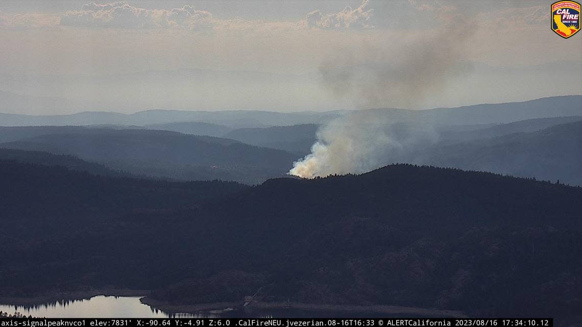
Highway Fire has burned nearly 31 acres with 5% containment, according to a Thursday update from Tahoe National Forest.
More than 300 firefighters have been assigned to the blaze, with additional personnel expected to arrive Thursday, U.S. Forest Service officials said. The forest service said in its morning update that firefighters plan to focus on perimeter and fire line reinforcement as daytime high temperatures remain in the mid-90s with northerly winds as high as 9 mph.
The grass fire ignited Wednesday afternoon near the town of Washington, close to Washington Road and south of Alpha Road close to Highway 20. The fire burned roughly 25 acres in three hours.
Nevada County sheriff’s officials on Thursday evening issued revised evacuation orders and warnings. Evacuations on Wednesday had been mandatory in three county evacuation zones: 30, 315 and 316. The zones are near the town of Washington, home to a little more than 100 residents.
Zone 30, located just north of Highway 20, remained under a mandatory evacuation order as of a 5 p.m. update from sheriff’s officials.
Zone 315 was split into two zones, 315-A and 315-B; Zone 315-A remained under evacuation orders while 315-B, a smaller pocket along Highway 20, was reduced to a warning. Zone 316, north of those two zones, was also reduced to an evacuation warning.
County evacuation zones 15 and 318, which had been in warning status from Wednesday through early Thursday afternoon, were cleared of evacuation advisories as of 5 p.m.
Nevada County fire map
Sources: Genasys Protect/Zonehaven Aware
Updated evacuation maps are available from Genasys Protect, formerly known as Zonehaven.
A temporary evacuation point is at Madelyn Helling Library at 980 Helling Way in Nevada City. The animal evacuation housing is at Nevada County Fairgrounds Gate 8 at 11228 McCourtney Road in Grass Valley.
Questions about the Highway Fire should be directed to the fire information line at 530-264-8309.
Klamath August Lightning Complex
The series of fires burning in Northern California’s far-north forestlands brought more mandatory evacuations Wednesday night.
The Siskiyou County Sheriff’s Office said it expanded evacuations orders in several areas that were under warnings for homes south of Hamburg, east of Horse Creek Road, south and north of Highway 96 and south of Forest Road 46N46. The fires are scattered across western Siskiyou County, hugging the western slopes of the Klamath National Forest.
The largest of the 20 fires burning in the complex is the Head Fire, which was started by lightning and has charred at least 3,000 acres near the confluence of the Klamath and Scott rivers.
Head Fire map
Sources: Genasys Protect/Zonehaven Aware
Siskiyou August Lightning Complex
Another series of lightning-sparked blazes are burning in the far southeast corner of Siskiyou County. The largest of the eight wildfires is the Ranch Fire, which merged with the White Fire. Cal Fire personnel reported that the combined fire has charred more than 700 acres and is 10% contained.
The other fires in the complex are below 75 acres with five of the smallest blazes under full containment. Combined, crews are reporting 20% containment across the complex.
According to Cal Fire, 673 lightning strikes were detected in Siskiyou County over a 48-hour stretch ending Wednesday morning with 130 of them detected as cloud-to-ground strikes within Cal Fire territory.

