Where’s that smoke coming from? Online maps show location, status of Idaho wildfires
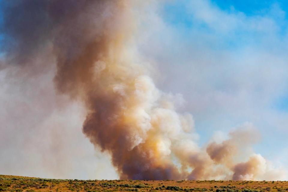
If you live in Boise, you may have noticed some smoke creeping over the Foothills and into the Treasure Valley in recent days. It’s coming from multiple active wildfires, big and small, burning throughout the Northwest, particularly in North Idaho, Washington and Canada.
But how can you find out precisely where the fires are?
Idaho has multiple online resources, including Fish and Game’s interactive fire map. The map shows all active wildfires in the Gem State, and the location of previous fires and burnt acreage from 2023 wildfires. You can click on each fire icon to learn more about the date it started, how many acres have burned and how much of the fire is contained.
The Environmental Protection Agency also runs an interactive fire and smoke map that provides a national view of all fires and smoke coverage.
The Department of Lands posts a detailed map on its website using information from the Integrated Reporting of Wildland-Fire Information system, which shows all active, controlled and inactive fires in Idaho.
The Department of Lands also maintains a fire news feed on which it frequently publishes updates and summaries on specific fires.
Which Idaho agencies issue wildfire alerts?
Idaho’s primary statewide source for wildfire alerts is the Department of Lands. The department issues wildfire alerts across Idaho’s 9 million acres of forests and rangelands, but doesn’t issue evacuation notices. It’s up to the local sheriff’s office to order an evacuation.
The Department of Land’s Twitter and the #IDLFireInfo hashtag are good social media sources for the most recent and frequently updated information.
Thee Sarah Loop Fire near Athol, ID, is now 100% contained and was held to 20 acres.
Kootenai County Emergency Management also announced all evacuations for the incident have been lifted.#IDLFireInfo#SarahLoopFire2023 pic.twitter.com/hEVIjas5Cj— ID Dept. of Lands (@IdahoLands) August 16, 2023
The Idaho Department of Environmental Quality also issues air quality advisories based on how much wildfire smoke is in the air. The advisories note where outdoor burning and wood stove or fireplace burning are disallowed in each county.
The DEQ issued a yellow/moderate air quality advisory for Friday in the Treasure Valley, and all outdoor burning in Ada County was banned.
Idaho residents can sign up for emergency notification systems that alert residents of potential dangers, such as weather and wildfires. Here are the best options for the Boise area:
CodeRED - Ada County and City of Boise alert system
Alert Sense - Canyon County alert system
Department of Lands alert system - Alerts for specific forest protective districts
How do you report a wildfire in Idaho?
If you spot a wildfire, don’t assume someone else has reported it. If no emergency crews are on the scene, play it safe and call it in. Idaho fires can be reported to 911 or the local sheriff’s office — for Ada County, the number is (208) 577-3460. If you are on a highway, note the nearest exit or milepost marker.
Once you’ve spotted a wildfire and called emergency services, move as far away from the source of the wildfire as possible.
“If (the fire) is showing that it’s going to grow quickly, you definitely want to get away from it in case it starts growing,” Spencer Tangen, a fire weather forecaster with the National Weather Service in Boise, told the Idaho Statesman. “So if you’re near a fire, you have to be very careful about the direction it could be growing because you don’t want to get trapped by the fire.”
What causes wildfires to start?
There have been 35,702 wildfires nationwide since the start of 2023, burning a total of 1,699,381 acres, according to the National Interagency Fire Center. Both numbers are below the past 10-year average, according to NIFC, headquartered in Boise at the airport.
About 40% of fires are caused by lightning, which means the other 60% are human-caused.
Tangen said human-caused wildfires are from some of the simplest things, such as an unattended bonfire or flicking a cigarette butt onto dry grass. He also warned about lesser-known causes, such as hot bullet casings falling on dry fuel and sparks from a chain dragged along a roadway.
Before heading into the wilderness, check for any red flag warnings in the area, Tangen said. A red flag warning is issued by the Weather Service and means conditions are ripe for wildfires to start and spread quickly, such as warm temperatures, low humidity and strong winds.
“When we issue them for the dry and windy conditions, people need to be very careful about anything that could cause a spark in grasses or the forest,” Tangen said.

