Why Canada’s Largest Fleet of Drones Has Taken Over This Small Island
In mid-August last year, Adam Fenech took me to the drone port, a wide-mouthed annex at one end of the brand new Canadian Center for Climate Change and Adaptation on Prince Edward Island, Canada’s smallest province, population 157,000. Data collected here, as well as at many other sites around PEI, is used to measure the impacts of climate change on the island and help it adapt.
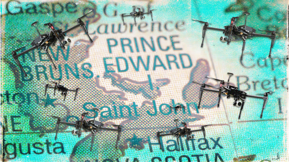
“It’s like Mission: Impossible in there,” Fenech told The Daily Beast. “We have the largest fleet of drones in the country. Most are tiny, but we also have the largest—the Phoenix Terrahawk, a fixed wing, plane-like drone with a 13-foot wingspan.”
Then there’s the DJI Matrice, a quadcopter with a 2.6 pound payload capacity—“our big workhorse,” said Fenech. “We can load a couple of cameras, including a thermal camera. The Harris Carrier, a heavy-lift gas-electric hybrid drone powered by six blades, can handle our LIDAR unit, useful for creating 3-D environments.”
Recent graduate Catherine Kennedy learned to use this equipment and got her drone license through the program. Of the new center, she said, “I think it’s a great opportunity for students to have more hands-on practical training.” When it comes to climate change science, she said, “There’s sometimes a gap between knowledge and practice.”
The Mad Rush to Save Pompeii From Another Natural Disaster
Kennedy, who plans to pursue her master’s at the center, worked as an intern with the Climate Sense program run by the University of PEI and the PEI government. She collected coastal erosion data at 100 monitoring sites across the island, arming landowners with information to make major decisions about whether or not to relocate their house.
From the new center, Fenech and I looked out over the village of St. Peters on the island’s north coast, a crossroads community with a couple of restaurants and tourist shops. The local population will increase significantly when the residence behind us reaches capacity of 40 students and visiting researchers. The $16 million building is carbon neutral, powered by geothermal and solar installations. It’s an extension of UPEI in the capital, Charlottetown, 32 miles to the southwest where Fenech is associate dean at the School of Climate Change and Adaptation. UPEI offered the world’s first Bachelor of Science degree in climate change and adaptation starting in 2017.
St. Peters was chosen as the site for the new center because it’s the gateway to nearby Greenwich peninsula, an adjunct of PEI National Park. Greenwich serves as the school’s "living laboratory." Students and staff conduct course work, collect data, and study first-hand the impacts of climate change on coastal, wetland, field and forest ecosystems.
Along with Charlottetown, the peninsula is ground zero for the impacts of climate change. It’s a low-lying, ever-shifting finger of land surrounded by the sea and protecting St. Peter’s Bay. Unlike the capital, it’s uninhabited, so it’s easier to study. But findings here translate to what we can expect for Charlottetown and other densely populated areas at extreme risk from sea level rise and coastal erosion.
After checking out the center, Fenech and I walked the Greenwich beach and trails. He described PEI as essentially a big sand bar, making it particularly vulnerable to extreme weather and erosion. The island is only 2,185 square miles and 174 miles tip to tip. Many residents depend on fishing and farming—42.5 percent of PEI is farmland—so they’re taking climate change threats to their livelihoods very seriously.
“Sea level is rising,” said Fenech. “There’s an increase in storm activity. The land itself is sinking. Not [by] much, but I wish it was going the other way.”
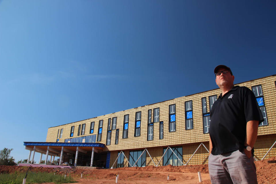
Dr. Adam Fenech poses in front of the drone port that is under construction at Centre for Climate Change.
Because the island is sinking and shrinking at the same time, the impacts of extreme weather events, rising temperatures, and large swings in precipitation are more pronounced. The most significant and alarming threats come in the form of coastal erosion and agricultural damage.
But Fenech’s team is already utilizing the new high-tech tools at their disposal to learn what could be in store for PEI. They’ve stitched together several years of drone data to show that the sea advanced 15 feet along a mile of beach at nearby Savage Harbor. Comparing historical records to their own data from around the island, they concluded that it has shrunk by nearly 10 square miles since 1968.
“That’s about 5,000 acres,” said Fenech. “Half the size of Charlottetown.” This might not sound like much, but Fenech knows it means that low-lying areas like Savage Harbor will erode much faster as climate change picks up.
The drones are the most visible and dynamic tools in the school’s technological arsenal. The LIDAR (light detection and ranging) sensor pings a pulsed laser off the ground back to the drone, taking measurements accurate within two centimeters that help generate 3D images of the landscape.
Drones equipped with NDVI sensors (Normalized Difference Vegetation Index) measure the greenness of plants, an indication of their health. PEI farmers rely on this data to predict yield and identify underperforming areas of their fields. At stake for these farmers are millions of dollars worth of crops and land-use, which makes the drone data extra valuable.
Though climate science for the last several decades has relied heavily on satellite technology, these drones are poised to provide much more precise data for the intense study of local environments. The 3D images generated and regenerated over hundreds of flights show exactly where and by how much the coastline is being submerged or eroded. PEI planners can see where new construction is unwise and which existing structures are at risk.
The school also has access to massive amounts of satellite data, which is still useful. To store and process all of this data, students and staff tap into ACE, a network of supercomputers available to member universities in eastern Canada. In tandem with the construction of the new center, 17 tidal stations and over 100 climate stations are being deployed around the island. These stations measure wind speed, precipitation, temperature, humidity and solar radiation. The tidal stations also measure sea level. All together, they will paint precise pictures of how the changing climate is impacting local weather and the behavior of the ocean.
PEI and the university aren’t the only ones that stand to benefit from these installations. Canada’s federal parks agency, the provincial government’s Emergency Measures Organization, and the regional Indigenous people known as the Mi’kmaq are all partners on this project who are looking to make better resiliency plans using better information. During a recent storm, data from newly installed stations showed that wharves were at risk because water levels rose above some of them. Fenech refers to these storm surges as the island’s early warning system. They can prompt local governments and others to prepare against climate change impacts.
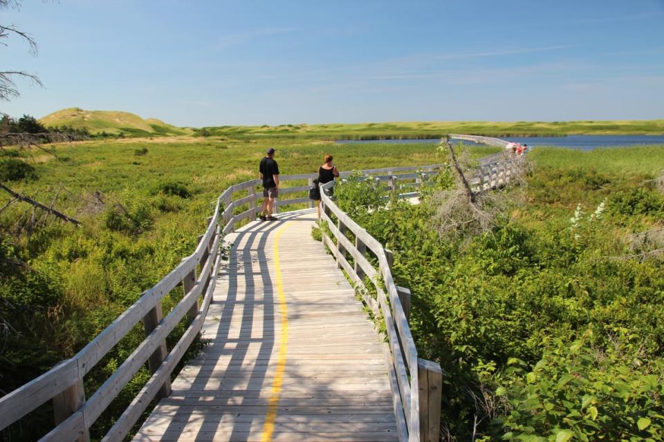
People walk down the boardwalk at PEI National Park.
A unique tool developed at the school called CLIVE (Coastal Impacts Visualization Environment) will continue to evolve at the new center. Similar to a virtual reality video game, CLIVE immerses the user in a 3D representation of a geographic area with tools to view sea level rise and coastal erosion, providing a glimpse of how vulnerable a certain area is to danger.
“The more realistic it gets, the scarier it gets,” Fenech said. “You’re standing in Charlottetown and the water rises above your head. Even though it’s not real, you start panicking.” It’s a powerful motivational tool because in a matter of minutes, policy makers and planners can actually experience what sea level rise will feel like on the ground where they live. The alarming virtual reality experience CLIVE delivers can push people to action when it comes to mitigating the impacts of climate change. Jurisdictions in Nova Scotia, California, the Caribbean and elsewhere have called on Fenech and his students to adapt CLIVE for their regions.
The lands of PEI’s Mi’kmaq people are particularly vulnerable to sea level rise. The school shares data with the community and flies LIDAR equipped drones to gather information and images the Mi’kmaq uses to assess risk and see where to avoid building in the future.
On the flip side, Fenech is just as keen to pull Indigenous knowledge that is decades, perhaps eons, deep into his own work.
The Young Africans on a Climate Crusade to ‘Save the World’ One Forest at a Time
“We take an approach called two-eyed seeing,” said Fenech. He’s published papers comparing Indigenous knowledge to instrumental records. “Western science can provide certain information, but traditional knowledge needs to be there as well. Human beings are excellent climate instruments. Whenever anybody says we need to look at the historical record to do a climate impact assessment and they say we don’t have any instruments, I say you’ve got all these human beings here. Let’s ask them.”
Kennedy agrees. “Obviously, science is very important to understanding climate risk,” she said. “PEI and other islands are susceptible to sea level rise and erosion. But it’s always important to have that connection with individuals and know what kind of lived experience there is.”
PEI’s new Center for Climate Change and Adaptation can’t prevent the changes we’re seeing due to adverse human activity. But it's one of the biggest test cases for how to utilize new technologies like drones to understand climate change on a local scale, to make accurate predictions that could apply to hundreds or even thousands of communities around the world.
Fenech doesn't mince his words when he thinks about the impact climate change will have on the island and its people, particularly when it comes to sea-level rise: “It’s frightening.” But the work at PEI might help illuminate the future such that we can predict the future with more confidence and be a little less afraid. In the long term, he said, “We need to re-define our relationship with the natural environment.”
Get the Daily Beast's biggest scoops and scandals delivered right to your inbox. Sign up now.
Stay informed and gain unlimited access to the Daily Beast's unmatched reporting. Subscribe now.

