Why the Fort Collins area didn't get as much rain, snow as forecast in latest storm
The significant spring rain for the Fort Collins area fell far short of the National Weather Service's forecast.
However, the storm did deliver an array of weather-related events across Colorado.
Here's a look at the Fort Collins-area predictions and actual rain and snow amounts
Fort Collins was first predicted to receive more than an inch of rain, and later 0.81 inches, but most stations around the city recorded roughly 0.30 to 0.40 inches during the Tuesday and Wednesday storm. Official totals for the city are not yet available.
Red Feather Lakes was forecast to get 9 inches of snow and Estes Park 4 inches, but reports showed totals ranging from no snow to less than 2 inches.
Greeley was forecast for 0.74 inches of rain, and one reporting station recorded 0.88 inches, but others reported about half that much.
A station 5.9 miles west of Bellvue reported 1.7 inches of rain and one 8 miles west of Loveland reported 1.25 inches.
Why Fort Collins received far less rain than forecast
The storm track moved slightly south, resulting in less upslope conditions and rain and snow for the Fort Collins area and northern foothills and mountains, according to Victoria Chavez, meteorologist at the National Weather Service in Boulder.
That favored locations from Interstate 70 and south, where Aurora picked up 1.41 inches of rain and the Pueblo area 2 to 2.5 inches.
More: What to know about Colorado's deadliest natural disasters, including key safety tips
Storm spawns Colorado's first tornado and thunderstorm warning of the season
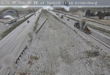
There were several landspout tornadoes reported mostly in southern Weld County around Keenesburg, Roggen and the Prospect Valley area, and near Denver International Airport, prompting a thunderstorm and tornado warning.
Landspout tornadoes form from the ground up to a thunderstorm cell, while other tornadoes form in the reverse. Landspout tornadoes are generally weak and are the most common tornado in Colorado.
Hail, flooding reported in Northern Colorado during storm
The Berthoud, Arvada, Westminster, Aurora, Dacono and Keenesburg areas reported hail, impacting Interstate 25 and Interstate 76.
There was a flood advisory for southwest Weld County, including the Hudson and Fort Lupton areas.
Fort Collins-area forecast calls for more rain, but will it prove true?
Here is the Fort Collins forecast through the weekend, according to the National Weather Service:
Thursday, April 27: 20% chance of rain and thunderstorms during the day, increasing to 90% chance of mostly rain with some snow; half inch possible Thursday night into early Friday morning. High of 68 degrees.
Friday, April 28: 20% chance of rain/snow mix in the morning. High of 55 degrees and north wind 18 to 26 mph, gusting to 40 mph.
Saturday, April 29: Mostly sunny, breezy and high of 72 degrees.
Sunday, April 30: Sunny, with a high near 71.
Colorado spring lawn care: What to know about snow mold, fertilizer, watering and more
This article originally appeared on Fort Collins Coloradoan: Why the Fort Collins area didn't get as much rain, snow as forecast
