Why do thunderstorms largely avoid Boise? When might we next see lightning? Some answers
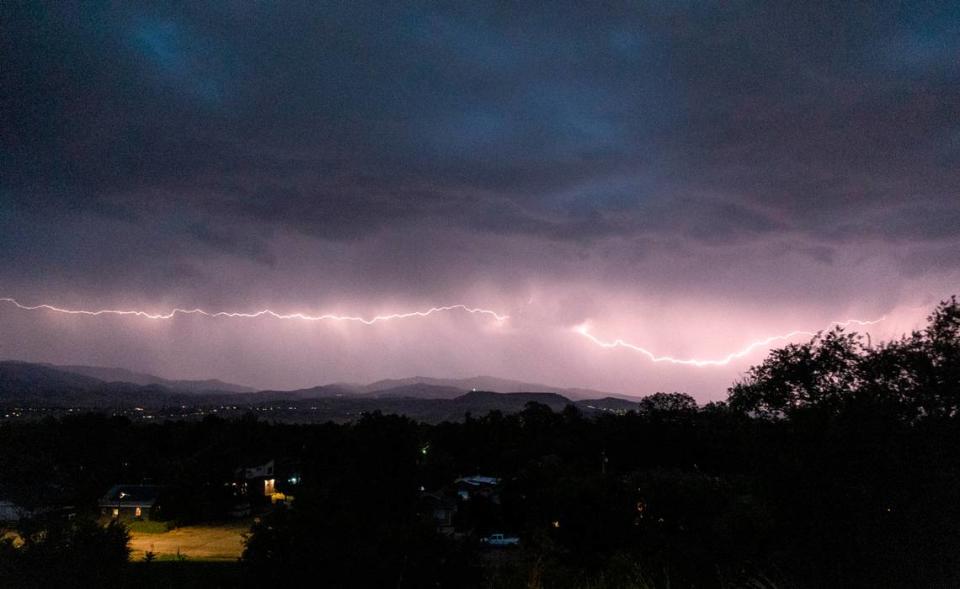
The Treasure Valley sky was filled Monday night with the flash of lightning and the sound of thunder.
In total, 86 bolts of lightning streaked across the Boise sky, signifying one of the most active days of thunderstorms ever recorded in May for the Treasure Valley, according to the National Weather Service.
Yesterday's lightning density in the Treasure Valley was in the top 5% of recorded days in May with over 86 strikes!
Over 828 strikes were recorded in our forecast area. #idwx #ORwx https://t.co/3Nb7EXDFaA— NWS Boise (@NWSBoise) May 9, 2023
For weather nerds and storm enthusiasts, the round of storms was a fresh change to the typically light showers and clear skies that Boise experiences throughout the warmer months. About 75% of Boise’s precipitation comes from winter storms and early-summer downpours.
So why doesn’t Boise enjoy more severe weather in the spring, and when is the next chance to hear some rumbles or see flashes in the sky?
Why doesn’t Boise get thunderstorms very often?
There are three major components you need for a thunderstorm, according to National Weather Service meteorologist Bill Wojciek: moisture, instability and lift.
Areas like the Midwest and South see a lot of thunderstorms because moisture-heavy air from the Gulf of Mexico travels northward, providing plenty of unstable energy in the atmosphere.
That warm air then has to be lifted higher into the atmosphere via a cold front — warm air has a lower density than cooler air and therefore rises — or a mountain range.
Boise is in the high desert, meaning its climate is semi-arid, and therefore there’s less moisture available in the atmosphere. Being situated in the Treasure Valley, with the Owyhee Mountains to the south and Boise Mountains to the north, doesn’t help Boise’s case, either.
Because warm air rises, cool and dry air sinks into the Treasure Valley, causing cooler temperatures than other surrounding areas and stifling storms.
“A lot of times what happens is the thunderstorms develop over the mountain, like the Owyhee Mountains, and then by the time they come off the mountains, they’re drying out,” Wojciek said. “And they don’t have the moisture content they did have once they get over the valley.”
Boise also doesn’t often feel the effects of Southwest monsoons in late summer and early fall. Monsoons typically occur around the Four Corners High, Wojciek said, which pulls moisture from the south and northward through the Southwest desert and into Idaho.
But moisture from those monsoons wraps around the high and typically hits East Idaho, avoiding the Treasure Valley altogether.
“The times when it does come up in this area, a lot of times we’re kind of on the fringe of it,” Wojciek said. “So we can actually have the drier kind of storms where they develop over the mountains, and then by the time they get in the valley here, again, just you get a lot of winds and gusts, but not a lot of rain.”
When is Boise’s next chance for thunderstorms?
If there’s a time for Boiseans to enjoy nature’s light show, it is early spring.
High temperatures will soar back into the 80s this weekend. Saturday through Monday, there is a 20% chance of thunderstorms among the mostly sunny weather, according to the National Weather Service forecast.
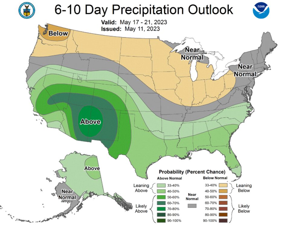
The Climate Prediction Center has Boise on the cusp of average precipitation and a 33%-40% chance of above-average for the upcoming week. Boise has received 0.89 inches of rain in May, nearly double the historical average of 0.46 inches.