When will widespread fog go away in central, eastern US?
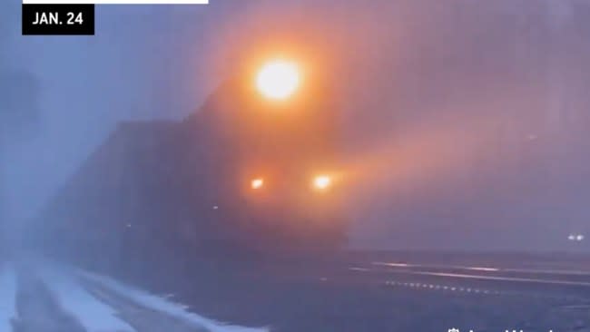

As AccuWeather meteorologists warned about days in advance, a massive area of fog has developed and is playing havoc with ground and air travel in much of the central and eastern United States. The widespread fog will linger into the weekend before dissolving but at a price.
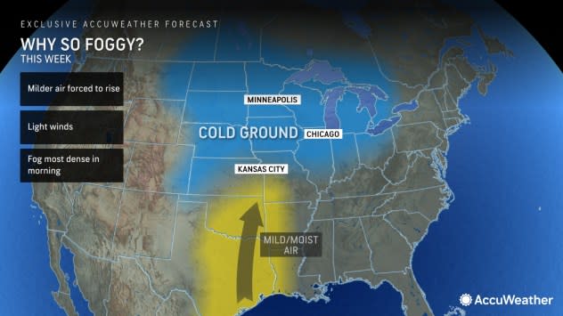
The exchange of dead-of-the-winter Arctic air from the middle of the month to conditions more typical of March or April resulted in the expanse of foggy conditions this week.
 |
The conditions are a product of moist, mild air passing over a cold landscape, just like when a freezer door is opened on a hot and humid day.
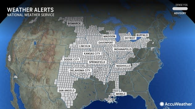
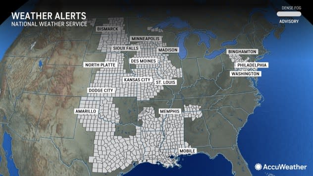
The extent of National Weather Service dense fog advisories from Thursday morning resembled the Louisiana Purchase from 1803, AccuWeather Chief On-Air Meteorologist Bernie Rayno said.
 |
This map of the United States shows where National Weather Service dense fog advisories were in effect on Thursday morning, Jan. 25, 2024. |
"Close to 100 million people in more than two dozen states were experiencing dense fog outside their window at the start of the day on Thursday," Rayno stated. Fog is considered dense when the visibility is 1/4 of a mile or less.
Nationwide, there were more than 1,100 weather-related flight delays on Thursday morning, according to FlightAware.com. On Friday morning, the number of delays was down to about 800. A ground stop was implemented at Chicago's O'Hare International Airport by the Federal Aviation Administration on Thursday morning due to fog and a low cloud ceiling.
 |
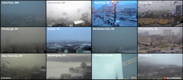
Earthcams show fog in 12 major cities on the morning of Jan. 26, 2024. |
"If the fog isn't enough, relentless rounds of rain continue in parts of the South, leading to escalating flooding problems," Rayno added. The persistent rain is not only wiping out the severity of the long-term drought in the region, but it is also leading to urban, low-lying areas, small streams and river flooding.
 |
This map shows the extent of National Weather Service dense fog advisories for Friday morning, Jan. 26, 2024. |
Fog developed once again across the center of the nation on Friday morning, when dense fog advisories were in effect from North Dakota to central Texas and from Kansas to Illinois, Mississippi and western Tennessee. Even though the number of people experiencing dense fog had slipped to 74 million, there was still room for a great deal of improvement. However, that will not happen until later this weekend to early next week.
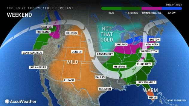
For the fog to become less dense or go away, the difference in temperature between the air and the ground has to diminish or the air must dry out. Both will transition from northwest to southeast over the Central and Eastern states through early next week as a new storm from the Gulf of Mexico cycles through then moves off the mid-Atlantic coast. The ground temperature will rise slowly as colder and drier air moves in from Canada.
 |
However, before the departure of that storm, conditions may get worse before they improve. Fog may become more dense in some communities and develop in areas of the East and South into this weekend, where it has been absent or limited thus far as the new storm will throw even more moisture into the mix.
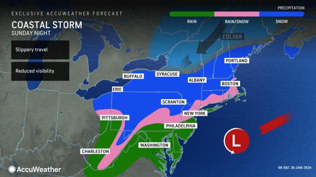
Fog problems could broaden along the Interstate 85 and 95 corridors into Sunday, which may lead to airline issues at the major hubs of Atlanta, Charlotte, Washington, D.C., Philadelphia, New York City and Boston.
In addition to the fog exchange, the storm will bring its share of travel problems due to rain, snow and a wintry mix as the colder air filters in with high moisture levels initially from parts of the Midwest to the central Appalachians and New England this weekend.
 |
As conditions deteriorate along the Atlantic Seaboard this weekend, they should begin to improve over the Plains and Midwest as that chillier and drier air filters in behind the storm.
A pattern more typical of late January to early February will set up in the Midwest and the East next week as the jet stream dips southward.
 |
However, while this will allow colder air to drain in from central Canada, Arctic air may be locked out. Still, the air may turn cold enough to allow any storms that come along to bring areas of snow or a wintry mix to parts of the regions. The pattern may allow a couple of such opportunities into the first part of February.
The upcoming lower, more seasonable temperatures next week will slow that rate of runoff and reduce the risk of ice jams in the Midwest and Northeast.
Want next-level safety, ad-free? Unlock advanced, hyperlocal severe weather alerts when you subscribe to Premium+ on the AccuWeather app. AccuWeather Alerts™ are prompted by our expert meteorologists who monitor and analyze dangerous weather risks 24/7 to keep you and your family safer.
