B.C.'s South Coast on tap for slippery snow event, up 20 cm possible
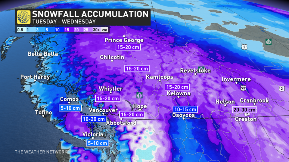
A major snowstorm aiming for B.C.'s South Coast could drop anywhere from 5-30 cm of snow across the region through Wednesday. Dangerous travel is likely as the snow picks up later Tuesday, with drivers being urged to adapt to the changing and deteriorating conditions.
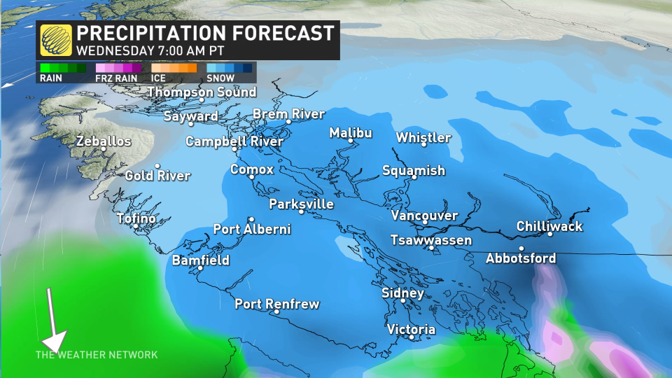
Moisture from the Pacific system will interact with Arctic air already in place over the B.C. South Coast, helping to keep the region on the wintry side of this storm system. Snow could mix with rain over some areas into Wednesday, however, with the threat for freezing rain and icy conditions on the line, as well.
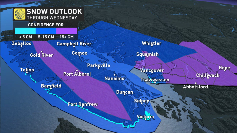
Snowfall warnings are in place for a good portion of southern B.C.
RELATED: Temperatures plunge in B.C. and Alberta with once-in-a-generation cold spell
Tuesday night into Wednesday
Conditions are forecast to deteriorate Tuesday overnight into Wednesday morning across the South Coast, with temperatures stubbornly remaining at or below the freezing mark.
Confidence is growing that the cold air will win in the Lower Mainland, allowing for almost all of the system to remain as snow. Areas immediately along the coast could have some marine influence on the other hand, which could bring mixing or even melt some of the snow on contact. Areas just a few kilometres inland will look drastically different.
SEE ALSO: Canada is colder than a cloud, and looks like one on satellite
For Victoria and surrounding communities, there is lower confidence in the amount of snow that will fall, and also how much mixing can move into the region with it being a bit further south and closer to the centre of the low. Along the east side of Vancouver Island, snow is expected for all, even down to sea level.
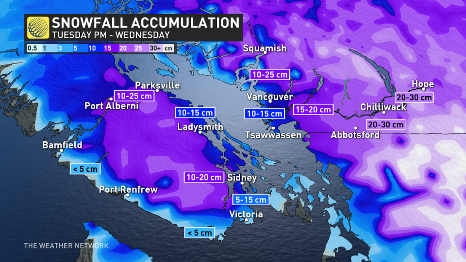
Accumulations will vary greatly from the shorelines in Victoria up to the airport. The system will start as snow in Victoria and then coastal sections could transition to mixing, which would limit snowfall amounts. These areas could see accumulations in the 5-15 cm range. Travel is expected to be difficult on Wednesday with the snow and slippery conditions.
RELATED: Beware of King Tides
The same will be said for the Lower Mainland, with the heavy snowfall expected to wreak havoc on the Wednesday morning commute, and some residual impacts on the evening commute, too.
Tuesday overnight, there is the chance for some milder air aloft to get very close to, or just cross the border into the Lower Mainland. This would bring the risk of icy precipitation. However, the warm air seems shallow and short lived, degrading by Wednesday morning, which favours a brief mixing or all snow event. Between 10-20 cm of snow is forecast in Vancouver.
Areas north of the Fraser River are likely to stay as all snowfall, making for treacherous travel. Northern and central B.C. will also see snow with the northern front.
WATCH:Vancouver Island hour-by-hour snowstorm forecast
Thursday
Another system is on tap for Thursday into Friday, which could bring more snow to the region.
Eventually, warmer temperatures will win and rain will take over.

Stay with The Weather Network for more updates and information on your forecast in B.C.

