As wild weather hits elsewhere in the U.S., Florida's tropical outlook remains calm
The calm Atlantic week continues with a belt of high pressure over the central Atlantic and into the Gulf of Mexico and a dry air mass over the Caribbean keeping things "fairly tranquil," according to forecasters at the National Hurricane Center.
Don't expect it to last, though. Today the National Oceanic and Atmospheric Administration (NOAA) updated its predictions for the 2023 Atlantic hurricane season from "near normal" to "above normal," saying we can expect to see 14-21 named storms this year, with six to 11 of those becoming hurricanes.
Those high-pressure areas also are helping keep Florida oppressively hot. As it has all week, the National Weather Service has issued excessive heat warnings and watches across the state, warning of "feels like" heat indices of up to 115. Residents are advised to stay indoors in cooled rooms as much as possible, stay hydrated, and if you must go outside, wear sunscreen and protective clothing.
The northern states will be seeing more storms Thursday. A broad area of active weather is expected to bring severe thunderstorms across the Carolinas to north Georgia, the NWS said, while heavy rain and flash flooding hit the upper East Coast.
"Close to 100 million people will be at risk of severe weather across the U.S. into the weekend.," AccuWeather predicts. with a possible surge of airline delays and flight cancellations and significant delays on area highways due to "ponding and poor visibility."
In the Pacific, Hurricane Dora skirted the Hawaiian Islands and its winds whipped wildfires into conflagrations Wednesday, forcing hundreds of evacuations and even sending people fleeing into the ocean to escape the flames. At least 36 people have died in the Lahaina fire, officials said.
The National Hurricane Center is watching four tropical waves in the Atlantic and Caribbean.
August is traditionally the beginning of the most active season for hurricanes in the Atlantic. Hurricane season lasts from June 1 through Nov. 30, with Sept. 10 the peak.
The most recent named storm was Hurricane Don, which dissipated two weeks ago in the deep Atlantic. The next storms to be named would be Emily and Franklin.
According to an update from Colorado State University last week, the primary threat formation area for major hurricanes in early- to mid-August is in the tropical Atlantic east of the Lesser Antilles. CSU's Tropical Weather and Climate Research Team is predicting 18 named storms this season, including the five we've already seen. Nine of them are expected to become hurricanes (including Don) and four are predicted to be major hurricanes.
Hurricane risk about to ramp up: Here's why experts are expecting a busy 2023 season.
What to expect in tropics: The savage heart of hurricane season begins now. Here's what to expect.
Two days previously AccuWeather forecasters updated their prediction of what's left for the 2023 Atlantic hurricane season and warned the Atlantic basin could get “very active” in the coming weeks.
AccuWeather is now forecasting 13 to 17 named storms this year, higher than the initial forecast of 11 to 15 storms released in March, with four to eight forecast to become hurricanes, and one to three predicted to become major hurricanes.
A major hurricane is a Category 3 storm or higher, with maximum sustained winds of at least 111 mph.
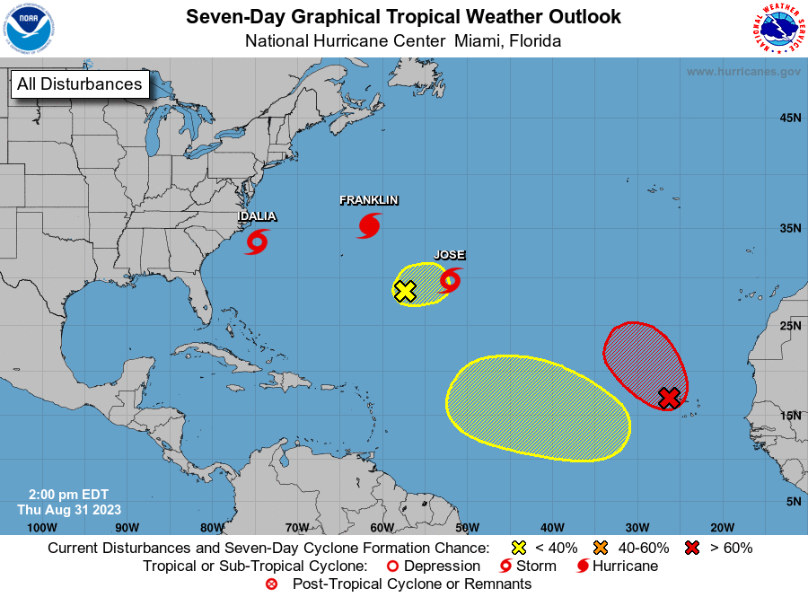
Here is the latest update from the NHC as of 2 p.m. Aug. 8:
What's out there and where are they?

Tropical wave 1: An eastern Atlantic tropical wave has its axis along 22W, south of 17N, and is moving slowly westward at 5-10 kt. Scattered moderate convection is observed from 06N to 11N and east of 26W.
Tropical wave 2: Another eastern Atlantic tropical wave has its axis along 36W, south of 17N, and is moving slowly westward at 5 kt. Scattered moderate convection is noted from 05N to 09N and between 30W and 42W.
Tropical wave 3: An eastern Caribbean tropical wave has its axis along 63W, south of 20N, moving W at 15 kt. Scattered moderate convection is evident from 12N to 22N and between 61W and 70W.
Tropical wave 4: A central Caribbean tropical wave has its axis along 76W, south of 21N, moving W at 10 kt. No significant convection is noted over water.
Who is likely to be impacted?
It's too early at this time to determine if there will be any impact to the U.S. from the tropical waves.
Forecasters urge all residents to continue monitoring the tropics and to always be prepared.
Weather watches and warnings issued in Florida
When is the Atlantic hurricane season?
The Atlantic hurricane season runs from June 1 through Nov. 30.
When is the peak of hurricane season?
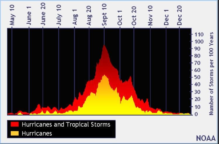
The peak of the season is Sept. 10, with the most activity happening between mid-August and mid-October, according to the Hurricane Center.
Tropical forecast over the next seven days
Excessive rainfall forecast
What's out there?
Systems currently being monitored by the National Hurricane Center.
What's next?
We will continue to update our tropical weather coverage daily. Download your local site's app to ensure you're always connected to the news. And look at our special subscription offers here.
This article originally appeared on The Daytona Beach News-Journal: Florida hurricane season: Outlook remains calm, 4 tropical waves tracked

