From thunderstorms to quick freeze: Southern Ontario caught in seasons battle
This week, Central Canada will see why the forthcoming spring is a transitional, volatile season that can clash with winter at times.
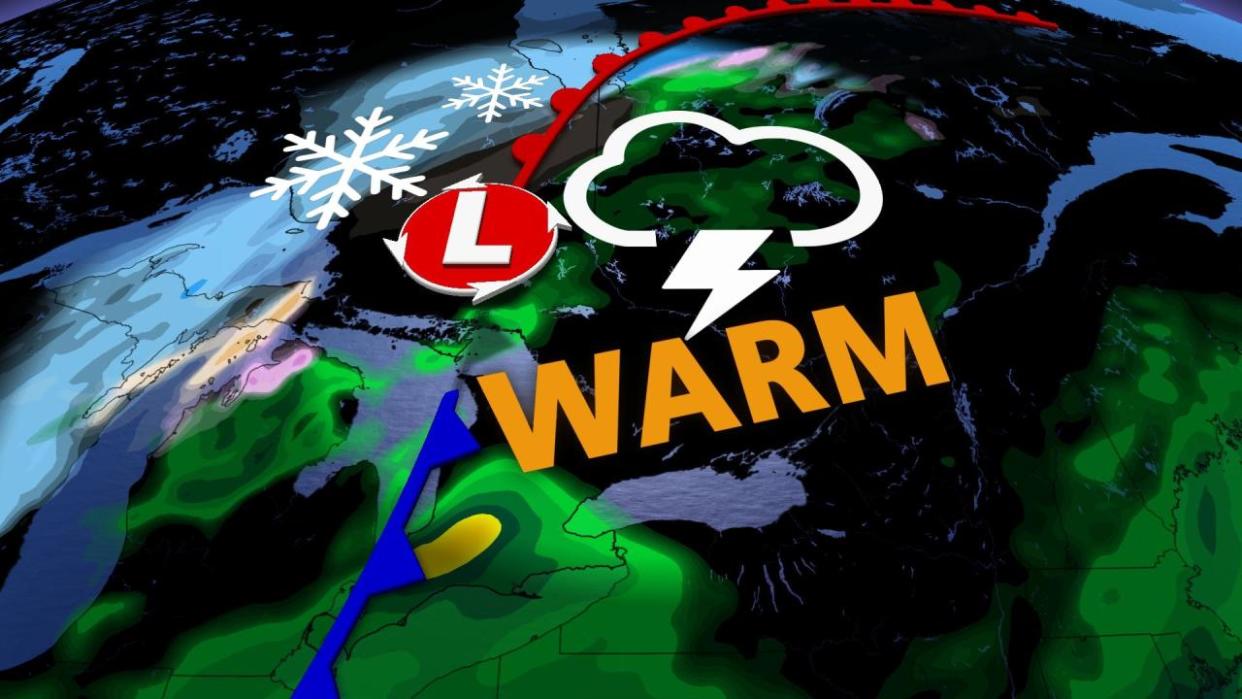
The setup could be quite hazardous in scope, with a spring storm loaded with a wide range of impacts that could be quite disruptive for some areas of southern Ontario, in particular.
DON’T MISS: Earth just experienced its hottest 12 months in recorded history
Record-breaking warmth could kick-start the affair, but there will be some trouble brewing with and after it. Don't let the warmth fool you. With it comes a thunderstorm risk for some areas, potentially even some potent cells for the southwest –– an uncommon feature in February.
A drastic temperature change will soon put an end to the warmth, bringing with it the chance of a flash and hard freeze, depending on the locale, with values plummeting by as much as 20 degrees in a short amount of time. To add to that, a round of snow will follow suit for some, but even without the snow, expect road conditions to be difficult after the freeze.
Tuesday: Mild air could create record-setting temperatures
The last days of meteorological winter started off with an upper-level ridge building over the Great Lakes and a broad low-pressure system churning over the U.S. Midwest. The result is good news for those who are looking forward to spring: Temperatures soaring to levels more common of late April than late February.
SEE ALSO: Atlantic ‘hurricane alley’ sees ominous mid-July heat in February
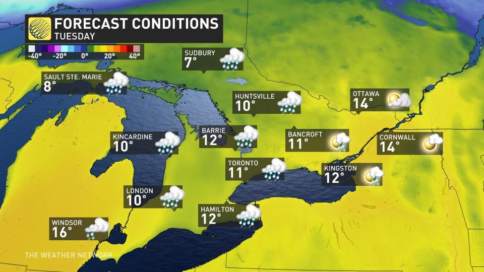
After a warm Monday, temperatures increase further on Tuesday across all of southern and eastern Ontario. However, locations downwind of the lakes will stay much cooler, while inland communities will enjoy readings well into the mid-teens.
Communities along Highway 401 like Brockville and Cornwall could see readings as high as 17°C on Tuesday as warmer winds blow out of New York, a tally that is about 17 degrees above normal for the end of February. Warm winds from across the border could bring similar temperatures to the eastern Niagara Peninsula.
Rare February thunderstorm threat creeps in
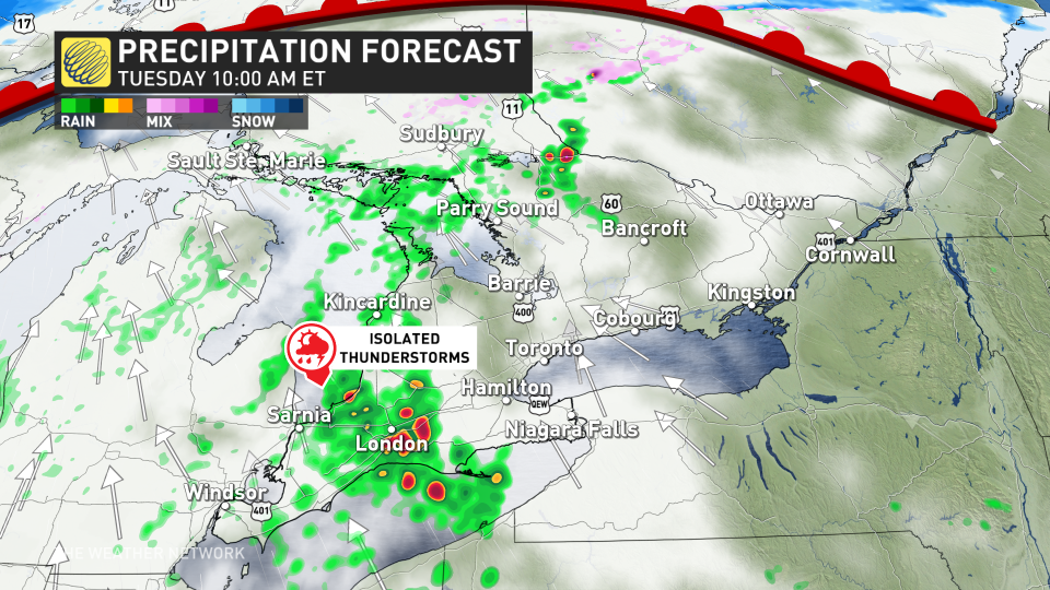
Our first risk for thunderstorms will bubble up on Tuesday as a warm front pulls some instability across southern Ontario. The risk starts across the southwest, and up towards cottage country through the early afternoon.
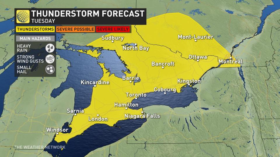
After the lunch hour, the risk spread across the Greater Toronto Area (GTA), as the warm front lifts across the area. Keep an eye out for a passing heavy shower and rumbles of thunder.
A second round of storms will need to be monitored closely late Tuesday and into Wednesday, though the storm's timing and track continues to fluctuate at this time. While the general nature of the storms will remain non-severe, the extreme southwest has a window of opportunity for more potent cells to develop. Here, there could be large hail and stronger wind gusts.
RELATED: Why nocturnal thunderstorms can be particularly dangerous
Wednesday: Major cooldown with the threat for snow and a flash or hard freeze
Wednesday is when things take a tumble, and fast, too.
The region will see a cold front push in, with a razor-thin line separating a snowstorm in the north and another potentially record-breaking warm, stormy day in the south.
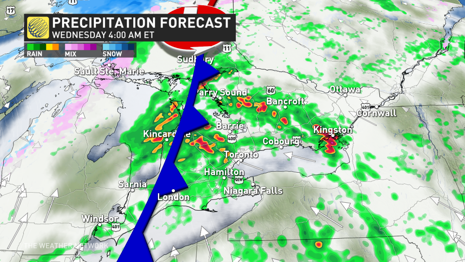
On Wednesday morning, the GTA and eastern Ontario will likely see heavy rainfall to start the day, with possible rumbles in the air, too.
By Wednesday afternoon, conditions will begin to change in a hurry. Most may record a 20-degree drop in temperatures by the overnight, making it one of the more extreme temperature drops in recent memory.
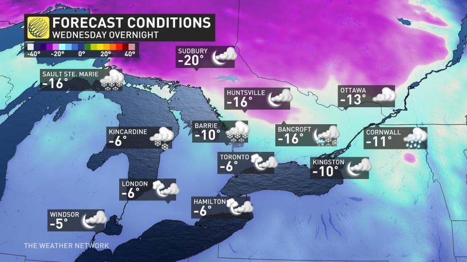
Forecasters are concerned for a flash-freeze event with any standing water turning to ice. Central and eastern Ontario could see a temperature drop of 10 to 15 degrees within three- to four-hour period Wednesday evening. That will result in surfaces becoming slipper rather quickly. Any plans to travel during this time will likely need to be postponed.
Meanwhile, parts of the southwestern sections could see a hard freeze.
MUST SEE: How global warming is reshaping winter life in Canada
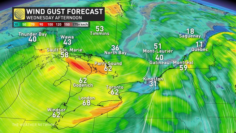
In addition, temperature swings such as these will come in with a roar. Gusty winds between 60-80 km/h are a concern across southern and eastern Ontario Wednesday evening, with bitterly cold wind chill values present.
Ottawa’s high of 14°C during the day Wednesday will turn on its head to a brutal low of -13°C by the overnight period.
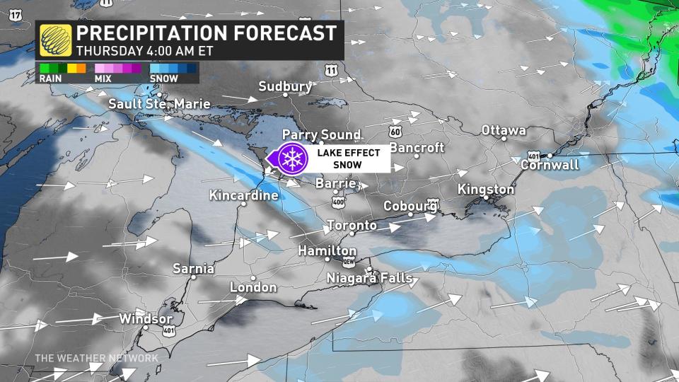
After temperatures plunge, precipitation will rapidly transition to snow across southern Ontario Wednesday overnight into Thursday.
Precipitation will quickly change over to bursts of snow, including lake- effect bands, quickly replacing the regions that had the opportunity to experience thunderstorms on Wednesday.
The good news is that the burst of cold won’t last for long. Temperatures will quickly rebound across southern and eastern Ontario heading into the weekend.
Stay with The Weather Network for all the latest on your forecast across Ontario.

